TopoQuest Logo
Do you find TopoQuest useful?
Help keep TopoQuest running and adding new maps/features by donating!
Bitcoin:  19c7KJd3qBynnjoSw5npx9KScwjBe4ifkT
Litecoin:  LXs6TkuXGGXo1vDsWCkWVdjQX94eUKd6ui
Home View Maps Find Maps Find Places Resources & Links


New River, Arizona Topographic Map

USGS Map Title: New River, AZ
USGS Map MRC: 33112H2
DRG (GeoTIFF) Download: o33112h2.tif


Neighboring USGS Topographic Map Quads:


  Columbia, AZ  
34112A3
 

  Black Canyon City, AZ  
34112A2
 

  Squaw Creek Mesa, AZ  
34112A1
 

  Governors Peak, AZ  
33112H3
 

  New River, AZ  
33112H2
 

  Daisy Mountain, AZ  
33112H1
 

  Baldy Mountain, AZ  
33112G3
 

  Biscuit Flat, AZ  
33112G2
 

  New River SE, AZ  
33112G1


Map MRC Location:

N34°
W113°
N34°
W112°
H8 H7 H6 H5 H4 H3 H2 H1
G8 G7 G6 G5 G4 G3 G2 G1
F8 F7 F6 F5 F4 F3 F2 F1
E8 E7 E6 E5 E4 E3 E2 E1
D8 D7 D6 D5 D4 D3 D2 D1
C8 C7 C6 C5 C4 C3 C2 C1
B8 B7 B6 B5 B4 B3 B2 B1
A8 A7 A6 A5 A4 A3 A2 A1
N33°
W113°
N33°
W112°

New River, AZ USGS 1:24K Topographic Map Preview:
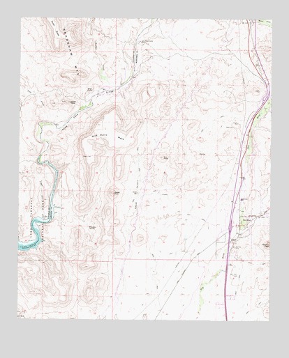
New River, AZ USGS Topographic Map
Click on map above to begin viewing in our Map Viewer.

This topographic map contains these locations and features:
Feature Name Type Latitude Longitude GNIS ID View Map
Bonnie Bell MineMineN33.9270°W112.1796°14235View Map
Boulder CreekStreamN33.9700°W112.2071°1867View Map
Daisy Mountain Fire Department Station 146BuildingN33.9207°W112.1277°2672387View Map
Daisy Mountain Post OfficePost OfficeN33.8843°W112.1514°2670270View Map
Doe PeakSummitN33.9423°W112.1788°3992View Map
Dutch ButteSummitN33.9928°W112.2335°21256View Map
Indian MesaSummitN33.9650°W112.2266°6218View Map
Little Grand Canyon RanchoLocaleN33.9906°W112.1904°7115View Map
Mazatzal Divide 23TrailN33.9973°W112.1674°14748View Map
New RiverPopulated PlaceN33.9159°W112.1360°8605View Map
New River Elementary SchoolSchoolN33.9263°W112.1405°8606View Map
New River InterchangeCrossingN33.9134°W112.1457°14816View Map
New River SubstationLocaleN33.9153°W112.1327°14817View Map
Sweat CanyonValleyN33.9048°W112.1946°12037View Map
Sweat PeakSummitN33.9278°W112.2043°12038View Map
Sweat SpringSpringN33.9278°W112.1918°12039View Map
Table Mesa InterchangeCrossingN33.9681°W112.1279°15107View Map
Tule CreekStreamN33.9567°W112.2366°12825View Map
Whiskey SpringSpringN33.9133°W112.2158°13590View Map
White BluffsCliffN33.9689°W112.2157°13600View Map
Wild Burro MesaSummitN33.9559°W112.2124°13753View Map

Note: Coordinates in the location and feature list above are referenced to NAD83 datum.


Copyright (C) 2008-2024 Ryan Niemi / Sunset Dynamics ... All Rights Reserved