TopoQuest Logo
Do you find TopoQuest useful?
Help keep TopoQuest running and adding new maps/features by donating!
Bitcoin:  19c7KJd3qBynnjoSw5npx9KScwjBe4ifkT
Litecoin:  LXs6TkuXGGXo1vDsWCkWVdjQX94eUKd6ui
Home View Maps Find Maps Find Places Resources & Links


Squaw Peak, Arizona Topographic Map

USGS Map Title: Squaw Peak, AZ
USGS Map MRC: 35113B1
DRG (GeoTIFF) Download: o35113b1.tif


Neighboring USGS Topographic Map Quads:


  Sugarloaf Peak, AZ  
35113C2
 

  Yampai SE, AZ  
35113C1
 

  Seligman West, AZ  
35112C8
 

  Cross Mountain, AZ  
35113B2
 

  Squaw Peak, AZ  
35113B1
 

  Purcell Canyon, AZ  
35112B8
 

  Anvil Rock Ranch, AZ  
35113A2
 

  Anvil Rock, AZ  
35113A1
 

  Turkey Canyon, AZ  
35112A8


Map MRC Location:

N36°
W114°
N36°
W113°
H8 H7 H6 H5 H4 H3 H2 H1
G8 G7 G6 G5 G4 G3 G2 G1
F8 F7 F6 F5 F4 F3 F2 F1
E8 E7 E6 E5 E4 E3 E2 E1
D8 D7 D6 D5 D4 D3 D2 D1
C8 C7 C6 C5 C4 C3 C2 C1
B8 B7 B6 B5 B4 B3 B2 B1
A8 A7 A6 A5 A4 A3 A2 A1
N35°
W114°
N35°
W113°

Squaw Peak, AZ USGS 1:24K Topographic Map Preview:
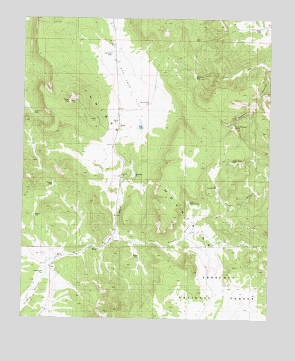
Squaw Peak, AZ USGS Topographic Map
Click on map above to begin viewing in our Map Viewer.

This topographic map contains these locations and features:
Feature Name Type Latitude Longitude GNIS ID View Map
Big Purcell TankReservoirN35.1803°W113.0268°38252View Map
Broken Dam TankReservoirN35.1431°W113.1130°38271View Map
Brown Basin TankReservoirN35.1905°W113.0197°38273View Map
Deer TankReservoirN35.2412°W113.0363°38403View Map
Gosney TankReservoirN35.1807°W113.1101°38464View Map
Grapevine CanyonValleyN35.2292°W113.0021°38478View Map
Greeley TankReservoirN35.1676°W113.1198°38482View Map
Green Waterhole SpringSpringN35.2044°W113.0186°38483View Map
H-RanchLocaleN35.1575°W113.0792°38488View Map
Hooker TankReservoirN35.1508°W113.0660°21290View Map
Jolly Place TankReservoirN35.2103°W113.1206°38544View Map
Little Phil TankReservoirN35.2353°W113.0813°38573View Map
Little Purcell CanyonValleyN35.1583°W113.0766°38575View Map
Little Purcell TankReservoirN35.1735°W113.0414°38576View Map
Mapes TankReservoirN35.2463°W113.0056°38604View Map
Norton WellWellN35.1614°W113.0271°41095View Map
Red LakeLakeN35.2052°W113.0665°38737View Map
Red Lake DrawValleyN35.1492°W113.1099°38738View Map
Red Lake FlatFlatN35.2236°W113.0752°38739View Map
Red Lake TankReservoirN35.1847°W113.0696°38740View Map
Red Lake WellWellN35.2147°W113.0621°38741View Map
Short Creek TankReservoirN35.2267°W113.0384°38809View Map
Squaw PeakSummitN35.2153°W113.1024°38842View Map

Note: Coordinates in the location and feature list above are referenced to NAD83 datum.


Copyright (C) 2008-2025 Ryan Niemi / Sunset Dynamics ... All Rights Reserved