TopoQuest Logo
Do you find TopoQuest useful?
Help keep TopoQuest running and adding new maps/features by donating!
Bitcoin:  19c7KJd3qBynnjoSw5npx9KScwjBe4ifkT
Litecoin:  LXs6TkuXGGXo1vDsWCkWVdjQX94eUKd6ui
Home View Maps Find Maps Find Places Resources & Links


Turkey Canyon, Arizona Topographic Map

USGS Map Title: Turkey Canyon, AZ
USGS Map MRC: 35112A8
DRG (GeoTIFF) Download: o35112a8.tif


Neighboring USGS Topographic Map Quads:


  Squaw Peak, AZ  
35113B1
 

  Purcell Canyon, AZ  
35112B8
 

  Turkey Canyon NE, AZ  
35112B7
 

  Anvil Rock, AZ  
35113A1
 

  Turkey Canyon, AZ  
35112A8
 

  Red Mountain, AZ  
35112A7
 

  Mount Hope, AZ  
34113H1
 

  Juniper Mountains, AZ  
34112H8
 

  Indian Peak, AZ  
34112H7


Map MRC Location:

N36°
W113°
N36°
W112°
H8 H7 H6 H5 H4 H3 H2 H1
G8 G7 G6 G5 G4 G3 G2 G1
F8 F7 F6 F5 F4 F3 F2 F1
E8 E7 E6 E5 E4 E3 E2 E1
D8 D7 D6 D5 D4 D3 D2 D1
C8 C7 C6 C5 C4 C3 C2 C1
B8 B7 B6 B5 B4 B3 B2 B1
A8 A7 A6 A5 A4 A3 A2 A1
N35°
W113°
N35°
W112°

Turkey Canyon, AZ USGS 1:24K Topographic Map Preview:
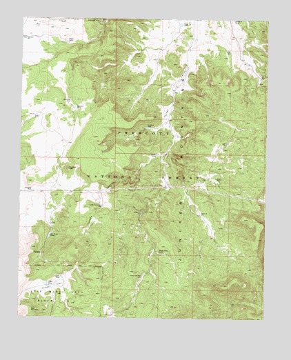
Turkey Canyon, AZ USGS Topographic Map
Click on map above to begin viewing in our Map Viewer.

This topographic map contains these locations and features:
Feature Name Type Latitude Longitude GNIS ID View Map
Deep WellWellN35.1167°W112.9982°38399View Map
Deer MountainSummitN35.0033°W112.9946°28385View Map
Happy Camp TankReservoirN35.0274°W112.9300°29734View Map
Happy Camp WellWellN35.0172°W112.9380°29735View Map
Haystack PeakSummitN35.0622°W112.9763°29816View Map
Haystack TankReservoirN35.0881°W112.9735°29818View Map
Hughs TankReservoirN35.0685°W112.9312°30272View Map
Hutch TankReservoirN35.0578°W112.9011°30307View Map
Indian TankReservoirN35.0731°W112.8954°30381View Map
Iron King MineMineN35.1008°W112.8785°30419View Map
Iron WellWellN35.0986°W112.8813°38531View Map
Jacks TankReservoirN35.0845°W112.9944°30479View Map
Juniper MountainsRangeN35.0656°W112.9177°30666View Map
Lindberg TankReservoirN35.0796°W112.9369°31001View Map
Lower TankReservoirN35.0169°W112.9791°31383View Map
Middle WellWellN35.0439°W112.9388°31833View Map
New WindmillLocaleN35.0267°W112.9894°32305View Map
Old Military TrailTrailN35.0120°W112.9174°2041023View Map
Powerline TankReservoirN35.0533°W112.9938°33178View Map
Rock Hole TankReservoirN35.0904°W112.9756°33711View Map
Section Nine WellWellN35.0431°W112.9082°34234View Map
Section Twenty One TankReservoirN35.0273°W112.8936°2039962View Map
Toad TankReservoirN35.1231°W112.9199°35354View Map
Trick TankReservoirN35.0906°W112.9449°41068View Map
Turkey Canyon WellWellN35.0467°W112.9591°35535View Map
Turkey FlatFlatN35.0128°W112.9830°35556View Map
Upper TankReservoirN35.0143°W112.9861°35723View Map
Wolf TankReservoirN35.1150°W112.9777°36356View Map

Note: Coordinates in the location and feature list above are referenced to NAD83 datum.


Copyright (C) 2008-2025 Ryan Niemi / Sunset Dynamics ... All Rights Reserved