TopoQuest Logo
Do you find TopoQuest useful?
Help keep TopoQuest running and adding new maps/features by donating!
Bitcoin:  19c7KJd3qBynnjoSw5npx9KScwjBe4ifkT
Litecoin:  LXs6TkuXGGXo1vDsWCkWVdjQX94eUKd6ui
Home View Maps Find Maps Find Places Resources & Links


Stanberry, Missouri Topographic Map

USGS Map Title: Stanberry, MO
USGS Map MRC: 40094B5
DRG (GeoTIFF) Download: o40094b5.tif


Neighboring USGS Topographic Map Quads:


  Ravenwood, MO  
40094C6
 

  Alanthus Grove, MO  
40094C5
 

  Gentry, MO  
40094C4
 

  Guilford, MO  
40094B6
 

  Stanberry, MO  
40094B5
 

  Darlington, MO  
40094B4
 

  Whitesville, MO  
40094A6
 

  King City, MO  
40094A5
 

  Ford City, MO  
40094A4


Map MRC Location:

N41°
W95°
N41°
W94°
H8 H7 H6 H5 H4 H3 H2 H1
G8 G7 G6 G5 G4 G3 G2 G1
F8 F7 F6 F5 F4 F3 F2 F1
E8 E7 E6 E5 E4 E3 E2 E1
D8 D7 D6 D5 D4 D3 D2 D1
C8 C7 C6 C5 C4 C3 C2 C1
B8 B7 B6 B5 B4 B3 B2 B1
A8 A7 A6 A5 A4 A3 A2 A1
N40°
W95°
N40°
W94°

Stanberry, MO USGS 1:24K Topographic Map Preview:
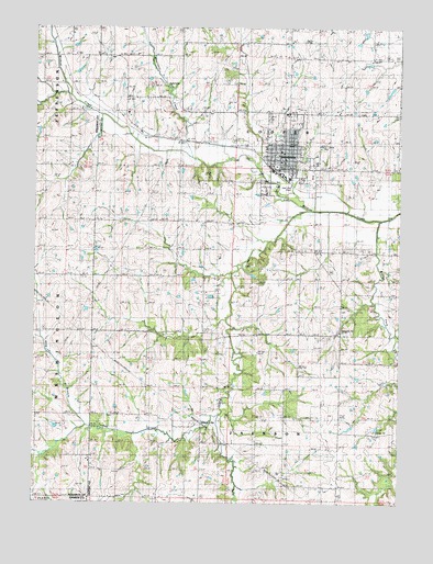
Stanberry, MO USGS Topographic Map
Click on map above to begin viewing in our Map Viewer.

This topographic map contains these locations and features:
Feature Name Type Latitude Longitude GNIS ID View Map
Beggs School (historical)SchoolN40.1475°W94.5305°713884View Map
City of StanberryCivilN40.2166°W94.5381°2395949View Map
Cogdill SchoolSchoolN40.1800°W94.5347°716074View Map
Cooper CemeteryCemeteryN40.1886°W94.5494°716279View Map
Crosswhite School (historical)SchoolN40.1705°W94.5800°716541View Map
Floyd School (historical)SchoolN40.2325°W94.5764°718042View Map
Granor CemeteryCemeteryN40.1544°W94.5086°718700View Map
High Ridge CemeteryCemeteryN40.2266°W94.5454°2702171View Map
Island CityPopulated PlaceN40.1455°W94.5711°740957View Map
Island City School (historical)SchoolN40.1450°W94.5741°747018View Map
Island CreekStreamN40.2022°W94.5313°720180View Map
King BranchStreamN40.1458°W94.6072°720606View Map
Lafayette School (historical)SchoolN40.1486°W94.6244°720736View Map
Meekers CemeteryCemeteryN40.1480°W94.5972°722199View Map
Moccasin CreekStreamN40.2158°W94.5719°737958View Map
Mount PleasantPopulated PlaceN40.2272°W94.5011°739618View Map
Mount Pleasant SchoolSchoolN40.2286°W94.5022°722878View Map
StanberryPopulated PlaceN40.2178°W94.5383°726998View Map
Stanberry Elementary SchoolSchoolN40.2195°W94.5408°2545166View Map
Stanberry High SchoolSchoolN40.2189°W94.5409°2545240View Map
Stanberry Post OfficePost OfficeN40.2148°W94.5412°2782652View Map
Stanberry Rural Fire DistrictBuildingN40.2132°W94.5411°2621675View Map
Star School (historical)SchoolN40.1994°W94.5752°727022View Map
Turkey CreekStreamN40.1486°W94.5619°727861View Map
Walnut ForkStreamN40.2000°W94.5066°728301View Map

Note: Coordinates in the location and feature list above are referenced to NAD83 datum.


Copyright (C) 2008-2024 Ryan Niemi / Sunset Dynamics ... All Rights Reserved