TopoQuest Logo
Do you find TopoQuest useful?
Help keep TopoQuest running and adding new maps/features by donating!
Bitcoin:  19c7KJd3qBynnjoSw5npx9KScwjBe4ifkT
Litecoin:  LXs6TkuXGGXo1vDsWCkWVdjQX94eUKd6ui
Home View Maps Find Maps Find Places Resources & Links


Standish, Maine Topographic Map

USGS Map Title: Standish, ME
USGS Map MRC: 43070F5
DRG (GeoTIFF) Download: o43070f5.tif


Neighboring USGS Topographic Map Quads:


  Steep Falls, ME  
43070G6
 

  Sebago Lake, ME  
43070G5
 

  North Windham, ME  
43070G4
 

  Limington, ME  
43070F6
 

  Standish, ME  
43070F5
 

  Gorham, ME  
43070F4
 

  Waterboro, ME  
43070E6
 

  Bar Mills, ME  
43070E5
 

  Old Orchard Beach, ME  
43070E4


Map MRC Location:

N44°
W71°
N44°
W70°
H8 H7 H6 H5 H4 H3 H2 H1
G8 G7 G6 G5 G4 G3 G2 G1
F8 F7 F6 F5 F4 F3 F2 F1
E8 E7 E6 E5 E4 E3 E2 E1
D8 D7 D6 D5 D4 D3 D2 D1
C8 C7 C6 C5 C4 C3 C2 C1
B8 B7 B6 B5 B4 B3 B2 B1
A8 A7 A6 A5 A4 A3 A2 A1
N43°
W71°
N43°
W70°

Standish, ME USGS 1:24K Topographic Map Preview:
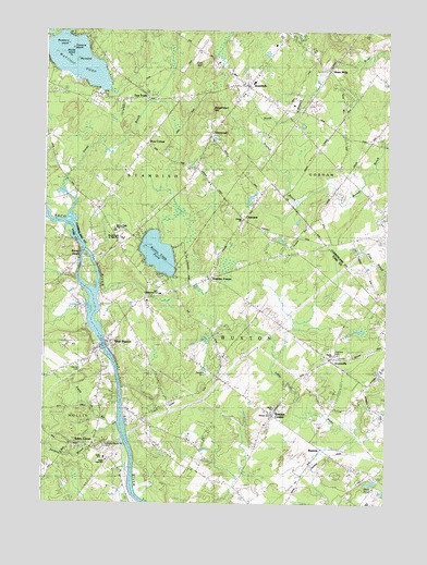
Standish, ME USGS Topographic Map
Click on map above to begin viewing in our Map Viewer.

This topographic map contains these locations and features:
Feature Name Type Latitude Longitude GNIS ID View Map
Big IslandIslandN43.7423°W70.6126°1912175View Map
Blake SchoolSchoolN43.7115°W70.5162°562555View Map
Blueberry IslandIslandN43.7462°W70.6159°1912185View Map
Boggs Mill SchoolSchoolN43.6784°W70.5920°562703View Map
Bonney Eagle DamDamN43.6877°W70.6116°1773579View Map
Bonny EaglePopulated PlaceN43.6898°W70.6145°562736View Map
Bonny Eagle CemeteryCemeteryN43.6920°W70.5956°2741931View Map
Bonny Eagle CemeteryCemeteryN43.6831°W70.6199°2741932View Map
Bonny Eagle High SchoolSchoolN43.6970°W70.5987°1912191View Map
Bonny Eagle Middle SchoolSchoolN43.6949°W70.5966°1910781View Map
Bonny Eagle PondLakeN43.6909°W70.5836°562737View Map
Breakheart HillSummitN43.7299°W70.5652°562924View Map
BuxtonPopulated PlaceN43.6379°W70.5189°563320View Map
Buxton CenterPopulated PlaceN43.6487°W70.5412°563321View Map
Buxton Center Baptist ChurchChurchN43.6490°W70.5412°1910790View Map
Buxton Center Elementary SchoolSchoolN43.6518°W70.5422°2738215View Map
Buxton Fire and Rescue Chicopee Station 3BuildingN43.7007°W70.5526°2553053View Map
Buxton Fire Department Station 1BuildingN43.6649°W70.5228°2553170View Map
Buxton Post OfficePost OfficeN43.6718°W70.5830°1910792View Map
Came CemeteryCemeteryN43.6776°W70.6016°2737114View Map
ChicopeePopulated PlaceN43.7006°W70.5534°563940View Map
Chicopee CemeteryCemeteryN43.6968°W70.5426°2737135View Map
Chicopee Road CemeteryCemeteryN43.6955°W70.5570°2737136View Map
Daniel Marrett House MuseumBuildingN43.7359°W70.5517°1912350View Map
Dearborn SchoolSchoolN43.6595°W70.5656°564925View Map
Douglass Seaplane BaseAirportN43.7370°W70.6101°582234View Map
Dow CornerPopulated PlaceN43.7201°W70.5903°565252View Map
Dows Corner CemeteryCemeteryN43.7220°W70.5866°2740659View Map
Duck PondLakeN43.6307°W70.5051°565348View Map
ElmwoodPopulated PlaceN43.7226°W70.5667°565875View Map
Elwell CemeteryCemeteryN43.6692°W70.5800°2736431View Map
Emery Bradbury CemeteryCemeteryN43.6362°W70.5658°2736432View Map
Emery CemeteryCemeteryN43.6553°W70.5350°2736433View Map
Flanders CemeteryCemeteryN43.6597°W70.5650°1910885View Map
Flood CemeteryCemeteryN43.6821°W70.5575°2736869View Map
Frank Jewett School (historical)SchoolN43.6506°W70.5403°1910895View Map
George E Jack SchoolSchoolN43.7364°W70.5491°1912475View Map
GrovevillePopulated PlaceN43.6637°W70.5201°567359View Map
Highland CemeteryCemeteryN43.6648°W70.5189°1910929View Map
Hill CemeteryCemeteryN43.6830°W70.5866°2736461View Map
Hillcrest CemeteryCemeteryN43.6617°W70.6095°1910932View Map
Hobson Joseph CemeteryCemeteryN43.6666°W70.5889°2736468View Map
Hollis High SchoolSchoolN43.6373°W70.6028°568195View Map
Hollis SchoolSchoolN43.6371°W70.6026°1910937View Map
Jack Memorial SchoolSchoolN43.6805°W70.5823°2738103View Map
Josies BrookStreamN43.6998°W70.6198°569007View Map
Junkins BrookStreamN43.6451°W70.5981°569034View Map
Kimbles CornerPopulated PlaceN43.6848°W70.5653°569187View Map
Leavitt CemeteryCemeteryN43.6773°W70.5877°2736501View Map
Libby LotCemeteryN43.6973°W70.6216°2736510View Map
Living Waters Christian ChurchChurchN43.6779°W70.5886°2573613View Map
Living Waters Christian SchoolSchoolN43.6780°W70.5886°2738046View Map
Lowell CemeteryCemeteryN43.7211°W70.5410°2736178View Map
Maplewood CemeteryCemeteryN43.6954°W70.6068°2736182View Map
Martin CemeteryCemeteryN43.6641°W70.5726°2736530View Map
Meeting House Hill CemeteryCemeteryN43.6394°W70.6039°1911020View Map
Merrill CemeteryCemeteryN43.6723°W70.5619°2736541View Map
Middle IslandIslandN43.7431°W70.6153°1912741View Map
NFI Buxton Beacon HouseSchoolN43.6738°W70.5823°2738044View Map
North ChurchChurchN43.6645°W70.5195°1911045View Map
Norton CemeteryCemeteryN43.7112°W70.6174°2736191View Map
Oak HillSummitN43.7413°W70.5680°572572View Map
Old Groveville CemeteryCemeteryN43.6578°W70.5093°2737171View Map
Old Red ChurchChurchN43.7381°W70.5553°1912826View Map
Paine CemeteryCemeteryN43.7109°W70.5659°2736194View Map
Paine CemeteryCemeteryN43.7406°W70.6009°2736195View Map
Palmer CemeteryCemeteryN43.6662°W70.5761°2737172View Map
Palmer LotCemeteryN43.6309°W70.6236°2737174View Map
Saco River ReservoirReservoirN43.6666°W70.6032°1773578View Map
Saco River ReservoirReservoirN43.6867°W70.6112°1773580View Map
Samuel D Hanson School (historical)SchoolN43.6492°W70.5414°1911154View Map
Sawyer Deering CemeteryCemeteryN43.6637°W70.5866°2737243View Map
Shadigee SchoolSchoolN43.6456°W70.5864°575276View Map
Shaw CemeteryCemeteryN43.7312°W70.5357°2736245View Map
Shaw MillsPopulated PlaceN43.7404°W70.5217°575327View Map
Shaws Mill CemeteryCemeteryN43.7371°W70.5182°1913051View Map
Smith BrookStreamN43.6462°W70.5987°575589View Map
South Standish SchoolSchoolN43.7040°W70.6067°575908View Map
StandishPopulated PlaceN43.7359°W70.5520°576237View Map
Standish Baptist AcademySchoolN43.7340°W70.5686°2738143View Map
Standish Census Designated PlaceCensusN43.7353°W70.5525°2583565View Map
Standish Congregational ChurchChurchN43.7370°W70.5531°1913095View Map
Standish Fire and Emergency Medical ServicesBuildingN43.7444°W70.5401°2552693View Map
Standish Post OfficePost OfficeN43.7306°W70.5443°1913096View Map
Thompson Gray CemeteryCemeteryN43.6929°W70.5348°2737302View Map
Tory Hill Meeting HouseChurchN43.6490°W70.5409°1911217View Map
Town of BuxtonCivilN43.6428°W70.5376°582380View Map
Town of HollisCivilN43.6295°W70.6245°582523View Map
Treasure IslandIslandN43.7451°W70.6145°1913222View Map
Two TrailsPopulated PlaceN43.7320°W70.5898°577508View Map
Tylers CornerPopulated PlaceN43.6401°W70.6087°579783View Map
Watchic PondReservoirN43.7384°W70.6059°577882View Map
Webster FieldAirportN43.6748°W70.5003°582153View Map
West BuxtonPopulated PlaceN43.6670°W70.6031°578113View Map
West Buxton DamDamN43.6666°W70.6032°1773577View Map
West Buxton Public LibraryBuildingN43.6655°W70.6001°1911263View Map
West Gorham CemeteryCemeteryN43.6949°W70.5014°2736263View Map
West Gorham CemeteryCemeteryN43.7198°W70.5864°1913126View Map
WLAM-AM (Gorham)TowerN43.6887°W70.5089°582274View Map

Note: Coordinates in the location and feature list above are referenced to NAD83 datum.


Copyright (C) 2008-2025 Ryan Niemi / Sunset Dynamics ... All Rights Reserved