TopoQuest Logo
Do you find TopoQuest useful?
Help keep TopoQuest running and adding new maps/features by donating!
Bitcoin:  19c7KJd3qBynnjoSw5npx9KScwjBe4ifkT
Litecoin:  LXs6TkuXGGXo1vDsWCkWVdjQX94eUKd6ui
Home View Maps Find Maps Find Places Resources & Links


Star, Idaho Topographic Map

USGS Map Title: Star, ID
USGS Map MRC: 43116F4
DRG (GeoTIFF) Download: o43116f4.tif


Neighboring USGS Topographic Map Quads:


  Southwest Emmett, ID  
43116G5
 

  Southeast Emmett, ID  
43116G4
 

  Pearl, ID  
43116G3
 

  Middleton, ID  
43116F5
 

  Star, ID  
43116F4
 

  Eagle, ID  
43116F3
 

  Nampa, ID  
43116E5
 

  Meridian, ID  
43116E4
 

  Cloverdale, ID  
43116E3


Map MRC Location:

N44°
W117°
N44°
W116°
H8 H7 H6 H5 H4 H3 H2 H1
G8 G7 G6 G5 G4 G3 G2 G1
F8 F7 F6 F5 F4 F3 F2 F1
E8 E7 E6 E5 E4 E3 E2 E1
D8 D7 D6 D5 D4 D3 D2 D1
C8 C7 C6 C5 C4 C3 C2 C1
B8 B7 B6 B5 B4 B3 B2 B1
A8 A7 A6 A5 A4 A3 A2 A1
N43°
W117°
N43°
W116°

Star, ID USGS 1:24K Topographic Map Preview:
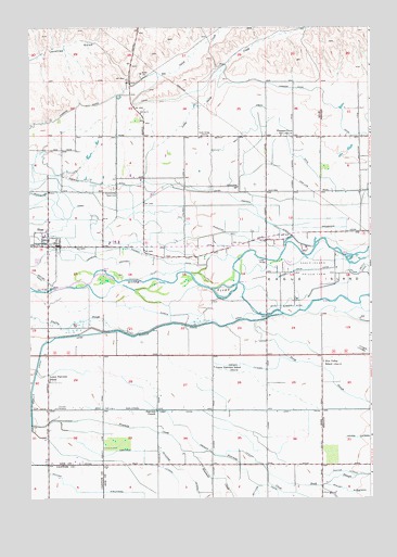
Star, ID USGS Topographic Map
Click on map above to begin viewing in our Map Viewer.

This topographic map contains these locations and features:
Feature Name Type Latitude Longitude GNIS ID View Map
Ada County Paramedics Medical Station 61BuildingN43.6270°W116.4340°2642837View Map
Big Gulch CreekStreamN43.7368°W116.4526°371499View Map
Blue Valley SchoolLocaleN43.6610°W116.3929°376330View Map
Chief Joseph Elementary SchoolSchoolN43.6259°W116.3795°401254View Map
City of EagleCivilN43.6697°W116.3824°2410378View Map
City of StarCivilN43.7020°W116.4937°2411972View Map
Creason LateralCanalN43.6346°W116.4165°372253View Map
Eagle DivisionCivilN43.7442°W116.3975°1936700View Map
Eagle Fire Protection District Station 3BuildingN43.7029°W116.4131°2619272View Map
Eagle Fish Health LaboratoryParkN43.6778°W116.4024°2765279View Map
Eagle HatcheryLocaleN43.6777°W116.4057°401323View Map
Eagle IslandIslandN43.6829°W116.3787°380987View Map
Eagle Island Prison FarmBuildingN43.6866°W116.3965°372527View Map
Eagle Island State ParkParkN43.6868°W116.3848°395344View Map
Fairview ChurchChurchN43.6482°W116.4540°372649View Map
Farmers Union CanalCanalN43.7285°W116.3873°381599View Map
Foothill DitchCanalN43.7046°W116.4248°372743View Map
Harton Davis CanalCanalN43.6849°W116.4040°373001View Map
Home of the Peace CemeteryCemeteryN43.7075°W116.4693°373117View Map
Hunter LateralCanalN43.6321°W116.3854°373184View Map
Lawrence Kennedy CanalCanalN43.6888°W116.4704°373530View Map
Lemp CanalCanalN43.6482°W116.4210°373551View Map
Linder BridgeBridgeN43.6882°W116.4135°373593View Map
Little Gulch CreekStreamN43.7057°W116.4540°373631View Map
Lower Fairview CemeteryCemeteryN43.6489°W116.4905°372648View Map
Lower Fairview SchoolSchoolN43.6560°W116.4932°373758View Map
Meridian Fire Department Station 2BuildingN43.6269°W116.4341°2619267View Map
Meridian Fire Department Station 5BuildingN43.6594°W116.4143°2619269View Map
Middleton Mill CanalCanalN43.6943°W116.4210°373934View Map
Ninemile CreekStreamN43.6371°W116.4407°374152View Map
North SloughStreamN43.6721°W116.4176°374231View Map
Pioneer CanalCanalN43.6882°W116.4507°374413View Map
Pleasant View SchoolLocaleN43.7213°W116.4076°376352View Map
Safford SublateralCanalN43.6268°W116.4760°374835View Map
Seven Suckers DitchCanalN43.6754°W116.4085°398114View Map
Simpson LateralCanalN43.6599°W116.4193°375037View Map
South SloughStreamN43.6288°W116.4032°375178View Map
StarPopulated PlaceN43.6921°W116.4935°398181View Map
Star BridgeBridgeN43.6804°W116.4935°375248View Map
Star Elementary SchoolSchoolN43.6989°W116.4925°401184View Map
Star Joint Fire Protection DistrictBuildingN43.6917°W116.4886°2618969View Map
Star Post OfficePost OfficeN43.6924°W116.4879°2781802View Map
Upper Fairview SchoolLocaleN43.6599°W116.4326°375677View Map
West Tap SublateralCanalN43.6488°W116.4679°375838View Map
Young HeliportAirportN43.7166°W116.3890°400811View Map

Note: Coordinates in the location and feature list above are referenced to NAD83 datum.


Copyright (C) 2008-2024 Ryan Niemi / Sunset Dynamics ... All Rights Reserved