TopoQuest Logo
Do you find TopoQuest useful?
Help keep TopoQuest running and adding new maps/features by donating!
Bitcoin:  19c7KJd3qBynnjoSw5npx9KScwjBe4ifkT
Litecoin:  LXs6TkuXGGXo1vDsWCkWVdjQX94eUKd6ui
Home View Maps Find Maps Find Places Resources & Links


Southeast Emmett, Idaho Topographic Map

USGS Map Title: Southeast Emmett, ID
USGS Map MRC: 43116G4
DRG (GeoTIFF) Download: o43116g4.tif


Neighboring USGS Topographic Map Quads:


  Northwest Emmett, ID  
43116H5
 

  Northeast Emmett, ID  
43116H4
 

  Montour, ID  
43116H3
 

  Southwest Emmett, ID  
43116G5
 

  Southeast Emmett, ID  
43116G4
 

  Pearl, ID  
43116G3
 

  Middleton, ID  
43116F5
 

  Star, ID  
43116F4
 

  Eagle, ID  
43116F3


Map MRC Location:

N44°
W117°
N44°
W116°
H8 H7 H6 H5 H4 H3 H2 H1
G8 G7 G6 G5 G4 G3 G2 G1
F8 F7 F6 F5 F4 F3 F2 F1
E8 E7 E6 E5 E4 E3 E2 E1
D8 D7 D6 D5 D4 D3 D2 D1
C8 C7 C6 C5 C4 C3 C2 C1
B8 B7 B6 B5 B4 B3 B2 B1
A8 A7 A6 A5 A4 A3 A2 A1
N43°
W117°
N43°
W116°

Southeast Emmett, ID USGS 1:24K Topographic Map Preview:
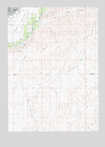
Southeast Emmett, ID USGS Topographic Map
Click on map above to begin viewing in our Map Viewer.

This topographic map contains these locations and features:
Feature Name Type Latitude Longitude GNIS ID View Map
Aikman (historical)Populated PlaceN43.8166°W116.4051°399346View Map
Butte View Elementary SchoolSchoolN43.8727°W116.4840°401307View Map
City of EmmettCivilN43.8685°W116.4890°2410437View Map
EmmettPopulated PlaceN43.8735°W116.4993°397688View Map
Emmett Junior High SchoolSchoolN43.8715°W116.4964°401312View Map
Emmett PlazaLocaleN43.8657°W116.4996°395358View Map
Freezeout HillSummitN43.8307°W116.4857°395403View Map
Jackass GulchValleyN43.7896°W116.4776°373273View Map
KJHY-FM (Emmett)TowerN43.8129°W116.4615°401867View Map
Last Chance CanalCanalN43.8585°W116.4812°373469View Map
Lincoln SchoolSchoolN43.8504°W116.4943°373591View Map
North Fork Willow CreekStreamN43.8107°W116.4335°374211View Map
Sand Hollow CreekStreamN43.8607°W116.4576°374892View Map
Schiller CreekStreamN43.8466°W116.3854°374916View Map
South Fork Willow CreekStreamN43.8107°W116.4335°391059View Map

Note: Coordinates in the location and feature list above are referenced to NAD83 datum.


Copyright (C) 2008-2025 Ryan Niemi / Sunset Dynamics ... All Rights Reserved