TopoQuest Logo
Do you find TopoQuest useful?
Help keep TopoQuest running and adding new maps/features by donating!
Bitcoin:  19c7KJd3qBynnjoSw5npx9KScwjBe4ifkT
Litecoin:  LXs6TkuXGGXo1vDsWCkWVdjQX94eUKd6ui
Home View Maps Find Maps Find Places Resources & Links


Southwest Emmett, Idaho Topographic Map

USGS Map Title: Southwest Emmett, ID
USGS Map MRC: 43116G5
DRG (GeoTIFF) Download: o43116g5.tif


Neighboring USGS Topographic Map Quads:


  Letha, ID  
43116H6
 

  Northwest Emmett, ID  
43116H5
 

  Northeast Emmett, ID  
43116H4
 

  Sand Hollow, ID  
43116G6
 

  Southwest Emmett, ID  
43116G5
 

  Southeast Emmett, ID  
43116G4
 

  Caldwell, ID  
43116F6
 

  Middleton, ID  
43116F5
 

  Star, ID  
43116F4


Map MRC Location:

N44°
W117°
N44°
W116°
H8 H7 H6 H5 H4 H3 H2 H1
G8 G7 G6 G5 G4 G3 G2 G1
F8 F7 F6 F5 F4 F3 F2 F1
E8 E7 E6 E5 E4 E3 E2 E1
D8 D7 D6 D5 D4 D3 D2 D1
C8 C7 C6 C5 C4 C3 C2 C1
B8 B7 B6 B5 B4 B3 B2 B1
A8 A7 A6 A5 A4 A3 A2 A1
N43°
W117°
N43°
W116°

Southwest Emmett, ID USGS 1:24K Topographic Map Preview:
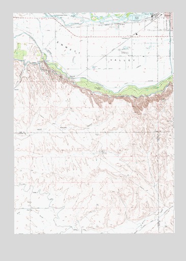
Southwest Emmett, ID USGS Topographic Map
Click on map above to begin viewing in our Map Viewer.

This topographic map contains these locations and features:
Feature Name Type Latitude Longitude GNIS ID View Map
Airport Pond Public Fishing AreaLocaleN43.8541°W116.5374°401209View Map
Black Canyon CanalCanalN43.8277°W116.5426°396132View Map
BramwellPopulated PlaceN43.8382°W116.5829°397477View Map
C-Line Canal EastCanalN43.7682°W116.5965°371834View Map
Del MontePopulated PlaceN43.8688°W116.5432°397622View Map
Emmett Fire DepartmentBuildingN43.8740°W116.5004°2618974View Map
Emmett High SchoolSchoolN43.8639°W116.5088°401311View Map
Emmett Municipal AirportAirportN43.8525°W116.5387°400814View Map
Emmett Valley DivisionCivilN43.8559°W116.5976°1936707View Map
Gem County DrainageCanalN43.8346°W116.5262°397732View Map
Gem County Fire District 1 Station 1BuildingN43.8724°W116.5011°2619250View Map
Haw CreekStreamN43.8749°W116.5499°373012View Map
Little FreezeoutGapN43.8346°W116.6218°373628View Map
Maxfield DitchCanalN43.8742°W116.6125°2633871View Map
Middleton DivisionCivilN43.7522°W116.6204°1936758View Map
Mud Lake Cow CampLocaleN43.7963°W116.5568°374059View Map
Payette River Wildlife Management AreaReserveN43.8724°W116.5532°401109View Map
South Slope SchoolSchoolN43.8318°W116.5574°375177View Map
Star Lane Pond Public Fishing AreaLocaleN43.8441°W116.5646°401686View Map
Star Lane Wildlife Habitat AreaReserveN43.8438°W116.5540°401685View Map
Tunnel Number 7 WastewayTunnelN43.8643°W116.6037°400307View Map
Vanderdasson SchoolSchoolN43.8727°W116.5929°375696View Map

Note: Coordinates in the location and feature list above are referenced to NAD83 datum.


Copyright (C) 2008-2025 Ryan Niemi / Sunset Dynamics ... All Rights Reserved