TopoQuest Logo
Do you find TopoQuest useful?
Help keep TopoQuest running and adding new maps/features by donating!
Bitcoin:  19c7KJd3qBynnjoSw5npx9KScwjBe4ifkT
Litecoin:  LXs6TkuXGGXo1vDsWCkWVdjQX94eUKd6ui
Home View Maps Find Maps Find Places Resources & Links


Stark North, Montana Topographic Map

USGS Map Title: Stark North, MT
USGS Map MRC: 47114B5
DRG (GeoTIFF) Download: o47114b5.tif


Neighboring USGS Topographic Map Quads:


  Knowles, MT  
47114C6
 

  Perma, MT  
47114C5
 

  McDonald, MT  
47114C4
 

  Horsehead Peak, MT  
47114B6
 

  Stark North, MT  
47114B5
 

  McCormick Peak, MT  
47114B4
 

  Tarkio, MT  
47114A6
 

  Stark South, MT  
47114A5
 

  Alberton, MT  
47114A4


Map MRC Location:

N48°
W115°
N48°
W114°
H8 H7 H6 H5 H4 H3 H2 H1
G8 G7 G6 G5 G4 G3 G2 G1
F8 F7 F6 F5 F4 F3 F2 F1
E8 E7 E6 E5 E4 E3 E2 E1
D8 D7 D6 D5 D4 D3 D2 D1
C8 C7 C6 C5 C4 C3 C2 C1
B8 B7 B6 B5 B4 B3 B2 B1
A8 A7 A6 A5 A4 A3 A2 A1
N47°
W115°
N47°
W114°

Stark North, MT USGS 1:24K Topographic Map Preview:
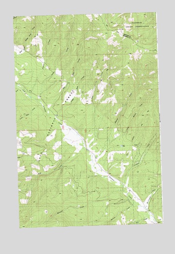
Stark North, MT USGS Topographic Map
Click on map above to begin viewing in our Map Viewer.

This topographic map contains these locations and features:
Feature Name Type Latitude Longitude GNIS ID View Map
16N23W17DDAA01 WellWellN47.1455°W114.5279°821010View Map
16N23W21BCBC01 WellWellN47.1388°W114.5257°820965View Map
17N24W36DDDA01 WellWellN47.1855°W114.5860°821303View Map
Barrette CreekStreamN47.1360°W114.5229°779383View Map
Big Blue CreekStreamN47.1908°W114.5965°779765View Map
Bird CreekStreamN47.1677°W114.5621°779936View Map
Camp CreekStreamN47.1996°W114.6054°780841View Map
Dry GulchValleyN47.1571°W114.5468°782625View Map
Fire CreekStreamN47.1299°W114.5101°783404View Map
Josephine CreekStreamN47.1471°W114.5335°785573View Map
Josephine Creek MineMineN47.1721°W114.5232°804839View Map
Josephine Creek TrailTrailN47.1910°W114.5107°785574View Map
Little Bear CreekStreamN47.1983°W114.6026°786228View Map
Little Blue CreekStreamN47.1888°W114.5921°786246View Map
Little Marion CreekStreamN47.1741°W114.5471°786323View Map
Lost LakeLakeN47.1715°W114.5346°807052View Map
Marion CreekStreamN47.1621°W114.5587°786849View Map
McCormick CreekStreamN47.1344°W114.5160°787014View Map
Moncure CreekStreamN47.1430°W114.5298°787553View Map
Ninemile/McCormick MineMineN47.1333°W114.5121°804864View Map
Pine CreekStreamN47.1694°W114.5640°788877View Map
Soldier CreekStreamN47.2021°W114.6112°790836View Map
StarkPopulated PlaceN47.1255°W114.5051°791450View Map
Stark Post Office (historical)Post OfficeN47.1255°W114.5051°1781231View Map
Stark School (historical)SchoolN47.1255°W114.5051°1781232View Map
Twin CreekStreamN47.2077°W114.6221°792507View Map

Note: Coordinates in the location and feature list above are referenced to NAD83 datum.


Copyright (C) 2008-2024 Ryan Niemi / Sunset Dynamics ... All Rights Reserved