TopoQuest Logo
Do you find TopoQuest useful?
Help keep TopoQuest running and adding new maps/features by donating!
Bitcoin:  19c7KJd3qBynnjoSw5npx9KScwjBe4ifkT
Litecoin:  LXs6TkuXGGXo1vDsWCkWVdjQX94eUKd6ui
Home View Maps Find Maps Find Places Resources & Links


Perma, Montana Topographic Map

USGS Map Title: Perma, MT
USGS Map MRC: 47114C5
DRG (GeoTIFF) Download: o47114c5.tif


Neighboring USGS Topographic Map Quads:


  Sunrise Spring, MT  
47114D6
 

  Camas Prairie, MT  
47114D5
 

  Melton Ranch, MT  
47114D4
 

  Knowles, MT  
47114C6
 

  Perma, MT  
47114C5
 

  McDonald, MT  
47114C4
 

  Horsehead Peak, MT  
47114B6
 

  Stark North, MT  
47114B5
 

  McCormick Peak, MT  
47114B4


Map MRC Location:

N48°
W115°
N48°
W114°
H8 H7 H6 H5 H4 H3 H2 H1
G8 G7 G6 G5 G4 G3 G2 G1
F8 F7 F6 F5 F4 F3 F2 F1
E8 E7 E6 E5 E4 E3 E2 E1
D8 D7 D6 D5 D4 D3 D2 D1
C8 C7 C6 C5 C4 C3 C2 C1
B8 B7 B6 B5 B4 B3 B2 B1
A8 A7 A6 A5 A4 A3 A2 A1
N47°
W115°
N47°
W114°

Perma, MT USGS 1:24K Topographic Map Preview:
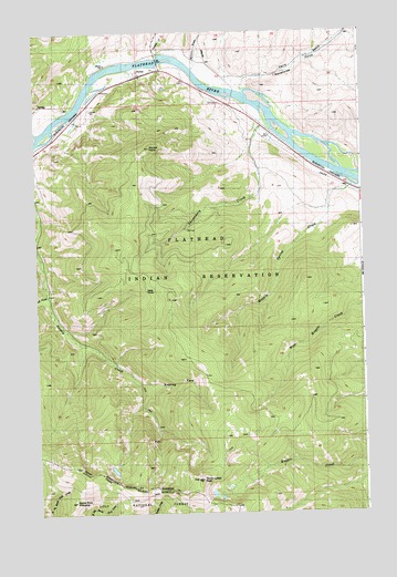
Perma, MT USGS Topographic Map
Click on map above to begin viewing in our Map Viewer.

This topographic map contains these locations and features:
Feature Name Type Latitude Longitude GNIS ID View Map
18N23W03CDD_01 WellWellN47.3416°W114.5135°822320View Map
19N23W32BCBA01 WellWellN47.3666°W114.5623°822468View Map
Burnt Fork PinnacleSummitN47.2524°W114.6118°780642View Map
Camas CreekStreamN47.3691°W114.5771°780807View Map
Ferry BasinBasinN47.3685°W114.5140°783363View Map
Forest Service Winter RangeLocaleN47.3688°W114.5248°783605View Map
Magpie Spring CreekStreamN47.3360°W114.5060°786781View Map
Makiness (historical)LocaleN47.3341°W114.5060°1781018View Map
PermaLocaleN47.3638°W114.5848°1781003View Map
PermaPopulated PlaceN47.3638°W114.5848°788767View Map
Perma PointSummitN47.3444°W114.5846°794305View Map
Perma Post Office (historical)Post OfficeN47.3638°W114.5848°1781004View Map
Racehorse GulchValleyN47.3608°W114.5454°789316View Map
Roaring Fork Seepay CreekStreamN47.2838°W114.5857°789625View Map
Teddy TunnelMineN47.3085°W114.5851°791936View Map
Three Lakes PeakSummitN47.2585°W114.5626°792128View Map
Vanderburg CreekStreamN47.3555°W114.5393°792680View Map
West Fork Seepay CreekStreamN47.3074°W114.6204°793077View Map
Wilcox DrawValleyN47.3655°W114.5640°793280View Map

Note: Coordinates in the location and feature list above are referenced to NAD83 datum.


Copyright (C) 2008-2025 Ryan Niemi / Sunset Dynamics ... All Rights Reserved