TopoQuest Logo
Do you find TopoQuest useful?
Help keep TopoQuest running and adding new maps/features by donating!
Bitcoin:  19c7KJd3qBynnjoSw5npx9KScwjBe4ifkT
Litecoin:  LXs6TkuXGGXo1vDsWCkWVdjQX94eUKd6ui
Home View Maps Find Maps Find Places Resources & Links


Horsehead Peak, Montana Topographic Map

USGS Map Title: Horsehead Peak, MT
USGS Map MRC: 47114B6
DRG (GeoTIFF) Download: o47114b6.tif


Neighboring USGS Topographic Map Quads:


  Quinns Hot Springs, MT  
47114C7
 

  Knowles, MT  
47114C6
 

  Perma, MT  
47114C5
 

  Idaho Gulch, MT  
47114B7
 

  Horsehead Peak, MT  
47114B6
 

  Stark North, MT  
47114B5
 

  Lozeau, MT  
47114A7
 

  Tarkio, MT  
47114A6
 

  Stark South, MT  
47114A5


Map MRC Location:

N48°
W115°
N48°
W114°
H8 H7 H6 H5 H4 H3 H2 H1
G8 G7 G6 G5 G4 G3 G2 G1
F8 F7 F6 F5 F4 F3 F2 F1
E8 E7 E6 E5 E4 E3 E2 E1
D8 D7 D6 D5 D4 D3 D2 D1
C8 C7 C6 C5 C4 C3 C2 C1
B8 B7 B6 B5 B4 B3 B2 B1
A8 A7 A6 A5 A4 A3 A2 A1
N47°
W115°
N47°
W114°

Horsehead Peak, MT USGS 1:24K Topographic Map Preview:
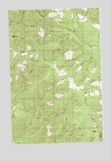
Horsehead Peak, MT USGS Topographic Map
Click on map above to begin viewing in our Map Viewer.

This topographic map contains these locations and features:
Feature Name Type Latitude Longitude GNIS ID View Map
Antelope CreekStreamN47.2377°W114.7293°768295View Map
Beecher CreekStreamN47.2260°W114.6621°779648View Map
D J Silver/Saint Louis MineMineN47.2413°W114.7121°804835View Map
Devils CreekStreamN47.2374°W114.7323°782328View Map
East Fork Beecher CreekStreamN47.2402°W114.6540°782802View Map
East Fork Burnt Fork CreekStreamN47.2249°W114.6279°782816View Map
Eustache CreekStreamN47.2372°W114.7318°783250View Map
Frances Copper MineMineN47.2483°W114.6954°804808View Map
Granite Number 2 MineMineN47.1319°W114.6801°804762View Map
Horsehead PeakSummitN47.1710°W114.6501°785064View Map
Liquidator MineMineN47.1305°W114.6676°804765View Map
Liquidator Number 2 MineMineN47.1333°W114.6690°804766View Map
Lookout Fraction Number 3 MineMineN47.1319°W114.6671°804764View Map
Lookout MountainSummitN47.1344°W114.6404°786553View Map
Lower Eddy Creek MineMineN47.1341°W114.6801°804781View Map
Lower Ninemile MineMineN47.2146°W114.6579°804838View Map
Lucy Ellen MineMineN47.1313°W114.6690°804767View Map
Martina (historical)LocaleN47.2188°W114.6343°1781258View Map
Martina CreekStreamN47.2146°W114.6404°786899View Map
Martina Creek MineMineN47.2099°W114.6510°804857View Map
Martina MineMineN47.2119°W114.6690°804802View Map
Martina Post Office (historical)Post OfficeN47.2188°W114.6343°1781259View Map
Mattie V CreekStreamN47.2127°W114.6337°786929View Map
Montreal (historical)LocaleN47.2360°W114.7051°1781252View Map
Ninemile Creek MineMineN47.2221°W114.6551°804858View Map
Ninemile MineMineN47.2138°W114.6618°804836View Map
North Fork Second CreekStreamN47.1274°W114.7454°788242View Map
Nugget CreekStreamN47.2344°W114.6940°788334View Map
Old TownPopulated PlaceN47.2349°W114.6993°794403View Map
Oliver CreekStreamN47.2385°W114.7437°788440View Map
Pats CreekStreamN47.2308°W114.6598°794404View Map
Queue CreekStreamN47.2422°W114.7004°789296View Map
Saint Louis CreekStreamN47.2344°W114.7004°789938View Map
Sawpit CreekStreamN47.2263°W114.6621°790083View Map
Sparks CreekStreamN47.2347°W114.7207°791134View Map
Upper Eddy Creek MineMineN47.1366°W114.6801°804761View Map
Upper Ninemile MineMineN47.2124°W114.6662°804837View Map
War Eagle MineMineN47.1291°W114.6551°804770View Map
West Fork Beecher CreekStreamN47.2402°W114.6540°792979View Map
West Fork Burnt Fork CreekStreamN47.2249°W114.6279°792986View Map

Note: Coordinates in the location and feature list above are referenced to NAD83 datum.


Copyright (C) 2008-2024 Ryan Niemi / Sunset Dynamics ... All Rights Reserved