TopoQuest Logo
Do you find TopoQuest useful?
Help keep TopoQuest running and adding new maps/features by donating!
Bitcoin:  19c7KJd3qBynnjoSw5npx9KScwjBe4ifkT
Litecoin:  LXs6TkuXGGXo1vDsWCkWVdjQX94eUKd6ui
Home View Maps Find Maps Find Places Resources & Links


Steele Center, Minnesota Topographic Map

USGS Map Title: Steele Center, MN
USGS Map MRC: 43093H2
DRG (GeoTIFF) Download: o43093h2.tif


Neighboring USGS Topographic Map Quads:


  Saco, MN  
44093A3
 

  Owatonna, MN  
44093A2
 

  Owatonna SE, MN  
44093A1
 

  Hope, MN  
43093H3
 

  Steele Center, MN  
43093H2
 

  Bixby, MN  
43093H1
 

  Ellendale, MN  
43093G3
 

  Hollandale, MN  
43093G2
 

  Blooming Prairie, MN  
43093G1


Map MRC Location:

N44°
W94°
N44°
W93°
H8 H7 H6 H5 H4 H3 H2 H1
G8 G7 G6 G5 G4 G3 G2 G1
F8 F7 F6 F5 F4 F3 F2 F1
E8 E7 E6 E5 E4 E3 E2 E1
D8 D7 D6 D5 D4 D3 D2 D1
C8 C7 C6 C5 C4 C3 C2 C1
B8 B7 B6 B5 B4 B3 B2 B1
A8 A7 A6 A5 A4 A3 A2 A1
N43°
W94°
N43°
W93°

Steele Center, MN USGS 1:24K Topographic Map Preview:
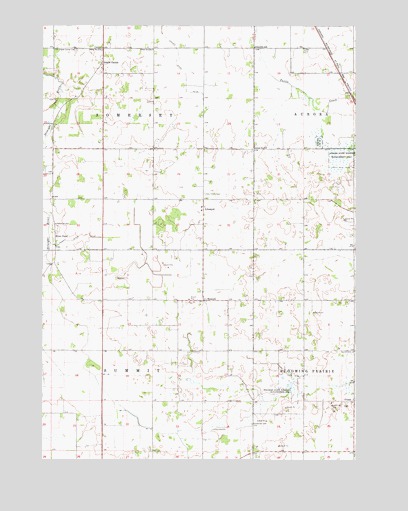
Steele Center, MN USGS Topographic Map
Click on map above to begin viewing in our Map Viewer.

This topographic map contains these locations and features:
Feature Name Type Latitude Longitude GNIS ID View Map
Aurora State Wildlife Management AreaParkN43.9616°W93.1260°639530View Map
Bohemian CemeteryCemeteryN43.8852°W93.1663°640334View Map
County Ditch Number TwentyoneCanalN43.9891°W93.1969°641821View Map
County Ditch Number TwentysevenCanalN43.9380°W93.2383°641884View Map
Danish CemeteryCemeteryN43.9061°W93.1260°642625View Map
Donald Anderson DamDamN43.9566°W93.1352°1776463View Map
Holy Trinity Catholic ChurchChurchN43.9500°W93.1860°2051296View Map
Holy Trinity CemeteryCemeteryN43.9516°W93.1858°645136View Map
LitomyslPopulated PlaceN43.9472°W93.1860°654799View Map
Litomysl ChurchChurchN43.9477°W93.1866°2051317View Map
Myron Standke DamDamN43.9416°W93.1835°1776462View Map
Oak Mound CemeteryCemeteryN43.9800°W93.2466°2051367View Map
Pogones State Wildlife Management AreaParkN43.8975°W93.1519°649603View Map
River PointPopulated PlaceN43.9391°W93.2452°654907View Map
Riverpoint Post Office (historical)Post OfficeN43.9391°W93.2452°2051266View Map
Saint Isodore SchoolSchoolN43.9486°W93.1669°2051327View Map
School Number 2102SchoolN43.9936°W93.1658°651510View Map
School Number 2112SchoolN43.9427°W93.2449°651517View Map
School Number 2114SchoolN43.9930°W93.2263°651519View Map
School Number 2127SchoolN43.9647°W93.1658°651522View Map
School Number 2146SchoolN43.9933°W93.2063°651531View Map
Steele CenterPopulated PlaceN43.9894°W93.2263°654962View Map
Steele Center CemeteryCemeteryN43.9930°W93.2369°652598View Map
Steele Center Post Office (historical)Post OfficeN43.9894°W93.2263°2051245View Map
Steele County Waterfowl Production AreaParkN43.9028°W93.1659°2765513View Map
SummitPopulated PlaceN43.9208°W93.1855°654967View Map
Township of SomersetCivilN43.9789°W93.2259°665643View Map
Township of SummitCivilN43.8919°W93.2258°665736View Map
UnionPopulated PlaceN43.8919°W93.1255°654982View Map

Note: Coordinates in the location and feature list above are referenced to NAD83 datum.


Copyright (C) 2008-2025 Ryan Niemi / Sunset Dynamics ... All Rights Reserved