TopoQuest Logo
Do you find TopoQuest useful?
Help keep TopoQuest running and adding new maps/features by donating!
Bitcoin:  19c7KJd3qBynnjoSw5npx9KScwjBe4ifkT
Litecoin:  LXs6TkuXGGXo1vDsWCkWVdjQX94eUKd6ui
Home View Maps Find Maps Find Places Resources & Links


Hope, Minnesota Topographic Map

USGS Map Title: Hope, MN
USGS Map MRC: 43093H3
DRG (GeoTIFF) Download: o43093h3.tif


Neighboring USGS Topographic Map Quads:


  Meriden, MN  
44093A4
 

  Saco, MN  
44093A3
 

  Owatonna, MN  
44093A2
 

  New Richland, MN  
43093H4
 

  Hope, MN  
43093H3
 

  Steele Center, MN  
43093H2
 

  Hartland, MN  
43093G4
 

  Ellendale, MN  
43093G3
 

  Hollandale, MN  
43093G2


Map MRC Location:

N44°
W94°
N44°
W93°
H8 H7 H6 H5 H4 H3 H2 H1
G8 G7 G6 G5 G4 G3 G2 G1
F8 F7 F6 F5 F4 F3 F2 F1
E8 E7 E6 E5 E4 E3 E2 E1
D8 D7 D6 D5 D4 D3 D2 D1
C8 C7 C6 C5 C4 C3 C2 C1
B8 B7 B6 B5 B4 B3 B2 B1
A8 A7 A6 A5 A4 A3 A2 A1
N43°
W94°
N43°
W93°

Hope, MN USGS 1:24K Topographic Map Preview:
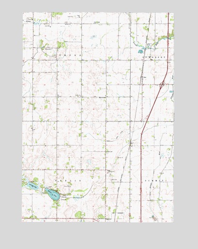
Hope, MN USGS Topographic Map
Click on map above to begin viewing in our Map Viewer.

This topographic map contains these locations and features:
Feature Name Type Latitude Longitude GNIS ID View Map
Beaver LakeReservoirN43.8900°W93.3435°1776565View Map
Beaver LakeLakeN43.8914°W93.3491°639833View Map
Beaver Lake DamDamN43.8900°W93.3435°1776564View Map
Berlin CemeteryCemeteryN43.9002°W93.3016°639968View Map
Berlin Post Office (historical)Post OfficeN43.8986°W93.3002°2051267View Map
County Ditch Number TwentyfiveCanalN43.9291°W93.2852°641857View Map
Danish CemeteryCemeteryN43.9500°W93.3269°642626View Map
HopePopulated PlaceN43.9619°W93.2760°645169View Map
HopeLocaleN43.9616°W93.2774°2051357View Map
Hope Oak Knoll Camp GroundLocaleN43.9555°W93.2508°2051298View Map
Hope Post OfficePost OfficeN43.9616°W93.2766°2051358View Map
Interchange 32CrossingN43.9572°W93.2597°2051412View Map
Judicial Ditch Number TwoCanalN43.8947°W93.2688°645840View Map
Lonergan LakeLakeN43.8965°W93.3661°647026View Map
Minnesota Canneries Historical MarkerParkN43.9833°W93.2558°2051405View Map
Minnesota State Schools Historical MarkerParkN43.9833°W93.2544°2051404View Map
School Number 2095SchoolN43.9933°W93.3169°651503View Map
School Number 2109SchoolN43.9172°W93.3063°651514View Map
School Number 2140SchoolN43.9494°W93.3066°651529View Map
Straight River North Bound Rest AreaLocaleN43.9833°W93.2544°2051413View Map
Straight River South Bound Rest AreaLocaleN43.9833°W93.2558°2051414View Map
Township of BerlinCivilN43.8921°W93.3475°663575View Map
Township of LemondCivilN43.9787°W93.3463°664751View Map
Zion ChurchChurchN43.9497°W93.3463°654464View Map
Zion Lutheran CemeteryCemeteryN43.9500°W93.3458°2051374View Map

Note: Coordinates in the location and feature list above are referenced to NAD83 datum.


Copyright (C) 2008-2025 Ryan Niemi / Sunset Dynamics ... All Rights Reserved