TopoQuest Logo
Do you find TopoQuest useful?
Help keep TopoQuest running and adding new maps/features by donating!
Bitcoin:  19c7KJd3qBynnjoSw5npx9KScwjBe4ifkT
Litecoin:  LXs6TkuXGGXo1vDsWCkWVdjQX94eUKd6ui
Home View Maps Find Maps Find Places Resources & Links


Steelville, Missouri Topographic Map

USGS Map Title: Steelville, MO
USGS Map MRC: 37091H3
DRG (GeoTIFF) Download: o37091h3.tif


Neighboring USGS Topographic Map Quads:


  Cuba, MO  
38091A4
 

  Leasburg, MO  
38091A3
 

  Onondaga Cave, MO  
38091A2
 

  Indian Springs, MO  
37091H4
 

  Steelville, MO  
37091H3
 

  Huzzah, MO  
37091H2
 

  Cook Station, MO  
37091G4
 

  Cherryville, MO  
37091G3
 

  Davisville, MO  
37091G2


Map MRC Location:

N38°
W92°
N38°
W91°
H8 H7 H6 H5 H4 H3 H2 H1
G8 G7 G6 G5 G4 G3 G2 G1
F8 F7 F6 F5 F4 F3 F2 F1
E8 E7 E6 E5 E4 E3 E2 E1
D8 D7 D6 D5 D4 D3 D2 D1
C8 C7 C6 C5 C4 C3 C2 C1
B8 B7 B6 B5 B4 B3 B2 B1
A8 A7 A6 A5 A4 A3 A2 A1
N37°
W92°
N37°
W91°

Steelville, MO USGS 1:24K Topographic Map Preview:
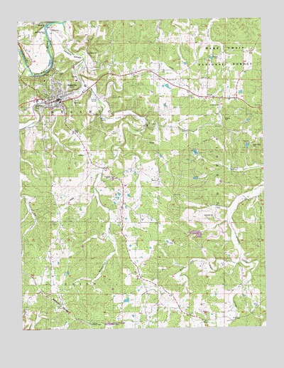
Steelville, MO USGS Topographic Map
Click on map above to begin viewing in our Map Viewer.

This topographic map contains these locations and features:
Feature Name Type Latitude Longitude GNIS ID View Map
Big SpringSpringN37.9655°W91.3596°736531View Map
Birds NestPopulated PlaceN37.9975°W91.3593°748870View Map
Birds Nest Beach ParkParkN37.9962°W91.3604°748871View Map
Black Jack CreekStreamN37.9020°W91.2632°748882View Map
Black Jack School (historical)SchoolN37.8918°W91.3047°736530View Map
Carden LakeReservoirN37.9461°W91.2851°764811View Map
Carden Lake DamDamN37.9450°W91.2851°764810View Map
Cardin LakeReservoirN37.9132°W91.2850°765106View Map
Cardin Lake DamDamN37.9134°W91.2835°765105View Map
Center Point ChurchChurchN37.9759°W91.2990°749316View Map
Center Point SchoolSchoolN37.9834°W91.2782°753154View Map
Cherry ValleyPopulated PlaceN37.9548°W91.2665°737891View Map
Cherry Valley CemeteryCemeteryN37.9475°W91.2546°749340View Map
Cherry Valley Number One Iron BankMineN37.9484°W91.2588°736529View Map
Cherry Valley Number Two Iron BankMineN37.9495°W91.2563°736528View Map
Cherry Valley School (historical)SchoolN37.9473°W91.2621°753155View Map
City of SteelvilleCivilN37.9696°W91.3546°2395962View Map
Clark Iron MineMineN37.9856°W91.3265°736527View Map
Coffee ChurchChurchN37.8934°W91.3607°749398View Map
Coffee SchoolSchoolN37.8934°W91.3607°753231View Map
Collins SpringSpringN37.9677°W91.3352°749430View Map
Crawford CountyCivilN37.9764°W91.3040°758482View Map
Crawford County Sheriff's OfficeBuildingN37.9663°W91.3559°2752162View Map
Eaton CemeteryCemeteryN37.8900°W91.2704°749793View Map
Edwards CemeteryCemeteryN37.9598°W91.2699°749805View Map
ElaverPopulated PlaceN37.9687°W91.2785°749808View Map
Evans SpringSpringN37.9604°W91.3332°749868View Map
Ferguson Iron BankMineN37.9087°W91.3640°736526View Map
Field LakeReservoirN37.9356°W91.2850°764804View Map
Field Lake DamDamN37.9350°W91.2835°764803View Map
Halbert Lead DiggingMineN37.9503°W91.3057°736525View Map
Helmering Farms DamDamN37.8867°W91.3201°764119View Map
Helmering Farms LakeReservoirN37.8864°W91.3216°764120View Map
Keysville Lookout TowerTowerN37.8773°W91.3399°755248View Map
Long SpringSpringN37.9572°W91.3087°750855View Map
MidlandPopulated PlaceN37.9784°W91.3271°736524View Map
Midland ChurchChurchN37.9353°W91.3046°751049View Map
Midland MineMineN37.9870°W91.3390°751050View Map
Midland SchoolSchoolN37.9834°W91.3335°753153View Map
Mononame 133 DamDamN37.9734°W91.3035°764024View Map
Mononame 852 DamDamN37.9700°W91.2568°764805View Map
Moultray CemeteryCemeteryN37.9845°W91.2724°751167View Map
N.G. Clark Number One Iron BankMineN37.9825°W91.3243°736523View Map
PatsyPopulated PlaceN37.9620°W91.2724°751508View Map
Peetz Iron BankMineN37.9431°W91.3707°736522View Map
Pleasant View School (historical)SchoolN37.9250°W91.3232°753157View Map
RoswellLocaleN37.9287°W91.3746°753152View Map
Sankey (historical)Populated PlaceN37.9770°W91.3438°755571View Map
Schweider CemeteryCemeteryN37.9203°W91.2760°752060View Map
SteelvillePopulated PlaceN37.9681°W91.3549°752345View Map
Steelville CemeteryCemeteryN37.9648°W91.3656°2681485View Map
Steelville Fire Protection District Station 1BuildingN37.9708°W91.3440°2621035View Map
Steelville Marshal's OfficeBuildingN37.9757°W91.3455°2752207View Map
Steelville Post OfficePost OfficeN37.9669°W91.3545°2782847View Map
Steelville R-3 High SchoolSchoolN37.9364°W91.3276°752346View Map
Straightway ChurchChurchN37.9650°W91.2724°752390View Map
United ChurchChurchN37.9762°W91.2785°752669View Map
Valley Side SchoolSchoolN37.8923°W91.2610°753159View Map
Whittenburg CreekStreamN37.9992°W91.3518°752876View Map
WildwoodsPopulated PlaceN37.9845°W91.3693°736532View Map
Woolsey School (historical)SchoolN37.9487°W91.3088°753156View Map

Note: Coordinates in the location and feature list above are referenced to NAD83 datum.


Copyright (C) 2008-2024 Ryan Niemi / Sunset Dynamics ... All Rights Reserved