TopoQuest Logo
Do you find TopoQuest useful?
Help keep TopoQuest running and adding new maps/features by donating!
Bitcoin:  19c7KJd3qBynnjoSw5npx9KScwjBe4ifkT
Litecoin:  LXs6TkuXGGXo1vDsWCkWVdjQX94eUKd6ui
Home View Maps Find Maps Find Places Resources & Links


Davisville, Missouri Topographic Map

USGS Map Title: Davisville, MO
USGS Map MRC: 37091G2
DRG (GeoTIFF) Download: o37091g2.tif


Neighboring USGS Topographic Map Quads:


  Steelville, MO  
37091H3
 

  Huzzah, MO  
37091H2
 

  Berryman, MO  
37091H1
 

  Cherryville, MO  
37091G3
 

  Davisville, MO  
37091G2
 

  Courtois, MO  
37091G1
 

  Howes Mill Spring, MO  
37091F3
 

  Viburnum West, MO  
37091F2
 

  Viburnum East, MO  
37091F1


Map MRC Location:

N38°
W92°
N38°
W91°
H8 H7 H6 H5 H4 H3 H2 H1
G8 G7 G6 G5 G4 G3 G2 G1
F8 F7 F6 F5 F4 F3 F2 F1
E8 E7 E6 E5 E4 E3 E2 E1
D8 D7 D6 D5 D4 D3 D2 D1
C8 C7 C6 C5 C4 C3 C2 C1
B8 B7 B6 B5 B4 B3 B2 B1
A8 A7 A6 A5 A4 A3 A2 A1
N37°
W92°
N37°
W91°

Davisville, MO USGS 1:24K Topographic Map Preview:
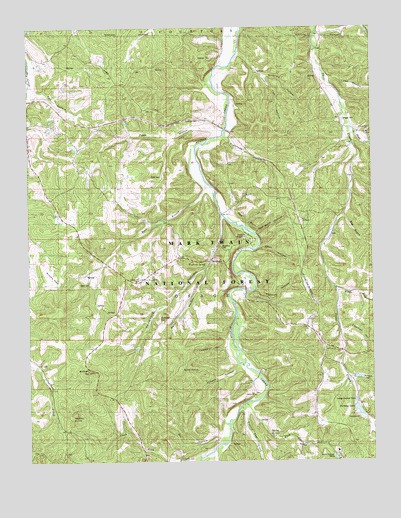
Davisville, MO USGS Topographic Map
Click on map above to begin viewing in our Map Viewer.

This topographic map contains these locations and features:
Feature Name Type Latitude Longitude GNIS ID View Map
Allen HollowValleyN37.8114°W91.1671°748574View Map
Baker HollowValleyN37.8050°W91.1874°748646View Map
Bald KnobSummitN37.7762°W91.1951°748651View Map
Bill HollowValleyN37.7570°W91.1818°748857View Map
Buzzard HollowValleyN37.7745°W91.1340°749145View Map
Center PostPopulated PlaceN37.8439°W91.1265°736598View Map
Center Post ChurchChurchN37.8445°W91.1265°749317View Map
Coleman CemeteryCemeteryN37.8481°W91.1896°749417View Map
Coleman CemeteryCemeteryN37.8664°W91.1849°749418View Map
Coleman HollowValleyN37.7875°W91.1365°749419View Map
Coleman School (historical)SchoolN37.8470°W91.1724°753385View Map
Crabtree FordLocaleN37.8209°W91.1799°736596View Map
DavisvillePopulated PlaceN37.8078°W91.1851°749590View Map
Davisville CampgroundLocaleN37.8134°W91.1696°749591View Map
Davisville HollowValleyN37.8206°W91.1810°749592View Map
Dohammer CemeteryCemeteryN37.8023°W91.2101°749676View Map
Earl HollowValleyN37.8573°W91.2471°749764View Map
Earl SchoolSchoolN37.8453°W91.2357°753383View Map
East Branch Shoal CreekStreamN37.8212°W91.1357°749767View Map
Eaton CemeteryCemeteryN37.8011°W91.2282°749792View Map
Fishtrap HollowValleyN37.7998°W91.1682°749926View Map
Fleming FordLocaleN37.8459°W91.1776°736595View Map
Fox Theater ChurchChurchN37.8025°W91.2093°749977View Map
Green HillSummitN37.8142°W91.1896°736594View Map
Greens Hill Lead MineMineN37.8670°W91.1815°736593View Map
Hedley KnobSummitN37.7628°W91.2349°750280View Map
Hill CemeteryCemeteryN37.7931°W91.2224°750326View Map
Holiday LakeReservoirN37.7645°W91.1306°758290View Map
Holiday Lake DamDamN37.7650°W91.1318°764419View Map
Indian Rock BluffCliffN37.8072°W91.1764°736592View Map
Little Shoal CreekStreamN37.8456°W91.1326°750800View Map
Lookout ChurchChurchN37.7828°W91.1424°750860View Map
Lookout School (historical)SchoolN37.7964°W91.1449°753382View Map
Middle Fork Shoal CreekStreamN37.8009°W91.1404°751038View Map
Mill Rock CreekStreamN37.7667°W91.1715°751085View Map
Mineca HollowValleyN37.7775°W91.1749°751113View Map
Possum Trot CreekStreamN37.7656°W91.1737°751721View Map
Pyatt CemeteryCemeteryN37.8323°W91.2029°751778View Map
Pyatt HollowValleyN37.8453°W91.1837°751779View Map
Pyatt Hollow Church (historical)ChurchN37.8445°W91.2179°753384View Map
R Haas and Heck A DamDamN37.7750°W91.1335°764354View Map
Red BluffCliffN37.8192°W91.1721°751830View Map
Red Bluff CampgroundLocaleN37.8139°W91.1693°754388View Map
Red Bluff HollowValleyN37.8162°W91.1687°751832View Map
Rock BranchStreamN37.8400°W91.1910°751919View Map
Sellers ChurchChurchN37.7692°W91.1687°752078View Map
Sellers School (historical)LocaleN37.7645°W91.1732°753381View Map
Simms FlatFlatN37.8034°W91.2415°752169View Map
Sinkhole HollowValleyN37.8603°W91.1643°752177View Map
Skaggs CemeteryCemeteryN37.8484°W91.1354°752187View Map
South Rock BranchStreamN37.7520°W91.1862°752271View Map
Sugartree HollowValleyN37.8434°W91.1787°752423View Map
Sullivan HillSummitN37.7764°W91.2287°752425View Map
Todd HollowValleyN37.8606°W91.1404°752552View Map
Tom HollowValleyN37.8675°W91.1743°752555View Map
Township of OsageCivilN37.7895°W91.2083°766547View Map
Trask and Garrisons Lead DiggingsMineN37.8625°W91.1743°736591View Map
Turnbough CemeteryCemeteryN37.7914°W91.2035°752618View Map
Woodlock CemeteryCemeteryN37.8120°W91.1818°752969View Map
Woodlock SpringSpringN37.8068°W91.1859°752970View Map
Yawberry HollowValleyN37.7831°W91.1801°752998View Map

Note: Coordinates in the location and feature list above are referenced to NAD83 datum.


Copyright (C) 2008-2025 Ryan Niemi / Sunset Dynamics ... All Rights Reserved