TopoQuest Logo
Do you find TopoQuest useful?
Help keep TopoQuest running and adding new maps/features by donating!
Bitcoin:  19c7KJd3qBynnjoSw5npx9KScwjBe4ifkT
Litecoin:  LXs6TkuXGGXo1vDsWCkWVdjQX94eUKd6ui
Home View Maps Find Maps Find Places Resources & Links


Stewart, Ohio Topographic Map

USGS Map Title: Stewart, OH
USGS Map MRC: 39081C8
DRG (GeoTIFF) Download: o39081c8.tif


Neighboring USGS Topographic Map Quads:


  Jacksonville, OH  
39082D1
 

  Amesville, OH  
39081D8
 

  Chesterhill, OH  
39081D7
 

  Athens, OH  
39082C1
 

  Stewart, OH  
39081C8
 

  Cutler, OH  
39081C7
 

  Shade, OH  
39082B1
 

  Alfred, OH  
39081B8
 

  Coolville, OH  
39081B7


Map MRC Location:

N40°
W82°
N40°
W81°
H8 H7 H6 H5 H4 H3 H2 H1
G8 G7 G6 G5 G4 G3 G2 G1
F8 F7 F6 F5 F4 F3 F2 F1
E8 E7 E6 E5 E4 E3 E2 E1
D8 D7 D6 D5 D4 D3 D2 D1
C8 C7 C6 C5 C4 C3 C2 C1
B8 B7 B6 B5 B4 B3 B2 B1
A8 A7 A6 A5 A4 A3 A2 A1
N39°
W82°
N39°
W81°

Stewart, OH USGS 1:24K Topographic Map Preview:
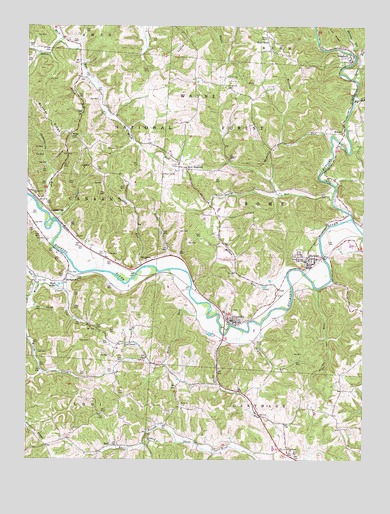
Stewart, OH USGS Topographic Map
Click on map above to begin viewing in our Map Viewer.

This topographic map contains these locations and features:
Feature Name Type Latitude Longitude GNIS ID View Map
Asbury CemeteryCemeteryN39.2559°W81.9535°1699457View Map
Ashbury ChurchChurchN39.2554°W81.9535°1075287View Map
Bean CemeteryCemeteryN39.2840°W81.9149°1075320View Map
Big RunStreamN39.3542°W81.8785°1075381View Map
BroadwellPopulated PlaceN39.3648°W81.8796°1075449View Map
Broadwell Post Office (historical)Post OfficeN39.3654°W81.8790°1958877View Map
Buck CemeteryCemeteryN39.2662°W81.9426°1075464View Map
Buckley RunStreamN39.3056°W81.9576°1058195View Map
Butts RunStreamN39.2917°W81.9332°1075498View Map
CanaanvillePopulated PlaceN39.3212°W81.9915°1062441View Map
Canaanville CemeteryCemeteryN39.3278°W81.9974°1699469View Map
Canaanville RunStreamN39.3226°W81.9954°1075520View Map
Carthage CemeteryCemeteryN39.2537°W81.9024°1699470View Map
Carthage ChurchChurchN39.2534°W81.9024°1075533View Map
ColePopulated PlaceN39.2990°W81.9062°1075608View Map
Coolville Volunteer Fire Department Station 2BuildingN39.2554°W81.9040°2549064View Map
Copeland CemeteryCemeteryN39.3572°W81.9259°1075629View Map
Dutch CreekStreamN39.3717°W81.9868°1075755View Map
East Canaan ChurchChurchN39.3073°W81.9560°1077329View Map
Federal CreekStreamN39.3195°W81.8793°1075836View Map
Federal Hocking Middle SchoolSchoolN39.3073°W81.8965°1058839View Map
Green RunStreamN39.2870°W81.9196°1075958View Map
GuysvillePopulated PlaceN39.2901°W81.9235°1075975View Map
Guysville CemeteryCemeteryN39.2934°W81.9232°1699494View Map
Guysville Post OfficePost OfficeN39.2904°W81.9235°1958896View Map
Herrold RunStreamN39.3426°W81.8876°1076039View Map
HullPopulated PlaceN39.2540°W81.9682°1076090View Map
Hull Post Office (historical)Post OfficeN39.2542°W81.9679°1964650View Map
KilvertPopulated PlaceN39.3454°W81.8824°1076181View Map
Kilvert CemeteryCemeteryN39.3453°W81.8871°1699505View Map
Kilvert Post Office (historical)Post OfficeN39.3459°W81.8818°1964657View Map
Lick RunStreamN39.2984°W81.9854°1076248View Map
Marietta RunStreamN39.3676°W81.8799°1076341View Map
Miller RunStreamN39.3029°W81.9037°1076395View Map
Mills School (historical)SchoolN39.2609°W81.9010°1058838View Map
Moss CemeteryCemeteryN39.3606°W81.9089°1699514View Map
New EnglandPopulated PlaceN39.3340°W81.9410°1076505View Map
New England CemeteryCemeteryN39.3312°W81.9421°1699520View Map
New England Post Office (historical)Post OfficeN39.3334°W81.9415°1959022View Map
Piper RunStreamN39.2995°W81.8935°1076649View Map
Rays LakesLakeN39.3004°W81.9879°1076718View Map
Riley HillSummitN39.3420°W81.9829°1076740View Map
Riley RunStreamN39.3615°W81.9785°1076741View Map
Rocky RunStreamN39.3048°W81.9493°1058196View Map
Rome Township Volunteer Fire DepartmentBuildingN39.3061°W81.8939°2549479View Map
Rome-Canaan High School (historical)SchoolN39.3073°W81.8965°1076766View Map
Sand RockLocaleN39.3726°W81.9104°1076825View Map
Sand Rock CemeteryCemeteryN39.3715°W81.9104°1699535View Map
Scott CreekStreamN39.3004°W81.9960°1076855View Map
Sharps RunStreamN39.3251°W81.8865°1076866View Map
South Canaan CemeteryCemeteryN39.2840°W81.9632°1699540View Map
South Canaan ChurchChurchN39.2837°W81.9632°1076932View Map
Spruce RunStreamN39.3598°W81.8790°1076950View Map
Sterling CemeteryCemeteryN39.3598°W81.9801°1699542View Map
StewartPopulated PlaceN39.3081°W81.8946°1076966View Map
Stewart CemeteryCemeteryN39.3090°W81.9012°1699543View Map
Stewart Census Designated PlaceCensusN39.3080°W81.8975°2628972View Map
Stewart Post OfficePost OfficeN39.3084°W81.8943°1958870View Map
StringtownPopulated PlaceN39.3015°W81.9863°1076980View Map
Tiger RunStreamN39.2887°W81.9126°1077054View Map
Township of RomeCivilN39.3160°W81.8929°1085757View Map
Willow CreekStreamN39.3040°W81.9810°1077197View Map
Wilson ChapelChurchN39.3715°W81.9112°1077203View Map

Note: Coordinates in the location and feature list above are referenced to NAD83 datum.


Copyright (C) 2008-2024 Ryan Niemi / Sunset Dynamics ... All Rights Reserved