TopoQuest Logo
Do you find TopoQuest useful?
Help keep TopoQuest running and adding new maps/features by donating!
Bitcoin:  19c7KJd3qBynnjoSw5npx9KScwjBe4ifkT
Litecoin:  LXs6TkuXGGXo1vDsWCkWVdjQX94eUKd6ui
Home View Maps Find Maps Find Places Resources & Links


Amesville, Ohio Topographic Map

USGS Map Title: Amesville, OH
USGS Map MRC: 39081D8
DRG (GeoTIFF) Download: o39081d8.tif


Neighboring USGS Topographic Map Quads:


  Corning, OH  
39082E1
 

  Ringgold, OH  
39081E8
 

  Stockport, OH  
39081E7
 

  Jacksonville, OH  
39082D1
 

  Amesville, OH  
39081D8
 

  Chesterhill, OH  
39081D7
 

  Athens, OH  
39082C1
 

  Stewart, OH  
39081C8
 

  Cutler, OH  
39081C7


Map MRC Location:

N40°
W82°
N40°
W81°
H8 H7 H6 H5 H4 H3 H2 H1
G8 G7 G6 G5 G4 G3 G2 G1
F8 F7 F6 F5 F4 F3 F2 F1
E8 E7 E6 E5 E4 E3 E2 E1
D8 D7 D6 D5 D4 D3 D2 D1
C8 C7 C6 C5 C4 C3 C2 C1
B8 B7 B6 B5 B4 B3 B2 B1
A8 A7 A6 A5 A4 A3 A2 A1
N39°
W82°
N39°
W81°

Amesville, OH USGS 1:24K Topographic Map Preview:
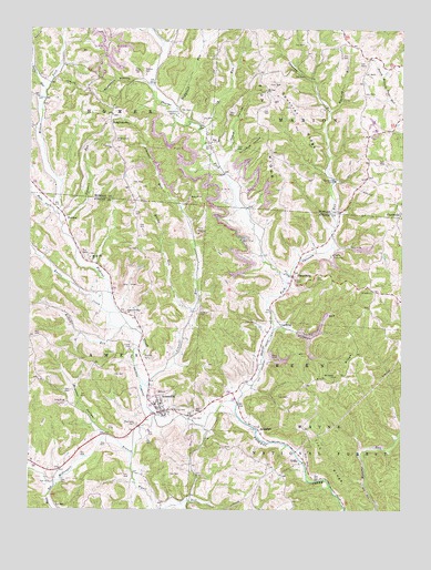
Amesville, OH USGS Topographic Map
Click on map above to begin viewing in our Map Viewer.

This topographic map contains these locations and features:
Feature Name Type Latitude Longitude GNIS ID View Map
AmesvillePopulated PlaceN39.4006°W81.9557°1075260View Map
Amesville Ames - Bern Township Volunteer Fire DepartmentBuildingN39.4000°W81.9524°2549477View Map
Amesville Elementary SchoolSchoolN39.4026°W81.9554°1058809View Map
Amesville Post OfficePost OfficeN39.4001°W81.9557°1958890View Map
Anderson HollowValleyN39.4865°W81.9632°1075262View Map
ArmadalePopulated PlaceN39.3959°W81.9229°1075275View Map
Armdale Post Office (historical)Post OfficeN39.3959°W81.9235°1958886View Map
Beasley CemeteryCemeteryN39.4145°W81.9612°1075331View Map
Brawley HollowValleyN39.3954°W81.9768°1075440View Map
Curtis Junction (historical)LocaleN39.4001°W81.9276°1067481View Map
Cutler CemeteryCemeteryN39.4164°W81.9657°1075668View Map
Drapers RunStreamN39.4495°W81.9893°1075740View Map
Ewing RunStreamN39.4273°W81.9454°1075819View Map
FederalPopulated PlaceN39.4520°W81.9893°1075835View Map
Federal Hill CemeteryCemeteryN39.4265°W81.9685°1699487View Map
Federal Valley ChurchChurchN39.4265°W81.9676°1075838View Map
Gifford State ForestForestN39.4473°W81.9090°1083169View Map
Henrys CemeteryCemeteryN39.4006°W81.9514°1076037View Map
Hyde ForkStreamN39.4520°W81.9910°1076101View Map
JoyPopulated PlaceN39.4703°W81.9410°1076156View Map
Joy CemeteryCemeteryN39.4765°W81.9415°1076157View Map
Joy Christian ChurchChurchN39.4692°W81.9390°1068907View Map
Joy Methodist Episcopal Church (historical)ChurchN39.4756°W81.9426°1068908View Map
Joy Post Office (historical)Post OfficeN39.4709°W81.9415°2037876View Map
Joy RunStreamN39.4742°W81.9432°1076158View Map
Kasler CreekStreamN39.4262°W81.9699°1076166View Map
Kitten RunStreamN39.4234°W81.9676°1076189View Map
LathropPopulated PlaceN39.4229°W81.9154°1076207View Map
Linscott RunStreamN39.4073°W81.9604°1076254View Map
Lovel CemeteryCemeteryN39.4693°W81.9315°1076310View Map
McDougall BranchStreamN39.3992°W81.9576°1076363View Map
McElfresh RunStreamN39.4787°W81.9524°1065801View Map
Miners ForkStreamN39.4520°W81.9910°1079582View Map
Mound Hill CemeteryCemeteryN39.4409°W81.9796°1699515View Map
Mound Hill ChurchChurchN39.4406°W81.9796°1076442View Map
Mount Carmel ChurchChurchN39.4098°W81.8971°1076445View Map
Mount Zion Bible Christian ChurchChurchN39.4840°W81.9215°1076468View Map
Mount Zion CemeteryCemeteryN39.4837°W81.9210°1068922View Map
Mud Sock CemeteryCemeteryN39.3971°W81.9637°1076481View Map
Mush RunStreamN39.3826°W81.9910°1076487View Map
Opossum RunStreamN39.4345°W81.9140°1076576View Map
PlantsvillePopulated PlaceN39.4523°W81.8757°1076652View Map
Plantsville Post Office (historical)Post OfficeN39.4529°W81.8762°2038199View Map
Quickbum HollowValleyN39.4681°W81.9324°1076704View Map
Sharps Fork Federal CreekStreamN39.4026°W81.9301°1076864View Map
SharpsburgPopulated PlaceN39.4359°W81.9115°1076867View Map
Sharpsburg Post OfficePost OfficeN39.4362°W81.9110°1958867View Map
Smith RunStreamN39.4840°W81.9951°1076924View Map
Spurrier RidgeRidgeN39.4762°W81.9115°1076952View Map
Starling RunStreamN39.4787°W81.8993°1076958View Map
Sulphur RunStreamN39.4220°W81.9182°1076995View Map
Tharp HollowValleyN39.4692°W81.9332°1077038View Map
Tick RidgeRidgeN39.3995°W81.9046°1077048View Map
Township of BernCivilN39.4081°W81.8957°1085751View Map
Township of MarionCivilN39.4964°W81.8808°1086690View Map
UtleyPopulated PlaceN39.3870°W81.9099°1077107View Map
Utley Post Office (historical)Post OfficeN39.3876°W81.9096°1958879View Map
Village of AmesvilleCivilN39.4015°W81.9550°2397956View Map
Watson CemeteryCemeteryN39.4890°W81.9619°1077146View Map
WrightstownPopulated PlaceN39.4762°W81.9735°1077234View Map
Wrightstown CemeteryCemeteryN39.4709°W81.9715°1077235View Map
Wrightsville Bible Christian ChurchChurchN39.4778°W81.9726°1068977View Map
Wyatt RunStreamN39.3892°W81.9657°1077236View Map
Zion RidgeRidgeN39.4862°W81.9224°1077257View Map

Note: Coordinates in the location and feature list above are referenced to NAD83 datum.


Copyright (C) 2008-2024 Ryan Niemi / Sunset Dynamics ... All Rights Reserved