TopoQuest Logo
Do you find TopoQuest useful?
Help keep TopoQuest running and adding new maps/features by donating!
Bitcoin:  19c7KJd3qBynnjoSw5npx9KScwjBe4ifkT
Litecoin:  LXs6TkuXGGXo1vDsWCkWVdjQX94eUKd6ui
Home View Maps Find Maps Find Places Resources & Links


Stewarts Point, California Topographic Map

USGS Map Title: Stewarts Point, CA
USGS Map MRC: 38123F4
DRG (GeoTIFF) Download: o38123f4.tif


Neighboring USGS Topographic Map Quads:


  Gualala, CA  
38123G5
 

  McGuire Ridge, CA  
38123G4
 

  Gube Mountain, CA  
38123G3


  Stewarts Point, CA  
38123F4
 

  Annapolis, CA  
38123F3


  Plantation, CA  
38123E3


Map MRC Location:

N39°
W124°
N39°
W123°
H8 H7 H6 H5 H4 H3 H2 H1
G8 G7 G6 G5 G4 G3 G2 G1
F8 F7 F6 F5 F4 F3 F2 F1
E8 E7 E6 E5 E4 E3 E2 E1
D8 D7 D6 D5 D4 D3 D2 D1
C8 C7 C6 C5 C4 C3 C2 C1
B8 B7 B6 B5 B4 B3 B2 B1
A8 A7 A6 A5 A4 A3 A2 A1
N38°
W124°
N38°
W123°

Stewarts Point, CA USGS 1:24K Topographic Map Preview:
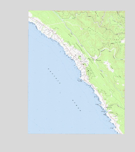
Stewarts Point, CA USGS Topographic Map
Click on map above to begin viewing in our Map Viewer.

This topographic map contains these locations and features:
Feature Name Type Latitude Longitude GNIS ID View Map
Beatty RidgeRidgeN38.7213°W123.3997°218933View Map
Black PointCapeN38.6791°W123.4320°219397View Map
Black Point BeachBeachN38.6863°W123.4325°1723317View Map
Black Point LandingLocaleN38.6794°W123.4283°1658073View Map
Brushy RidgeRidgeN38.7380°W123.3820°233558View Map
Buckeye CreekStreamN38.7405°W123.4570°220029View Map
Buckeye Creek CemeteryCemeteryN38.7315°W123.4306°2755395View Map
Department of Forestry and Fire Protection The Sea Ranch StationBuildingN38.7011°W123.4272°2623912View Map
Fisherman BayBayN38.6477°W123.4003°223549View Map
GermanCivilN38.6960°W123.4320°233921View Map
Little CreekStreamN38.7341°W123.4078°227239View Map
McClellon GulchValleyN38.6471°W123.3975°228300View Map
Pebble BeachBeachN38.6966°W123.4397°1723331View Map
Rocky PointCapeN38.6305°W123.3897°231778View Map
Sea RanchPopulated PlaceN38.7152°W123.4545°1723333View Map
Sea Ranch Census Designated PlaceCensusN38.7166°W123.4527°2583133View Map
Sea Ranch Volunteer Fire Department North StationBuildingN38.7324°W123.4761°2624259View Map
Sea Ranch Volunteer Fire Department South StationBuildingN38.7011°W123.4272°2623828View Map
Stewarts CreekStreamN38.6499°W123.3995°235470View Map
Stewarts PointPopulated PlaceN38.6519°W123.3992°252807View Map
Stewarts PointCapeN38.6546°W123.4081°235471View Map
Stewarts Point CemeteryCemeteryN38.6499°W123.3964°1989476View Map
Stewarts Point IslandIslandN38.6546°W123.4089°235472View Map
Stewarts Point Post OfficePost OfficeN38.6525°W123.3999°2789171View Map
The Sea Ranch AirportAirportN38.7026°W123.4290°1654050View Map
Valley CrossingPopulated PlaceN38.6996°W123.4136°1660089View Map
Wheatfield Fork Gualala RiverStreamN38.7013°W123.4158°237594View Map
White Cap ArchArchN38.7211°W123.4703°2709988View Map

Note: Coordinates in the location and feature list above are referenced to NAD83 datum.


Copyright (C) 2008-2024 Ryan Niemi / Sunset Dynamics ... All Rights Reserved