TopoQuest Logo
Do you find TopoQuest useful?
Help keep TopoQuest running and adding new maps/features by donating!
Bitcoin:  19c7KJd3qBynnjoSw5npx9KScwjBe4ifkT
Litecoin:  LXs6TkuXGGXo1vDsWCkWVdjQX94eUKd6ui
Home View Maps Find Maps Find Places Resources & Links


McGuire Ridge, California Topographic Map

USGS Map Title: McGuire Ridge, CA
USGS Map MRC: 38123G4
DRG (GeoTIFF) Download: o38123g4.tif


Neighboring USGS Topographic Map Quads:


  Eureka Hill, CA  
38123H5
 

  Zeni Ridge, CA  
38123H4
 

  Ornbaun Valley, CA  
38123H3
 

  Gualala, CA  
38123G5
 

  McGuire Ridge, CA  
38123G4
 

  Gube Mountain, CA  
38123G3


  Stewarts Point, CA  
38123F4
 

  Annapolis, CA  
38123F3


Map MRC Location:

N39°
W124°
N39°
W123°
H8 H7 H6 H5 H4 H3 H2 H1
G8 G7 G6 G5 G4 G3 G2 G1
F8 F7 F6 F5 F4 F3 F2 F1
E8 E7 E6 E5 E4 E3 E2 E1
D8 D7 D6 D5 D4 D3 D2 D1
C8 C7 C6 C5 C4 C3 C2 C1
B8 B7 B6 B5 B4 B3 B2 B1
A8 A7 A6 A5 A4 A3 A2 A1
N38°
W124°
N38°
W123°

McGuire Ridge, CA USGS 1:24K Topographic Map Preview:
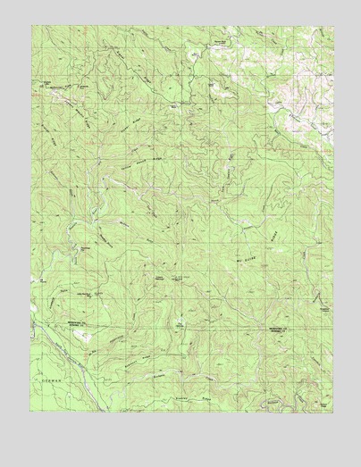
McGuire Ridge, CA USGS Topographic Map
Click on map above to begin viewing in our Map Viewer.

This topographic map contains these locations and features:
Feature Name Type Latitude Longitude GNIS ID View Map
Bear CreekStreamN38.8463°W123.4020°218807View Map
Big Pepperwood CreekStreamN38.7632°W123.4789°219227View Map
Billings CreekStreamN38.8477°W123.4103°219293View Map
Brandt RidgeRidgeN38.8396°W123.4945°219777View Map
Ciapusci RanchLocaleN38.8491°W123.4400°253202View Map
Cox OpeningFlatN38.7794°W123.4397°221724View Map
Dry CreekStreamN38.8149°W123.4753°222608View Map
Fisher RidgeRidgeN38.8407°W123.4606°223547View Map
Gianoli RanchLocaleN38.8563°W123.4253°253201View Map
Groshong GulchValleyN38.7766°W123.4947°224650View Map
Gualala MountainSummitN38.8560°W123.4964°1658687View Map
Hayfield CreekStreamN38.8438°W123.4183°225059View Map
Hoodoo GulchValleyN38.8102°W123.4750°225532View Map
Horsethief CanyonValleyN38.7846°W123.3800°225656View Map
Jackknife TunnelTunnelN38.8546°W123.4808°226065View Map
Jackknife TurnLocaleN38.8549°W123.4817°1724202View Map
Johnny Woodin RidgeRidgeN38.8496°W123.4817°226287View Map
Little Red Rock MountainSummitN38.7877°W123.4756°227342View Map
Log Cabin RanchLocaleN38.7746°W123.4770°227469View Map
Lowrey OpeningsFlatN38.7944°W123.4489°253203View Map
McGann GulchValleyN38.8116°W123.4745°228359View Map
McGuire RidgeRidgeN38.8030°W123.4025°228379View Map
McKenzie GradeFlatN38.8549°W123.4858°228392View Map
North Fork Gualala RiverStreamN38.7782°W123.4986°229679View Map
Old Red Rock PlacePopulated PlaceN38.7930°W123.4420°1659295View Map
Palmer CreekStreamN38.8682°W123.3953°230266View Map
Peachtree FlatFlatN38.8035°W123.4828°230434View Map
Rickard RanchLocaleN38.8394°W123.3778°231558View Map
Robinson CreekStreamN38.8110°W123.4833°231684View Map
Robinson CreekStreamN38.8480°W123.4100°231687View Map
Robinson RidgeRidgeN38.7666°W123.4536°231697View Map
Rockpile CreekStreamN38.7510°W123.4706°231751View Map
Signal RidgeRidgeN38.8619°W123.4333°233114View Map
South Fork Gualala RiverStreamN38.7785°W123.4986°235010View Map
Squaw RockSummitN38.8694°W123.4192°1659851View Map
Stanley RidgeRidgeN38.7549°W123.4372°235375View Map
Stewart CreekStreamN38.8174°W123.4233°235464View Map
Tindall CampLocaleN38.8574°W123.4789°236379View Map
Y Ranch (historical)LocaleN38.8671°W123.4192°1653131View Map
Yellow Hound RidgeRidgeN38.8307°W123.4497°238242View Map
Zeni RanchLocaleN38.8655°W123.4325°253200View Map

Note: Coordinates in the location and feature list above are referenced to NAD83 datum.


Copyright (C) 2008-2024 Ryan Niemi / Sunset Dynamics ... All Rights Reserved