TopoQuest Logo
Do you find TopoQuest useful?
Help keep TopoQuest running and adding new maps/features by donating!
Bitcoin:  19c7KJd3qBynnjoSw5npx9KScwjBe4ifkT
Litecoin:  LXs6TkuXGGXo1vDsWCkWVdjQX94eUKd6ui
Home View Maps Find Maps Find Places Resources & Links


Stoutsville, Ohio Topographic Map

USGS Map Title: Stoutsville, OH
USGS Map MRC: 39082E7
DRG (GeoTIFF) Download: o39082e7.tif


Neighboring USGS Topographic Map Quads:


  Ashville, OH  
39082F8
 

  East Ringgold, OH  
39082F7
 

  Amanda, OH  
39082F6
 

  Circleville, OH  
39082E8
 

  Stoutsville, OH  
39082E7
 

  Clearport, OH  
39082E6
 

  Kingston, OH  
39082D8
 

  Hallsville, OH  
39082D7
 

  Laurelville, OH  
39082D6


Map MRC Location:

N40°
W83°
N40°
W82°
H8 H7 H6 H5 H4 H3 H2 H1
G8 G7 G6 G5 G4 G3 G2 G1
F8 F7 F6 F5 F4 F3 F2 F1
E8 E7 E6 E5 E4 E3 E2 E1
D8 D7 D6 D5 D4 D3 D2 D1
C8 C7 C6 C5 C4 C3 C2 C1
B8 B7 B6 B5 B4 B3 B2 B1
A8 A7 A6 A5 A4 A3 A2 A1
N39°
W83°
N39°
W82°

Stoutsville, OH USGS 1:24K Topographic Map Preview:
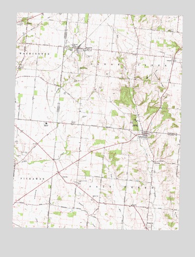
Stoutsville, OH USGS Topographic Map
Click on map above to begin viewing in our Map Viewer.

This topographic map contains these locations and features:
Feature Name Type Latitude Longitude GNIS ID View Map
Bunker Hill CemeteryCemeteryN39.5856°W82.8313°1038519View Map
Chestnut RidgeRidgeN39.5848°W82.7663°1039049View Map
Clear Creek Elementary SchoolSchoolN39.6040°W82.8246°1081011View Map
Clearcreek Township Fire Department Station 510BuildingN39.6050°W82.8236°2549417View Map
Conrad CemeteryCemeteryN39.6155°W82.7572°1039319View Map
Dresbach CemeteryCemeteryN39.5609°W82.8313°1806805View Map
Dresbach ChurchChurchN39.5609°W82.8327°1039786View Map
Fairview ChurchChurchN39.6020°W82.7843°1040353View Map
Fairview FarmLocaleN39.5292°W82.8208°2725813View Map
Heidelberg Reform CemeteryCemeteryN39.6037°W82.8263°1806872View Map
Heidelberg Reformed United Church of ChristChurchN39.6048°W82.8263°1806820View Map
HuntsvillePopulated PlaceN39.5398°W82.7699°1062822View Map
Imler CemeteryCemeteryN39.5170°W82.8143°1041919View Map
Imler School (historical)SchoolN39.5151°W82.8105°1080572View Map
Infirmary CemeteryCemeteryN39.6184°W82.8674°1041977View Map
J and J Trailer ParkPopulated PlaceN39.5578°W82.7775°2463220View Map
LeistvillePopulated PlaceN39.5298°W82.8388°1062849View Map
Leistville Post Office (historical)Post OfficeN39.5292°W82.8388°2043412View Map
Logan Elm High SchoolSchoolN39.5609°W82.8516°1042720View Map
Lutz School (historical)SchoolN39.5445°W82.8257°1080571View Map
Maple Hill CemeteryCemeteryN39.6006°W82.8227°1042961View Map
Mildon HeliportAirportN39.5598°W82.7752°1083040View Map
Millers (historical)Populated PlaceN39.5876°W82.7854°1056163View Map
Neff CemeteryCemeteryN39.5822°W82.8104°1043793View Map
New Conrad CemeteryCemeteryN39.6156°W82.7571°1806838View Map
OaklandPopulated PlaceN39.5984°W82.7566°1065187View Map
Old Conrad CemeteryCemeteryN39.6153°W82.7593°1806847View Map
Pickaway County InfirmaryBuildingN39.6184°W82.8713°1083427View Map
Pleasant View ChurchChurchN39.5181°W82.8152°1044618View Map
Pumpkin RidgeRidgeN39.5134°W82.7546°1044795View Map
Pumpkin Ridge School (historical)SchoolN39.5120°W82.7549°1080573View Map
Ragland FarmsLocaleN39.5278°W82.8028°2725798View Map
Rice and Black CemeteryCemeteryN39.5431°W82.8643°1044965View Map
Rice School (historical)SchoolN39.5440°W82.8632°1080570View Map
Saint Johns ChurchChurchN39.6059°W82.8316°1045525View Map
Saint Pauls ChurchChurchN39.5928°W82.8724°1045758View Map
Saint Pauls Evangelical CemeteryCemeteryN39.5926°W82.8718°1963388View Map
Saltcreek - Tarlton Volunteer Fire Department Station 1BuildingN39.5561°W82.7780°2549176View Map
Saltcreek Elementary SchoolSchoolN39.5142°W82.7860°1050132View Map
School Number 3 (historical)SchoolN39.6062°W82.8580°1080568View Map
School Number 6 (historical)SchoolN39.5767°W82.8613°1080569View Map
Spengler CemeteryCemeteryN39.5653°W82.8242°1046524View Map
Stout CemeteryCemeteryN39.6249°W82.8431°1046748View Map
StoutsvillePopulated PlaceN39.6048°W82.8291°1065391View Map
Stoutsville Post OfficePost OfficeN39.6042°W82.8291°1985017View Map
StringtownPopulated PlaceN39.5034°W82.7741°1063039View Map
Stringtown Post Office (historical)Post OfficeN39.5028°W82.7735°2043424View Map
TarltonPopulated PlaceN39.5559°W82.7760°1061673View Map
Tarlton CemeteryCemeteryN39.5551°W82.7738°1963389View Map
Tarlton Cross MoundSummitN39.5623°W82.7854°1806874View Map
Tarlton Post OfficePost OfficeN39.5556°W82.7763°2042428View Map
Tarlton State ParkParkN39.5623°W82.7843°1046957View Map
Tarlton United Brethren CemeteryCemeteryN39.5576°W82.7792°1806875View Map
Tedrow FarmLocaleN39.5514°W82.8186°2725905View Map
Thompson School (historical)SchoolN39.5728°W82.7871°1053467View Map
Township of ClearcreekCivilN39.6020°W82.7830°1086075View Map
Township of SaltcreekCivilN39.5144°W82.7918°1086802View Map
Village of StoutsvilleCivilN39.6050°W82.8234°2399911View Map
Village of TarltonCivilN39.5543°W82.7781°2399954View Map
Wolf CemeteryCemeteryN39.5902°W82.8071°1048032View Map
Wolf CreekStreamN39.5876°W82.7888°1048025View Map
Wood College School (historical)SchoolN39.5745°W82.8252°1053468View Map
Zion CemeteryCemeteryN39.6120°W82.8688°1048251View Map

Note: Coordinates in the location and feature list above are referenced to NAD83 datum.


Copyright (C) 2008-2024 Ryan Niemi / Sunset Dynamics ... All Rights Reserved