TopoQuest Logo
Do you find TopoQuest useful?
Help keep TopoQuest running and adding new maps/features by donating!
Bitcoin:  19c7KJd3qBynnjoSw5npx9KScwjBe4ifkT
Litecoin:  LXs6TkuXGGXo1vDsWCkWVdjQX94eUKd6ui
Home View Maps Find Maps Find Places Resources & Links


Strawberry Butte, Oregon Topographic Map

USGS Map Title: Strawberry Butte, OR
USGS Map MRC: 42120A7
DRG (GeoTIFF) Download: o42120a7.tif


Neighboring USGS Topographic Map Quads:


  Barnes Valley, OR  
42120B8
 

  Arkansas Flat, OR  
42120B7
 

  Drews Reservoir, OR  
42120B6
 

  Antler Point, OR  
42120A8
 

  Strawberry Butte, OR  
42120A7
 

  Dog Lake, OR  
42120A6
 

  Steele Swamp, CA  
41120H8
 

  Weed Valley, CA  
41120H7
 

  Beaver Mountain, CA  
41120H6


Map MRC Location:

N43°
W121°
N43°
W120°
H8 H7 H6 H5 H4 H3 H2 H1
G8 G7 G6 G5 G4 G3 G2 G1
F8 F7 F6 F5 F4 F3 F2 F1
E8 E7 E6 E5 E4 E3 E2 E1
D8 D7 D6 D5 D4 D3 D2 D1
C8 C7 C6 C5 C4 C3 C2 C1
B8 B7 B6 B5 B4 B3 B2 B1
A8 A7 A6 A5 A4 A3 A2 A1
N42°
W121°
N42°
W120°

Strawberry Butte, OR USGS 1:24K Topographic Map Preview:
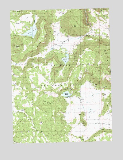
Strawberry Butte, OR USGS Topographic Map
Click on map above to begin viewing in our Map Viewer.

This topographic map contains these locations and features:
Feature Name Type Latitude Longitude GNIS ID View Map
Adams SpringSpringN42.0194°W120.8416°1137020View Map
Albertson DamDamN42.0427°W120.8054°1155510View Map
Albertson RanchLocaleN42.0249°W120.8122°1167652View Map
Albertson ReservoirReservoirN42.0450°W120.8075°1137051View Map
Barry PointSummitN42.1088°W120.7989°1137546View Map
Brushy MountainSummitN42.0399°W120.8319°1138731View Map
Cedar SpringSpringN42.0848°W120.7588°1155478View Map
Center PeakSummitN42.0257°W120.7875°1139542View Map
Devaul DamDamN42.1106°W120.8461°1153942View Map
East Willow CreekStreamN42.0171°W120.7802°1141649View Map
Gober SpringSpringN42.0532°W120.7713°1142792View Map
Green Valley SpringSpringN42.0753°W120.7506°1143060View Map
Harp MountainSummitN42.0179°W120.8641°1143314View Map
Harp SpringSpringN42.0060°W120.8631°1143315View Map
Kenny SpringSpringN42.1033°W120.8216°1144554View Map
Long ValleyValleyN42.1060°W120.7725°1145452View Map
Melix SpringSpringN42.0651°W120.8744°1158369View Map
Onion KnollSummitN42.0438°W120.7619°1147237View Map
Reed RanchLocaleN42.0982°W120.8061°1148355View Map
Sage SpringSpringN42.0998°W120.7730°1148936View Map
South Arm DamDamN42.0826°W120.8038°1153941View Map
South Arm ReservoirReservoirN42.0782°W120.8072°1149898View Map
South Arm SpringSpringN42.0668°W120.8165°1149899View Map
South PeakSummitN42.0182°W120.7861°1150062View Map
Squaw SpringSpringN42.1209°W120.8103°1150295View Map
Strawberry ButteSummitN42.0924°W120.8705°1150476View Map
Strawberry FlatFlatN42.1115°W120.8689°1150483View Map
Strawberry ReservoirReservoirN42.1043°W120.8500°1150486View Map
Strawberry SpringSpringN42.0938°W120.8747°1158508View Map
The PotholeBasinN42.0016°W120.7902°1151037View Map
Willow Camp SpringSpringN42.0312°W120.8652°1152404View Map
Yocum (historical)Populated PlaceN42.0221°W120.7844°1154156View Map
Yocum Post Office (historical)Post OfficeN42.0221°W120.7844°1166224View Map
Yocum ValleyBasinN42.0290°W120.7722°1152737View Map

Note: Coordinates in the location and feature list above are referenced to NAD83 datum.


Copyright (C) 2008-2025 Ryan Niemi / Sunset Dynamics ... All Rights Reserved