TopoQuest Logo
Do you find TopoQuest useful?
Help keep TopoQuest running and adding new maps/features by donating!
Bitcoin:  19c7KJd3qBynnjoSw5npx9KScwjBe4ifkT
Litecoin:  LXs6TkuXGGXo1vDsWCkWVdjQX94eUKd6ui
Home View Maps Find Maps Find Places Resources & Links


Strayhorse, Arizona Topographic Map

USGS Map Title: Strayhorse, AZ
USGS Map MRC: 33109E3
DRG (GeoTIFF) Download: o33109e3.tif


Neighboring USGS Topographic Map Quads:


  Hoodoo Knoll, AZ  
33109F4
 

  Hannagan Meadow, AZ  
33109F3
 

  Beaverhead, AZ  
33109F2
 

  Baldy Bill Point, AZ  
33109E4
 

  Strayhorse, AZ  
33109E3
 

  Bear Mountain, AZ  
33109E2
 

  Robinson Mesa, AZ  
33109D4
 

  Rose Peak, AZ  
33109D3
 

  Dutch Blue Creek, AZ  
33109D2


Map MRC Location:

N34°
W110°
N34°
W109°
H8 H7 H6 H5 H4 H3 H2 H1
G8 G7 G6 G5 G4 G3 G2 G1
F8 F7 F6 F5 F4 F3 F2 F1
E8 E7 E6 E5 E4 E3 E2 E1
D8 D7 D6 D5 D4 D3 D2 D1
C8 C7 C6 C5 C4 C3 C2 C1
B8 B7 B6 B5 B4 B3 B2 B1
A8 A7 A6 A5 A4 A3 A2 A1
N33°
W110°
N33°
W109°

Strayhorse, AZ USGS 1:24K Topographic Map Preview:
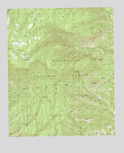
Strayhorse, AZ USGS Topographic Map
Click on map above to begin viewing in our Map Viewer.

This topographic map contains these locations and features:
Feature Name Type Latitude Longitude GNIS ID View Map
Aker LakeLakeN33.6167°W109.3442°39901View Map
Arizona Highway Department Maintance YardLocaleN33.5531°W109.3170°42462View Map
Blue LookoutLocaleN33.5626°W109.2967°25383View Map
Blue PeakSummitN33.5620°W109.2970°39922View Map
Blue Peak LookoutLocaleN33.5626°W109.2973°42691View Map
Blue Vista Scenic OverlookLocaleN33.5648°W109.3534°1853527View Map
Burnt Corral DrawValleyN33.5181°W109.3234°27025View Map
Butterfly CienegaFlatN33.6170°W109.3365°27093View Map
Cache CienegaFlatN33.5987°W109.3515°27158View Map
Crabtree ParkParkN33.5473°W109.3306°28142View Map
Crabtree SpringSpringN33.5373°W109.3361°42463View Map
Crabtree SpringSpringN33.5387°W109.3354°25384View Map
Crabtree Trail Twenty-twoTrailN33.5198°W109.3451°39961View Map
Crooks MesaSummitN33.5306°W109.2545°28181View Map
Hagen CorralLocaleN33.5087°W109.3254°42459View Map
Hidden TankReservoirN33.5075°W109.3688°1853526View Map
Indian PeakSummitN33.5598°W109.2809°30348View Map
K P TankReservoirN33.5769°W109.3529°40011View Map
KP CienegaFlatN33.5792°W109.3562°30693View Map
KP Cienega CampgroundLocaleN33.5762°W109.3559°40010View Map
KP Trail SeventyTrailN33.5945°W109.3076°40012View Map
Lengthy Canyon Trail Eighty-nineTrailN33.5023°W109.2895°40017View Map
Lengthy SpringSpringN33.5239°W109.3028°42460View Map
Lengthy SpringSpringN33.5237°W109.3029°25386View Map
Moonshine ParkFlatN33.6164°W109.2526°31997View Map
Raspberry BasinBasinN33.5526°W109.2845°33381View Map
Raspberry PeakSummitN33.5512°W109.2751°33383View Map
Raspberry Trail Thirty-fiveTrailN33.5251°W109.2590°40062View Map
Rattlesnake BasinBasinN33.5492°W109.3079°33385View Map
Rattlesnake Basin CabinLocaleN33.5501°W109.3140°1853529View Map
Rattlesnake LakeLakeN33.5152°W109.3194°40065View Map
Rattlesnake TankReservoirN33.5112°W109.3201°40067View Map
Salt HouseLocaleN33.5467°W109.3576°33990View Map
Salt House CorralLocaleN33.5387°W109.3662°1853525View Map
Salt House Eighteen TrailTrailN33.5473°W109.3417°40079View Map
Sawed Off MountainSummitN33.5737°W109.2617°34099View Map
Stray Horse CampgroundLocaleN33.5503°W109.3181°40103View Map
StrayhorsePopulated PlaceN33.5506°W109.3181°34896View Map
Strayhorse Administative SiteLocaleN33.5412°W109.3173°25387View Map
Strayhorse Forest Service FacilityLocaleN33.5414°W109.3181°42461View Map
Walnut SpringSpringN33.5370°W109.3558°1853528View Map
Walnut SpringSpringN33.5317°W109.3462°40126View Map
Walnut TankReservoirN33.5156°W109.3545°40127View Map
Willow SpringSpringN33.6206°W109.3192°36246View Map

Note: Coordinates in the location and feature list above are referenced to NAD83 datum.


Copyright (C) 2008-2025 Ryan Niemi / Sunset Dynamics ... All Rights Reserved