TopoQuest Logo
Do you find TopoQuest useful?
Help keep TopoQuest running and adding new maps/features by donating!
Bitcoin:  19c7KJd3qBynnjoSw5npx9KScwjBe4ifkT
Litecoin:  LXs6TkuXGGXo1vDsWCkWVdjQX94eUKd6ui
Home View Maps Find Maps Find Places Resources & Links


Stuart, Virginia Topographic Map

USGS Map Title: Stuart, VA
USGS Map MRC: 36080F3
DRG (GeoTIFF) Download: o36080f3.tif


Neighboring USGS Topographic Map Quads:


  Willis, VA  
36080G4
 

  Woolwine, VA  
36080G3
 

  Charity, VA  
36080G2
 

  Meadows of Dan, VA  
36080F4
 

  Stuart, VA  
36080F3
 

  Patrick Springs, VA  
36080F2
 

  Claudville, VA  
36080E4
 

  Stuart SE, VA  
36080E3
 

  Nettleridge, VA  
36080E2


Map MRC Location:

N37°
W81°
N37°
W80°
H8 H7 H6 H5 H4 H3 H2 H1
G8 G7 G6 G5 G4 G3 G2 G1
F8 F7 F6 F5 F4 F3 F2 F1
E8 E7 E6 E5 E4 E3 E2 E1
D8 D7 D6 D5 D4 D3 D2 D1
C8 C7 C6 C5 C4 C3 C2 C1
B8 B7 B6 B5 B4 B3 B2 B1
A8 A7 A6 A5 A4 A3 A2 A1
N36°
W81°
N36°
W80°

Stuart, VA USGS 1:24K Topographic Map Preview:
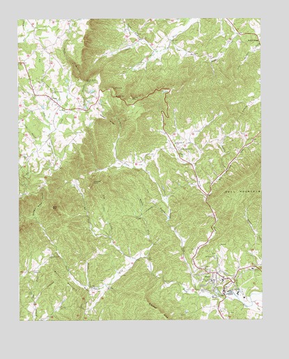
Stuart, VA USGS Topographic Map
Click on map above to begin viewing in our Map Viewer.

This topographic map contains these locations and features:
Feature Name Type Latitude Longitude GNIS ID View Map
Big Ivy CreekStreamN36.7037°W80.3584°1463366View Map
Blue Ridge DistrictCivilN36.6914°W80.3606°1927107View Map
Bouldin Memorial CemeteryCemeteryN36.6954°W80.2912°1497935View Map
Bouldin Memorial ChurchChurchN36.6954°W80.2914°1463697View Map
Brushy ForkStreamN36.6512°W80.3087°1463949View Map
Bull Mountain ForkStreamN36.6760°W80.2773°1464065View Map
Camp BranchStreamN36.6968°W80.3576°1464307View Map
Campbell BranchStreamN36.6346°W80.2626°1464363View Map
Carter MountainSummitN36.6279°W80.3020°1464486View Map
Central Academy (historical)SchoolN36.6996°W80.2887°1497940View Map
Community ChurchChurchN36.6982°W80.2939°1497945View Map
Cruzes StorePopulated PlaceN36.6768°W80.2778°1497951View Map
Dan River ChurchChurchN36.7118°W80.3506°1465583View Map
Dobbins School (historical)SchoolN36.6376°W80.3295°1497953View Map
DobynsPopulated PlaceN36.6382°W80.3367°1499345View Map
Edwardsville School (historical)SchoolN36.7118°W80.3437°1497955View Map
Grassy KnobSummitN36.6815°W80.3295°1497963View Map
Indian Grave MountainSummitN36.6626°W80.2645°1497973View Map
Ivy BranchStreamN36.6679°W80.2973°1468547View Map
Lily Cove BranchStreamN36.6593°W80.3273°1469431View Map
Little Ivy CreekStreamN36.7037°W80.3584°1469574View Map
Lone Ivy School (historical)SchoolN36.7371°W80.3051°1497981View Map
Lovers LeapGapN36.7207°W80.3276°1469880View Map
Mayo MountainSummitN36.6418°W80.3553°1470221View Map
Mayo Mountain CemeteryCemeteryN36.6521°W80.3576°1497985View Map
Mayo Mountain ChurchChurchN36.6521°W80.3578°1470222View Map
Mitchells DamDamN36.7201°W80.3364°1490557View Map
Mount Calvary ChurchChurchN36.6507°W80.2745°1470817View Map
Naked RidgeRidgeN36.7065°W80.3264°1471312View Map
New Dan River CemeteryCemeteryN36.7201°W80.3570°1497997View Map
New Dan River ChurchChurchN36.7196°W80.3567°1471408View Map
North Fork Poor House CreekStreamN36.6443°W80.2862°1471616View Map
North Fork Smith RiverStreamN36.7415°W80.3117°1471618View Map
Patrick CountyCivilN36.6784°W80.2843°1497999View Map
Patrick County CourthouseBuildingN36.6424°W80.2698°1498000View Map
Patrick County JailBuildingN36.6333°W80.2584°2767124View Map
Patrick County Sheriff's OfficeBuildingN36.6424°W80.2699°2767017View Map
Patrick Henry Community CollegeSchoolN36.6467°W80.2726°2498506View Map
Pioneer Community HospitalHospitalN36.6462°W80.2549°2438447View Map
Poorhouse CreekStreamN36.6346°W80.2762°1472615View Map
Puddin CreekStreamN36.6868°W80.2678°1472845View Map
Rich RunStreamN36.7410°W80.2956°1473183View Map
Rock MountainSummitN36.6721°W80.3576°1473380View Map
Rye Cove CreekStreamN36.6496°W80.3151°1473670View Map
Shingle Block HollowValleyN36.6679°W80.3664°1474530View Map
Smith River FallsFallsN36.7243°W80.3392°1474774View Map
Spoon MountainSummitN36.7168°W80.3164°1474959View Map
StuartPopulated PlaceN36.6410°W80.2656°1500182View Map
Stuart Elementary SchoolSchoolN36.6415°W80.2760°2498432View Map
Stuart Post OfficePost OfficeN36.6420°W80.2693°2766303View Map
Stuart Volunteer Fire DepartmentBuildingN36.6412°W80.2661°2086076View Map
Tobacco KnobSummitN36.6821°W80.3367°1475747View Map
Toms KnobSummitN36.6379°W80.3742°1475780View Map
Town of StuartCivilN36.6411°W80.2689°2391431View Map
VestaPopulated PlaceN36.7168°W80.3578°1476176View Map
Vesta Post OfficePost OfficeN36.7160°W80.3571°2766430View Map
Walker ChurchChurchN36.6451°W80.3676°1476234View Map
Waterfall BranchStreamN36.7276°W80.3395°1476369View Map
Williams DamDamN36.6918°W80.2864°1490559View Map
Wilson CreekStreamN36.6385°W80.3378°1476819View Map
Wood School (historical)SchoolN36.7382°W80.3623°1498018View Map

Note: Coordinates in the location and feature list above are referenced to NAD83 datum.


Copyright (C) 2008-2024 Ryan Niemi / Sunset Dynamics ... All Rights Reserved