TopoQuest Logo
Do you find TopoQuest useful?
Help keep TopoQuest running and adding new maps/features by donating!
Bitcoin:  19c7KJd3qBynnjoSw5npx9KScwjBe4ifkT
Litecoin:  LXs6TkuXGGXo1vDsWCkWVdjQX94eUKd6ui
Home View Maps Find Maps Find Places Resources & Links


Nettleridge, Virginia Topographic Map

USGS Map Title: Nettleridge, VA
USGS Map MRC: 36080E2
DRG (GeoTIFF) Download: o36080e2.tif


Neighboring USGS Topographic Map Quads:


  Stuart, VA  
36080F3
 

  Patrick Springs, VA  
36080F2
 

  Sanville, VA  
36080F1
 

  Stuart SE, VA  
36080E3
 

  Nettleridge, VA  
36080E2
 

  Spencer, VA  
36080E1
 

  Hanging Rock, NC  
36080D3
 

  Danbury, NC  
36080D2
 

  Ayersville, NC  
36080D1


Map MRC Location:

N37°
W81°
N37°
W80°
H8 H7 H6 H5 H4 H3 H2 H1
G8 G7 G6 G5 G4 G3 G2 G1
F8 F7 F6 F5 F4 F3 F2 F1
E8 E7 E6 E5 E4 E3 E2 E1
D8 D7 D6 D5 D4 D3 D2 D1
C8 C7 C6 C5 C4 C3 C2 C1
B8 B7 B6 B5 B4 B3 B2 B1
A8 A7 A6 A5 A4 A3 A2 A1
N36°
W81°
N36°
W80°

Nettleridge, VA USGS 1:24K Topographic Map Preview:
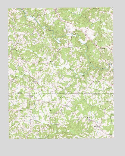
Nettleridge, VA USGS Topographic Map
Click on map above to begin viewing in our Map Viewer.

This topographic map contains these locations and features:
Feature Name Type Latitude Longitude GNIS ID View Map
Anglin BranchStreamN36.6143°W80.2170°1462482View Map
Ayers School (historical)SchoolN36.5693°W80.2145°1497926View Map
Banner BranchStreamN36.5154°W80.2073°980527View Map
Beasley School (historical)SchoolN36.5324°W80.1262°1952640View Map
Big A CemeteryCemeteryN36.6046°W80.2167°1497929View Map
Big A ChurchChurchN36.6037°W80.2167°1463299View Map
Big A School (historical)SchoolN36.5976°W80.2123°1497930View Map
Brown School (historical)SchoolN36.5560°W80.1353°1497938View Map
Cadwell CreekStreamN36.5601°W80.1703°1464234View Map
Campbell (historical)Populated PlaceN36.5279°W80.2373°1006155View Map
Campbell Post Office (historical)Post OfficeN36.5277°W80.2374°2681539View Map
Coleville (historical)Populated PlaceN36.5399°W80.2239°1019737View Map
Coleville Post Office (historical)Post OfficeN36.5399°W80.2242°2681538View Map
Concord CemeteryCemeteryN36.5874°W80.1750°1497946View Map
Concord ChurchChurchN36.5871°W80.1756°1465154View Map
Gilbert MillPopulated PlaceN36.5851°W80.2448°1477348View Map
Gilbert School (historical)SchoolN36.5924°W80.2495°1497960View Map
High Point CemeteryCemeteryN36.6096°W80.2253°1497969View Map
High Point ChurchChurchN36.6096°W80.2248°1468020View Map
High Point School (historical)SchoolN36.6096°W80.2259°1497970View Map
Hughes CreekStreamN36.5843°W80.2214°1468357View Map
Indian Knob Church (historical)ChurchN36.5543°W80.2412°1497974View Map
Jim Boaz DamDamN36.6218°W80.1964°1490553View Map
Jim Boaz PondReservoirN36.6218°W80.1964°1490554View Map
Jute School (historical)SchoolN36.5112°W80.2064°1952671View Map
Lackey Store (historical)Populated PlaceN36.5315°W80.1820°988071View Map
Landis AirportAirportN36.6246°W80.1696°2675579View Map
Little Peters CreekStreamN36.5321°W80.2495°1469615View Map
Little Russell CreekStreamN36.5737°W80.1989°1469643View Map
Macedonia School (historical)SchoolN36.5210°W80.2373°1952676View Map
Minnies ChapelChurchN36.5568°W80.2451°1470614View Map
Minnies Chapel CemeteryCemeteryN36.5568°W80.2456°1497990View Map
Moorefield StorePopulated PlaceN36.5565°W80.1370°1470714View Map
Moorefield Store Volunteer Fire DepartmentBuildingN36.5568°W80.1368°2086073View Map
Moorefield's AirstripAirportN36.5606°W80.1372°1498645View Map
Mountain BranchStreamN36.5065°W80.1931°990684View Map
Nettle RidgePopulated PlaceN36.5860°W80.1395°1477574View Map
Nettle Ridge CemeteryCemeteryN36.5868°W80.1392°1497995View Map
Nettle Ridge Methodist ChurchChurchN36.5868°W80.1395°1497996View Map
New Hope ChurchChurchN36.5768°W80.2356°1471428View Map
Noels BranchStreamN36.5857°W80.2445°1474256View Map
Oak RidgePopulated PlaceN36.5029°W80.1298°1021702View Map
Oak Ridge Baptist ChurchChurchN36.5024°W80.1287°1952699View Map
Palmetto (historical)Populated PlaceN36.5551°W80.2167°1477607View Map
Palmetto School (historical)SchoolN36.5576°W80.1873°1497998View Map
Penn School (historical)SchoolN36.5576°W80.2314°1498004View Map
Peters Creek Baptist ChurchChurchN36.5412°W80.2251°992090View Map
Pleasant Grove CemeteryCemeteryN36.5537°W80.1434°1498008View Map
Pleasant Grove Primitive Baptist ChurchChurchN36.5540°W80.1431°1472467View Map
Russell CreekStreamN36.5682°W80.1489°1473647View Map
Russell Creek ChurchChurchN36.5518°W80.2145°1473648View Map
Shelton Store (historical)Populated PlaceN36.5112°W80.1425°994650View Map
Smith ChapelChurchN36.5176°W80.1534°994959View Map
Spoon Creek ChurchChurchN36.6246°W80.1437°1474955View Map
Tatum Macedonia ChurchChurchN36.6199°W80.1920°1475493View Map
Trinity ChurchChurchN36.5926°W80.1420°1475858View Map
Tuggle Mill (historical)LocaleN36.5007°W80.1653°1952710View Map

Note: Coordinates in the location and feature list above are referenced to NAD83 datum.


Copyright (C) 2008-2024 Ryan Niemi / Sunset Dynamics ... All Rights Reserved