TopoQuest Logo
Do you find TopoQuest useful?
Help keep TopoQuest running and adding new maps/features by donating!
Bitcoin:  19c7KJd3qBynnjoSw5npx9KScwjBe4ifkT
Litecoin:  LXs6TkuXGGXo1vDsWCkWVdjQX94eUKd6ui
Home View Maps Find Maps Find Places Resources & Links


Sugarloaf Mountain, Virginia Topographic Map

USGS Map Title: Sugarloaf Mountain, VA
USGS Map MRC: 37079F6
DRG (GeoTIFF) Download: o37079f6.tif


Neighboring USGS Topographic Map Quads:


  Clifton Forge, VA  
37079G7
 

  Longdale Furnace, VA  
37079G6
 

  Collierstown, VA  
37079G5
 

  Eagle Rock, VA  
37079F7
 

  Sugarloaf Mountain, VA  
37079F6
 

  Natural Bridge, VA  
37079F5
 

  Salisbury, VA  
37079E7
 

  Buchanan, VA  
37079E6
 

  Arnold Valley, VA  
37079E5


Map MRC Location:

N38°
W80°
N38°
W79°
H8 H7 H6 H5 H4 H3 H2 H1
G8 G7 G6 G5 G4 G3 G2 G1
F8 F7 F6 F5 F4 F3 F2 F1
E8 E7 E6 E5 E4 E3 E2 E1
D8 D7 D6 D5 D4 D3 D2 D1
C8 C7 C6 C5 C4 C3 C2 C1
B8 B7 B6 B5 B4 B3 B2 B1
A8 A7 A6 A5 A4 A3 A2 A1
N37°
W80°
N37°
W79°

Sugarloaf Mountain, VA USGS 1:24K Topographic Map Preview:
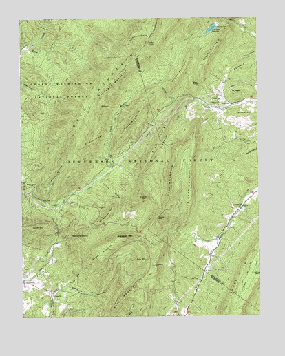
Sugarloaf Mountain, VA USGS Topographic Map
Click on map above to begin viewing in our Map Viewer.

This topographic map contains these locations and features:
Feature Name Type Latitude Longitude GNIS ID View Map
Ad Cox KnobSummitN37.7399°W79.6825°1499040View Map
Ad Cox Knob DamDamN37.7465°W79.6462°1481256View Map
BearwallowSummitN37.7126°W79.7045°1499102View Map
Biggs MountainSummitN37.7121°W79.6856°1481798View Map
Brushy MountainSummitN37.7301°W79.6548°1482070View Map
Camp MountainSummitN37.6943°W79.6675°1499208View Map
Chestnut FlatsFlatN37.7432°W79.6864°1482474View Map
Deacons CemeteryCemeteryN37.7143°W79.6445°1482957View Map
Dry RunStreamN37.6368°W79.7292°1483131View Map
Garden MountainSummitN37.6518°W79.7081°1499459View Map
Grassy MountainSummitN37.6674°W79.6770°1483756View Map
Gully MountainSummitN37.6490°W79.6848°1483863View Map
HeartsbloodGapN37.6974°W79.6739°1484009View Map
Hickory HollowValleyN37.6340°W79.7341°1484062View Map
Jane FurnaceLocaleN37.6887°W79.7020°1484399View Map
Lexington ReservoirReservoirN37.7468°W79.6398°1502340View Map
Lexington ReservoirReservoirN37.7455°W79.6488°1502058View Map
Limestone HollowValleyN37.6779°W79.7431°1484847View Map
Little Camp MountainSummitN37.6835°W79.6609°1484878View Map
Mays MountainSummitN37.6396°W79.6881°1485247View Map
Middle MountainSummitN37.7335°W79.6603°1485376View Map
Moores Creek DamDamN37.7468°W79.6398°1490802View Map
Mount Bethel ChurchChurchN37.6337°W79.7339°1485569View Map
Mount Horeb ChurchChurchN37.7137°W79.6395°1485594View Map
Mount PisgahSummitN37.7204°W79.6353°1499881View Map
North MountainSummitN37.7396°W79.6825°1499805View Map
Orebank MountainSummitN37.6462°W79.6798°1485988View Map
Painter MountainSummitN37.6987°W79.6762°1499835View Map
Piny KnobSummitN37.7226°W79.6589°1499879View Map
Prisehouse MountainSummitN37.6665°W79.7050°1499917View Map
Pullen CemeteryCemeteryN37.7160°W79.6439°1486448View Map
Rapps CemeteryCemeteryN37.6715°W79.6323°1806010View Map
Rapps ChurchChurchN37.6712°W79.6323°1486509View Map
Rapps MillPopulated PlaceN37.6704°W79.6339°1499934View Map
Rebecca FurnaceLocaleN37.6807°W79.7459°1486533View Map
ReidlandSummitN37.7285°W79.6342°1486567View Map
Rocky CreekStreamN37.7387°W79.7456°1486733View Map
Rocky FordLocaleN37.6732°W79.7364°1486734View Map
Sandbank MountainSummitN37.7282°W79.6959°1486925View Map
Sanford HillSummitN37.7099°W79.6367°1500029View Map
Scurff MountainSummitN37.6621°W79.7414°1486989View Map
Sloan BranchStreamN37.6810°W79.7123°1487320View Map
Smith BranchStreamN37.6810°W79.7123°1487327View Map
Smith FlatsFlatN37.7293°W79.6731°1487344View Map
Stamping Ground MountainSummitN37.6579°W79.7195°1487515View Map
Sugarloaf MountainSummitN37.6582°W79.6948°1487706View Map
The PinnaclePillarN37.7051°W79.6575°1806008View Map
Wildcat MountainSummitN37.6740°W79.6856°1500321View Map
Winding RidgeRidgeN37.6979°W79.7120°1488424View Map

Note: Coordinates in the location and feature list above are referenced to NAD83 datum.


Copyright (C) 2008-2024 Ryan Niemi / Sunset Dynamics ... All Rights Reserved