TopoQuest Logo
Do you find TopoQuest useful?
Help keep TopoQuest running and adding new maps/features by donating!
Bitcoin:  19c7KJd3qBynnjoSw5npx9KScwjBe4ifkT
Litecoin:  LXs6TkuXGGXo1vDsWCkWVdjQX94eUKd6ui
Home View Maps Find Maps Find Places Resources & Links


Sugarloaf Peak, New Mexico Topographic Map

USGS Map Title: Sugarloaf Peak, NM
USGS Map MRC: 33107B6
DRG (GeoTIFF) Download: o33107b6.tif


Neighboring USGS Topographic Map Quads:


  Lookout Mountain, NM  
33107C7
 

  Winston, NM  
33107C6
 

  Chise, NM  
33107C5
 

  Reeds Peak, NM  
33107B7
 

  Sugarloaf Peak, NM  
33107B6
 

  Thumb Tank Peak, NM  
33107B5
 

  Victorio Park, NM  
33107A7
 

  Apache Peak, NM  
33107A6
 

  Bell Mountain, NM  
33107A5


Map MRC Location:

N34°
W108°
N34°
W107°
H8 H7 H6 H5 H4 H3 H2 H1
G8 G7 G6 G5 G4 G3 G2 G1
F8 F7 F6 F5 F4 F3 F2 F1
E8 E7 E6 E5 E4 E3 E2 E1
D8 D7 D6 D5 D4 D3 D2 D1
C8 C7 C6 C5 C4 C3 C2 C1
B8 B7 B6 B5 B4 B3 B2 B1
A8 A7 A6 A5 A4 A3 A2 A1
N33°
W108°
N33°
W107°

Sugarloaf Peak, NM USGS 1:24K Topographic Map Preview:
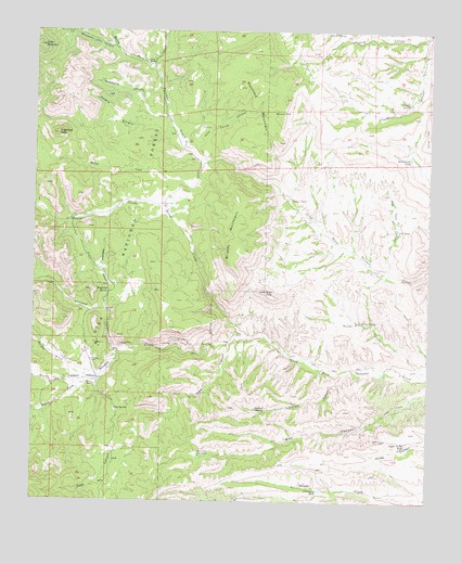
Sugarloaf Peak, NM USGS Topographic Map
Click on map above to begin viewing in our Map Viewer.

This topographic map contains these locations and features:
Feature Name Type Latitude Longitude GNIS ID View Map
American Flag and Flagstaff MineMineN33.1484°W107.7228°940067View Map
ArgonautMineN33.1659°W107.7006°917916View Map
Bear Canyon TankReservoirN33.1371°W107.6983°928878View Map
Black PeakSummitN33.1812°W107.6770°903891View Map
Brushy MountainSummitN33.1920°W107.6836°904117View Map
Circle Seven CreekStreamN33.1684°W107.6825°905169View Map
Circle Seven WellWellN33.1692°W107.6842°905170View Map
Cliff-L-EmboliteMineN33.1634°W107.7034°917931View Map
Cobb MountainSummitN33.2459°W107.7498°905227View Map
Cottonwood TankReservoirN33.1282°W107.6591°905429View Map
Curtis CanyonValleyN33.1576°W107.7317°905564View Map
Dark CanyonValleyN33.1670°W107.6881°905595View Map
Dines RanchLocaleN33.2412°W107.7145°905768View Map
East WindmillLocaleN33.2248°W107.6970°906000View Map
Emrick CanyonValleyN33.1603°W107.6492°906159View Map
Emrick SpringSpringN33.1490°W107.6767°906160View Map
Flag SpringSpringN33.1495°W107.7245°906294View Map
Flat TankReservoirN33.1975°W107.6355°906297View Map
Flat Tank CanyonValleyN33.1853°W107.6378°906298View Map
Grapevine CanyonValleyN33.2273°W107.7078°906697View Map
Grapevine SpringSpringN33.2337°W107.7192°912865View Map
Gurule CanyonValleyN33.2487°W107.6278°906782View Map
Gurule SpringSpringN33.2498°W107.6528°906784View Map
HermosaPopulated PlaceN33.1576°W107.7300°906935View Map
Hermosa CemeteryCemeteryN33.1623°W107.7317°906936View Map
Hermosa Post Office (historical)Post OfficeN33.1576°W107.7300°937358View Map
Hickland CanyonValleyN33.1645°W107.7231°906944View Map
Lookout TankReservoirN33.1256°W107.6859°928980View Map
Lower Coyote WellWellN33.2406°W107.6281°908269View Map
Lower Romero WindmillLocaleN33.1867°W107.6411°908285View Map
Middle WellWellN33.1992°W107.7389°908720View Map
Moccasin John CanyonValleyN33.2451°W107.7242°908811View Map
Moccasin John WellWellN33.2498°W107.7392°908813View Map
Montosa MountainSummitN33.2323°W107.6709°908857View Map
Montosa TankReservoirN33.2285°W107.6752°908858View Map
Morgan CreekStreamN33.1578°W107.7317°908905View Map
Negro Bob WellWellN33.2037°W107.7095°909043View Map
Ocean Wave and AntelopeMineN33.1659°W107.7231°917692View Map
Palomas ChiefMineN33.1662°W107.7034°917695View Map
PelicanMineN33.1673°W107.7045°917426View Map
Pelican Group MinesMineN33.1673°W107.7039°909537View Map
Pole Corral CanyonValleyN33.2162°W107.6964°909769View Map
Poverty CanyonValleyN33.2215°W107.7036°909823View Map
Poverty SpringSpringN33.2253°W107.7145°912875View Map
Proctor MineMineN33.1667°W107.7234°917691View Map
Protector MineMineN33.1667°W107.7231°909867View Map
Rattlesnake TankReservoirN33.2163°W107.6317°910024View Map
Romero TankReservoirN33.2053°W107.6694°910424View Map
Rouse CanyonValleyN33.1601°W107.6267°910455View Map
Rouse SpringSpringN33.1728°W107.6461°910458View Map
Rouse WellWellN33.1612°W107.6448°910459View Map
Sandstone SpringSpringN33.1367°W107.7434°912874View Map
Sugarloaf PeakSummitN33.2226°W107.7431°911463View Map
Sugarloaf SpringSpringN33.2242°W107.7361°912864View Map
Trujillo SpringSpringN33.2312°W107.6320°911838View Map
Upper Avilas TankReservoirN33.1407°W107.6320°911970View Map
Upper Coyote WellWellN33.2323°W107.6523°911980View Map
Upper House WellWellN33.2437°W107.7231°912866View Map
Upper Romero WindmillLocaleN33.1998°W107.6620°912005View Map
Wagonbed CanyonValleyN33.1753°W107.7264°912128View Map
Wagonbed SpringSpringN33.1809°W107.7264°912129View Map
Willow CreekStreamN33.2159°W107.6973°912402View Map
WolfordMineN33.1662°W107.7306°917463View Map

Note: Coordinates in the location and feature list above are referenced to NAD83 datum.


Copyright (C) 2008-2025 Ryan Niemi / Sunset Dynamics ... All Rights Reserved