TopoQuest Logo
Do you find TopoQuest useful?
Help keep TopoQuest running and adding new maps/features by donating!
Bitcoin:  19c7KJd3qBynnjoSw5npx9KScwjBe4ifkT
Litecoin:  LXs6TkuXGGXo1vDsWCkWVdjQX94eUKd6ui
Home View Maps Find Maps Find Places Resources & Links


Apache Peak, New Mexico Topographic Map

USGS Map Title: Apache Peak, NM
USGS Map MRC: 33107A6
DRG (GeoTIFF) Download: o33107a6.tif


Neighboring USGS Topographic Map Quads:


  Reeds Peak, NM  
33107B7
 

  Sugarloaf Peak, NM  
33107B6
 

  Thumb Tank Peak, NM  
33107B5
 

  Victorio Park, NM  
33107A7
 

  Apache Peak, NM  
33107A6
 

  Bell Mountain, NM  
33107A5
 

  Hillsboro Peak, NM  
32107H7
 

  Kingston, NM  
32107H6
 

  Hillsboro, NM  
32107H5


Map MRC Location:

N34°
W108°
N34°
W107°
H8 H7 H6 H5 H4 H3 H2 H1
G8 G7 G6 G5 G4 G3 G2 G1
F8 F7 F6 F5 F4 F3 F2 F1
E8 E7 E6 E5 E4 E3 E2 E1
D8 D7 D6 D5 D4 D3 D2 D1
C8 C7 C6 C5 C4 C3 C2 C1
B8 B7 B6 B5 B4 B3 B2 B1
A8 A7 A6 A5 A4 A3 A2 A1
N33°
W108°
N33°
W107°

Apache Peak, NM USGS 1:24K Topographic Map Preview:
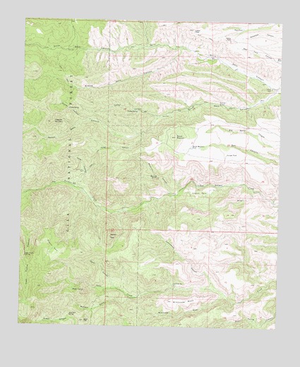
Apache Peak, NM USGS Topographic Map
Click on map above to begin viewing in our Map Viewer.

This topographic map contains these locations and features:
Feature Name Type Latitude Longitude GNIS ID View Map
Apache CampLocaleN33.0481°W107.7017°903212View Map
Apache PeakSummitN33.0370°W107.7084°903233View Map
Bald HillSummitN33.0026°W107.7198°903510View Map
Bald Hill SpringSpringN33.0048°W107.7264°903512View Map
Beam SpringSpringN33.0598°W107.7009°912730View Map
Cave CanyonValleyN33.0159°W107.7039°904844View Map
Chacon CorralLocaleN33.0551°W107.6761°928899View Map
Chacon ParkFlatN33.0553°W107.6642°905015View Map
Conley CanyonValleyN33.0845°W107.7181°905291View Map
Conley SpringSpringN33.0887°W107.7286°905292View Map
Cottonwood CanyonValleyN33.0159°W107.6559°905399View Map
Davis WellWellN33.1128°W107.7295°905622View Map
Dumm PlaceLocaleN33.0584°W107.7261°905902View Map
East Curtis SpringSpringN33.0290°W107.7481°905959View Map
Escondida SpringSpringN33.0126°W107.6934°912731View Map
Flagpole MountainSummitN33.0831°W107.7375°906295View Map
Hells CanyonValleyN33.0562°W107.7220°906912View Map
Hells Canyon WellWellN33.0634°W107.7214°906915View Map
Hilton CorralLocaleN33.0776°W107.6986°912735View Map
Hyler CanyonValleyN33.0792°W107.6931°907179View Map
Indian PeakSummitN33.1217°W107.6692°907219View Map
Indian TankReservoirN33.1178°W107.6509°907233View Map
Ingersoll MineMineN33.0001°W107.7220°915453View Map
Juniper TankReservoirN33.0712°W107.6514°907495View Map
L M Bar RanchLocaleN33.0987°W107.6309°907599View Map
Magner ParkFlatN33.0317°W107.7348°908358View Map
Magnum SpringSpringN33.0148°W107.7250°908359View Map
Maverick CanyonValleyN33.0537°W107.6784°908469View Map
Maverick SpringSpringN33.0615°W107.6848°908478View Map
McCann GulchValleyN33.0126°W107.6978°908490View Map
Middle Seco CanyonValleyN33.1009°W107.7003°2038801View Map
Middle Seco CreekStreamN33.1140°W107.6723°938787View Map
Milkhouse DrawValleyN33.0137°W107.6509°908738View Map
Milkhouse MesaSummitN33.0106°W107.6789°908739View Map
New TankReservoirN33.1096°W107.6276°909067View Map
North Seco CreekStreamN33.0981°W107.6275°902911View Map
North Seco WellWellN33.1148°W107.6900°909187View Map
Pague TankReservoirN33.1222°W107.6445°909437View Map
Pague WellWellN33.1101°W107.6584°909438View Map
Round MountainSummitN33.0778°W107.6770°910443View Map
Round Mountain TankReservoirN33.0731°W107.6684°910449View Map
Six B SpringSpringN33.0181°W107.6759°911100View Map
South Seco CreekStreamN33.0978°W107.6284°936863View Map
South Seco WindmillLocaleN33.0912°W107.6553°911274View Map
Turkey CanyonValleyN33.0862°W107.6848°911860View Map
Turkey SpringSpringN33.0884°W107.6950°911893View Map
Turkey WellWellN33.0865°W107.6834°911909View Map
Walnut CorralLocaleN33.0770°W107.7400°912734View Map

Note: Coordinates in the location and feature list above are referenced to NAD83 datum.


Copyright (C) 2008-2024 Ryan Niemi / Sunset Dynamics ... All Rights Reserved