TopoQuest Logo
Do you find TopoQuest useful?
Help keep TopoQuest running and adding new maps/features by donating!
Bitcoin:  19c7KJd3qBynnjoSw5npx9KScwjBe4ifkT
Litecoin:  LXs6TkuXGGXo1vDsWCkWVdjQX94eUKd6ui
Home View Maps Find Maps Find Places Resources & Links


Sullivan, Missouri Topographic Map

USGS Map Title: Sullivan, MO
USGS Map MRC: 38091B2
DRG (GeoTIFF) Download: o38091b2.tif


Neighboring USGS Topographic Map Quads:


  Strain, MO  
38091C3
 

  Spring Bluff, MO  
38091C2
 

  Stanton, MO  
38091C1
 

  Argo, MO  
38091B3
 

  Sullivan, MO  
38091B2
 

  Meramec State Park, MO  
38091B1
 

  Leasburg, MO  
38091A3
 

  Onondaga Cave, MO  
38091A2
 

  Anthonies Mill, MO  
38091A1


Map MRC Location:

N39°
W92°
N39°
W91°
H8 H7 H6 H5 H4 H3 H2 H1
G8 G7 G6 G5 G4 G3 G2 G1
F8 F7 F6 F5 F4 F3 F2 F1
E8 E7 E6 E5 E4 E3 E2 E1
D8 D7 D6 D5 D4 D3 D2 D1
C8 C7 C6 C5 C4 C3 C2 C1
B8 B7 B6 B5 B4 B3 B2 B1
A8 A7 A6 A5 A4 A3 A2 A1
N38°
W92°
N38°
W91°

Sullivan, MO USGS 1:24K Topographic Map Preview:
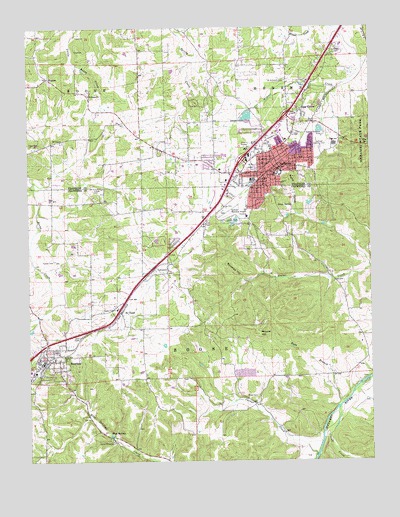
Sullivan, MO USGS Topographic Map
Click on map above to begin viewing in our Map Viewer.

This topographic map contains these locations and features:
Feature Name Type Latitude Longitude GNIS ID View Map
Blue SpringsSpringN38.1326°W91.2210°736279View Map
Bluff LakeLakeN38.1327°W91.2205°736453View Map
BourbonPopulated PlaceN38.1548°W91.2440°714562View Map
Bourbon CemeteryCemeteryN38.1626°W91.2375°2681482View Map
Bourbon Fire Protection DistrictBuildingN38.1548°W91.2453°2620491View Map
Bourbon Police DepartmentBuildingN38.1538°W91.2448°2752384View Map
Bourbon Post OfficePost OfficeN38.1528°W91.2465°2782953View Map
Bowman HollowValleyN38.1778°W91.1721°714590View Map
Camp MihaskaLocaleN38.1306°W91.2196°736286View Map
Carter CreekStreamN38.1253°W91.1465°715443View Map
Carter Lead MineMineN38.1623°W91.1929°736452View Map
City of BourbonCivilN38.1506°W91.2493°2394225View Map
City of SullivanCivilN38.2127°W91.1636°2395998View Map
City Park LakeReservoirN38.1940°W91.1751°764421View Map
City Park Lake DamDamN38.1934°W91.1768°764420View Map
Cress SpringSpringN38.1987°W91.1540°716490View Map
Crows CreekStreamN38.1398°W91.1376°749544View Map
Dowler Gristmill (historical)LocaleN38.1259°W91.2076°736451View Map
Dowler Mill SchoolSchoolN38.1264°W91.2015°742357View Map
Elm SpringSpringN38.2162°W91.1260°717536View Map
ElmontPopulated PlaceN38.2356°W91.2426°731566View Map
Finney CemeteryCemeteryN38.2038°W91.2261°717926View Map
Hibler Lead DiggingsMineN38.1648°W91.1674°736450View Map
Hill CemeteryCemeteryN38.1610°W91.2317°719595View Map
Hyde BranchStreamN38.1423°W91.1349°720056View Map
Independent Order of Odd Fellows Memorial CemeteryCemeteryN38.2172°W91.1625°2702125View Map
Isgrigs Lead DiggingsMineN38.1431°W91.1468°736449View Map
KTUI-AM (Sullivan)TowerN38.1950°W91.1868°759278View Map
KTUI-FM (Sullivan)TowerN38.1950°W91.1868°754242View Map
Luke Bluff Lead MineMineN38.1453°W91.1540°736448View Map
Mineral HillSummitN38.1614°W91.1668°722426View Map
Mineral Hill Lead MinesMineN38.1598°W91.1643°736446View Map
Missouri Baptist Sullivan HospitalHospitalN38.1955°W91.1702°2655038View Map
Missouri Department of Conservation Forestry Saint Louis Regional Field Fire Office SullivanBuildingN38.2169°W91.1669°2620680View Map
New Rock SchoolSchoolN38.1439°W91.1668°742356View Map
Oak Grove School (historical)LocaleN38.1820°W91.2279°742354View Map
Oak Grove VillagePopulated PlaceN38.2256°W91.1513°723560View Map
Pilot Grove Church (historical)ChurchN38.2309°W91.2365°742352View Map
Pump HollowValleyN38.1964°W91.1532°724996View Map
Ramstein LakeReservoirN38.1600°W91.2018°761662View Map
Ramstein Lake DamDamN38.1600°W91.2018°761661View Map
Reeds Defeat SchoolSchoolN38.2192°W91.2274°742353View Map
Rock CemeteryCemeteryN38.1437°W91.1674°725433View Map
Romine Lead MineMineN38.1559°W91.1551°736445View Map
Saint Anthonys CemeteryCemeteryN38.2347°W91.1563°725726View Map
Saint CloudPopulated PlaceN38.1687°W91.2176°725742View Map
Smith SchoolSchoolN38.1756°W91.1357°742355View Map
Soulard Lead MineMineN38.1592°W91.1751°736444View Map
SullivanPopulated PlaceN38.2081°W91.1604°731658View Map
Sullivan Country ClubLocaleN38.2148°W91.1435°755419View Map
Sullivan Elementary SchoolSchoolN38.2079°W91.1575°730660View Map
Sullivan Fire Protection District Station 1BuildingN38.2103°W91.1583°2621063View Map
Sullivan Police DepartmentBuildingN38.2000°W91.1716°2752325View Map
Sullivan Post OfficePost OfficeN38.2092°W91.1589°2783077View Map
Sullivan Regional AirportAirportN38.2322°W91.1648°758960View Map
Town of West SullivanCivilN38.1920°W91.1917°2400145View Map
Township of BooneCivilN38.1622°W91.2004°766541View Map
Turner CemeteryCemeteryN38.1831°W91.2407°727897View Map
Village of Oak Grove VillageCivilN38.2278°W91.1495°2399535View Map
Village of Saint CloudCivilN38.1732°W91.2128°2399160View Map
Von Hoffman LakeLakeN38.1309°W91.2171°728222View Map
Wesleyan ChurchChurchN38.2306°W91.2282°728523View Map
West SullivanPopulated PlaceN38.1875°W91.1960°1890983View Map
Wildcat HollowValleyN38.1314°W91.2210°736443View Map
Williams Lead MineMineN38.1503°W91.1715°736442View Map

Note: Coordinates in the location and feature list above are referenced to NAD83 datum.


Copyright (C) 2008-2024 Ryan Niemi / Sunset Dynamics ... All Rights Reserved