TopoQuest Logo
Do you find TopoQuest useful?
Help keep TopoQuest running and adding new maps/features by donating!
Bitcoin:  19c7KJd3qBynnjoSw5npx9KScwjBe4ifkT
Litecoin:  LXs6TkuXGGXo1vDsWCkWVdjQX94eUKd6ui
Home View Maps Find Maps Find Places Resources & Links


Sumner, Florida Topographic Map

USGS Map Title: Sumner, FL
USGS Map MRC: 29082B8
DRG (GeoTIFF) Download: o29082b8.tif


Neighboring USGS Topographic Map Quads:


  East Pass, FL  
29083C1
 

  Chiefland SW, FL  
29082C8
 

  Otter Creek, FL  
29082C7
 

  Cedar Key, FL  
29083B1
 

  Sumner, FL  
29082B8
 

  Waccasassa Bay, FL  
29082B7
 

  Seahorse Key, FL  
29083A1


  Withlacoochee Bay, FL  
29082A7


Map MRC Location:

N30°
W83°
N30°
W82°
H8 H7 H6 H5 H4 H3 H2 H1
G8 G7 G6 G5 G4 G3 G2 G1
F8 F7 F6 F5 F4 F3 F2 F1
E8 E7 E6 E5 E4 E3 E2 E1
D8 D7 D6 D5 D4 D3 D2 D1
C8 C7 C6 C5 C4 C3 C2 C1
B8 B7 B6 B5 B4 B3 B2 B1
A8 A7 A6 A5 A4 A3 A2 A1
N29°
W83°
N29°
W82°

Sumner, FL USGS 1:24K Topographic Map Preview:
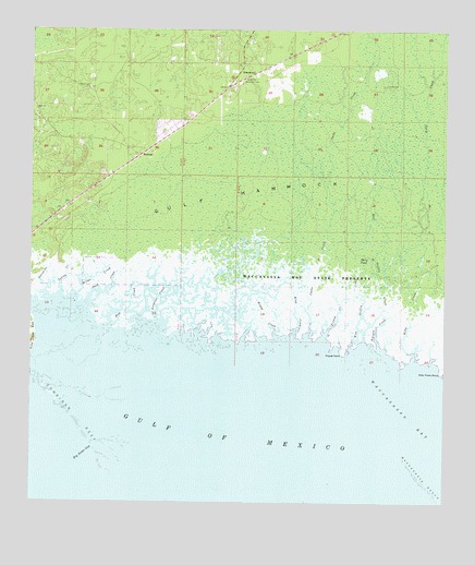
Sumner, FL USGS Topographic Map
Click on map above to begin viewing in our Map Viewer.

This topographic map contains these locations and features:
Feature Name Type Latitude Longitude GNIS ID View Map
Berry PondLakeN29.1898°W82.8977°278507View Map
Big Stake GapChannelN29.1400°W82.9807°278757View Map
Cedars AirfieldAirportN29.2300°W82.9431°309313View Map
Corrigan ReefBarN29.1447°W82.9832°280864View Map
Dorset CreekStreamN29.1789°W82.9954°281685View Map
East Griffin CreekStreamN29.1675°W82.8996°281983View Map
Hall CreekStreamN29.1716°W82.9771°283621View Map
Jacks CreekStreamN29.1697°W82.9168°284666View Map
Kelly CreekStreamN29.1633°W82.8843°285039View Map
Kelly Creek PointCapeN29.1594°W82.8765°285041View Map
King CreekStreamN29.1694°W82.9210°285106View Map
Porpoise CreekStreamN29.1714°W82.9629°289223View Map
RosewoodPopulated PlaceN29.2391°W82.9321°295588View Map
Rosewood Volunteer Fire DepartmentBuildingN29.2357°W82.9377°2644287View Map
Sand CreekStreamN29.1783°W82.9826°290511View Map
Shiloh CemeteryCemeteryN29.2350°W82.9823°291026View Map
South Bar ChannelChannelN29.1319°W82.9982°308484View Map
Spring CreekStreamN29.1797°W82.9912°291525View Map
SumnerPopulated PlaceN29.2169°W82.9676°294938View Map
Suwannee Lookout TowerTowerN29.2383°W82.9360°291909View Map
Tarpon CreekStreamN29.1661°W82.8946°292043View Map
Tripod CreekStreamN29.1677°W82.9121°292446View Map
Tripod PointCapeN29.1641°W82.9057°292449View Map
West Griffin CreekStreamN29.1658°W82.9032°293072View Map
Wilder CreekStreamN29.1794°W82.9865°293297View Map
Winzy CreekStreamN29.1691°W82.9257°293433View Map

Note: Coordinates in the location and feature list above are referenced to NAD83 datum.


Copyright (C) 2008-2025 Ryan Niemi / Sunset Dynamics ... All Rights Reserved