TopoQuest Logo
Do you find TopoQuest useful?
Help keep TopoQuest running and adding new maps/features by donating!
Bitcoin:  19c7KJd3qBynnjoSw5npx9KScwjBe4ifkT
Litecoin:  LXs6TkuXGGXo1vDsWCkWVdjQX94eUKd6ui
Home View Maps Find Maps Find Places Resources & Links


Sun Prairie, Wisconsin Topographic Map

USGS Map Title: Sun Prairie, WI
USGS Map MRC: 43089B2
DRG (GeoTIFF) Download: o43089b2.tif


Neighboring USGS Topographic Map Quads:


  Morrisonville, WI  
43089C3
 

  North Bristol, WI  
43089C2
 

  Columbus, WI  
43089C1
 

  De Forest, WI  
43089B3
 

  Sun Prairie, WI  
43089B2
 

  Marshall, WI  
43089B1
 

  Madison East, WI  
43089A3
 

  Cottage Grove, WI  
43089A2
 

  Deerfield, WI  
43089A1


Map MRC Location:

N44°
W90°
N44°
W89°
H8 H7 H6 H5 H4 H3 H2 H1
G8 G7 G6 G5 G4 G3 G2 G1
F8 F7 F6 F5 F4 F3 F2 F1
E8 E7 E6 E5 E4 E3 E2 E1
D8 D7 D6 D5 D4 D3 D2 D1
C8 C7 C6 C5 C4 C3 C2 C1
B8 B7 B6 B5 B4 B3 B2 B1
A8 A7 A6 A5 A4 A3 A2 A1
N43°
W90°
N43°
W89°

Sun Prairie, WI USGS 1:24K Topographic Map Preview:
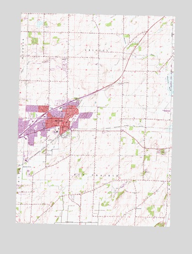
Sun Prairie, WI USGS Topographic Map
Click on map above to begin viewing in our Map Viewer.

This topographic map contains these locations and features:
Feature Name Type Latitude Longitude GNIS ID View Map
Angel ParkParkN43.1778°W89.2098°1560866View Map
Bailey FarmsLocaleN43.1450°W89.2389°2629207View Map
Bird Elementary SchoolSchoolN43.1958°W89.2269°1842326View Map
Bradley FarmsLocaleN43.1336°W89.1992°2704144View Map
Brazee LakeLakeN43.2014°W89.1807°1581139View Map
Brazee Swamp (historical)SwampN43.2000°W89.1834°1842342View Map
Bristol ChurchChurchN43.2230°W89.2118°1562219View Map
Bristol Lutheran CemeteryCemeteryN43.2228°W89.2119°2781249View Map
Burgess CornersPopulated PlaceN43.1808°W89.1871°1842350View Map
Buss's CornersPopulated PlaceN43.1661°W89.2073°1843065View Map
Calvary Baptist Christian SchoolSchoolN43.1832°W89.2463°1842351View Map
Chase Grain ElevatorLocaleN43.1789°W89.2142°2646608View Map
City of Sun PrairieCivilN43.1829°W89.2353°1584255View Map
City View HeightsPopulated PlaceN43.1803°W89.1798°1842365View Map
Drovers WoodsPopulated PlaceN43.1694°W89.1315°1842387View Map
Eastside Elementary SchoolSchoolN43.1892°W89.2036°1842397View Map
Hilton EstatesPopulated PlaceN43.2230°W89.2237°1842463View Map
Northside Elementary SchoolSchoolN43.1940°W89.2161°1842587View Map
Patrick Marsh Middle SchoolSchoolN43.1990°W89.1943°2716438View Map
Peace Evangelical Lutheran ChurchChurchN43.1880°W89.2165°1842611View Map
Peace Lutheran SchoolSchoolN43.1881°W89.2160°2716474View Map
Pebble ValleyPopulated PlaceN43.2258°W89.2287°1842613View Map
PiercevillePopulated PlaceN43.1358°W89.1532°1571357View Map
Pierceville CemeteryCemeteryN43.1448°W89.1524°1571358View Map
Porter FarmsLocaleN43.2250°W89.2442°2629209View Map
Prairie Meadow FarmsLocaleN43.2014°W89.1519°2629210View Map
Prairie Phoenix AcademySchoolN43.1815°W89.2184°1842708View Map
Prairie View HeightsPopulated PlaceN43.2175°W89.2132°1842624View Map
Sacred Hearts of Jesus and Mary Catholic ChurchChurchN43.1867°W89.2101°1842638View Map
Sacred Hearts of Jesus and Mary CemeteryCemeteryN43.1948°W89.2011°2781292View Map
Sacred Hearts SchoolSchoolN43.1857°W89.2106°1842637View Map
Schey AcresPopulated PlaceN43.1411°W89.2043°1842671View Map
Selzner FarmsLocaleN43.2394°W89.1722°2629208View Map
Sherwood Forest HeightsPopulated PlaceN43.2333°W89.2384°1842679View Map
Sun PrairiePopulated PlaceN43.1836°W89.2137°1575070View Map
Sun Prairie CemeteryCemeteryN43.1790°W89.2075°2781299View Map
Sun Prairie Emergency Medical Services Station 1BuildingN43.1841°W89.2127°2698239View Map
Sun Prairie Fire Department Station 1BuildingN43.1844°W89.2130°2697823View Map
Sun Prairie High SchoolSchoolN43.1736°W89.2099°1842707View Map
Sun Prairie Memory GardenCemeteryN43.1666°W89.2400°2781300View Map
Sun Prairie Police DepartmentBuildingN43.1831°W89.2106°2759444View Map
Sun Prairie Wastewater Treatment FacilityLocaleN43.1539°W89.2411°2709445View Map
Sweet CemeteryCemeteryN43.2099°W89.1660°1562218View Map
Town of BristolCivilN43.2411°W89.1840°1582862View Map
Town of Sun PrairieCivilN43.1470°W89.1806°1584256View Map
United Methodist Church of Sun PrairieChurchN43.1919°W89.2154°1842726View Map
West Bristol CemeteryCemeteryN43.2208°W89.2105°2781250View Map
Westside Elementary SchoolSchoolN43.1815°W89.2357°1842762View Map
WMAD-AM (Sun Prairie)TowerN43.1600°W89.2115°1582355View Map

Note: Coordinates in the location and feature list above are referenced to NAD83 datum.


Copyright (C) 2008-2025 Ryan Niemi / Sunset Dynamics ... All Rights Reserved