TopoQuest Logo
Do you find TopoQuest useful?
Help keep TopoQuest running and adding new maps/features by donating!
Bitcoin:  19c7KJd3qBynnjoSw5npx9KScwjBe4ifkT
Litecoin:  LXs6TkuXGGXo1vDsWCkWVdjQX94eUKd6ui
Home View Maps Find Maps Find Places Resources & Links


Columbus, Wisconsin Topographic Map

USGS Map Title: Columbus, WI
USGS Map MRC: 43089C1
DRG (GeoTIFF) Download: o43089c1.tif


Neighboring USGS Topographic Map Quads:


  Rio, WI  
43089D2
 

  Fall River, WI  
43089D1
 

  Lost Lake, WI  
43088D8
 

  North Bristol, WI  
43089C2
 

  Columbus, WI  
43089C1
 

  Astico, WI  
43088C8
 

  Sun Prairie, WI  
43089B2
 

  Marshall, WI  
43089B1
 

  Waterloo, WI  
43088B8


Map MRC Location:

N44°
W90°
N44°
W89°
H8 H7 H6 H5 H4 H3 H2 H1
G8 G7 G6 G5 G4 G3 G2 G1
F8 F7 F6 F5 F4 F3 F2 F1
E8 E7 E6 E5 E4 E3 E2 E1
D8 D7 D6 D5 D4 D3 D2 D1
C8 C7 C6 C5 C4 C3 C2 C1
B8 B7 B6 B5 B4 B3 B2 B1
A8 A7 A6 A5 A4 A3 A2 A1
N43°
W90°
N43°
W89°

Columbus, WI USGS 1:24K Topographic Map Preview:
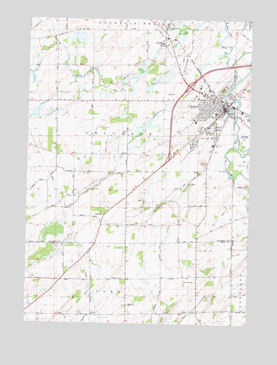
Columbus, WI USGS Topographic Map
Click on map above to begin viewing in our Map Viewer.

This topographic map contains these locations and features:
Feature Name Type Latitude Longitude GNIS ID View Map
City of ColumbusCivilN43.3354°W89.0300°1583005View Map
Clay Ridge School (historical)SchoolN43.2678°W89.1054°1563132View Map
ColumbusPopulated PlaceN43.3380°W89.0154°1563282View Map
Columbus Community HospitalHospitalN43.3228°W89.0353°2698460View Map
Columbus Community Hospital HeliportAirportN43.3228°W89.0343°1581925View Map
Columbus Elementary SchoolSchoolN43.3356°W89.0214°1842942View Map
Columbus Fire DepartmentBuildingN43.3376°W89.0160°2697827View Map
Columbus High SchoolSchoolN43.3271°W89.0204°1842943View Map
Columbus Middle SchoolSchoolN43.3367°W89.0193°1842944View Map
Columbus Mill PondReservoirN43.3372°W89.0105°2784766View Map
Columbus Police DepartmentBuildingN43.3375°W89.0152°2759697View Map
Columbus Wastewater Treatment PlantLocaleN43.3278°W89.0086°2723968View Map
Early Childhood Family Education Center SchoolSchoolN43.3369°W89.0191°2716716View Map
East York CemeteryCemeteryN43.2675°W89.0363°1564387View Map
Feelyater School (historical)SchoolN43.3192°W89.1082°1564898View Map
Firemans ParkParkN43.3297°W89.0221°1842957View Map
First Presbyterian ChurchChurchN43.3405°W89.0162°1842961View Map
Hillside CemeteryCemeteryN43.3472°W89.0148°1842978View Map
Mathaire FieldAirportN43.2575°W89.0670°1581037View Map
Mill PondReservoirN43.3378°W89.0107°1569492View Map
New Testament Baptist ChurchChurchN43.3436°W89.0173°1842991View Map
North Branch Crawfish RiverStreamN43.3708°W89.0409°1570369View Map
North York CemeteryCemeteryN43.2684°W89.0765°1570522View Map
Oak Lawn CemeteryCemeteryN43.2537°W89.0885°1842589View Map
Oak Lawn School (historical)SchoolN43.2539°W89.0879°1570666View Map
Olivet Congregational United Church of ChristChurchN43.3383°W89.0193°1842994View Map
Petersen Elementary SchoolSchoolN43.3565°W89.0501°1576896View Map
Robbins CreekStreamN43.3605°W89.0159°1572399View Map
Rotary ParkParkN43.3436°W89.0076°1850812View Map
Saint Jerome SchoolSchoolN43.3235°W89.0208°1843019View Map
Saint Jeromes Catholic ChurchChurchN43.3233°W89.0212°1843020View Map
Town of ColumbusCivilN43.3257°W89.0737°1583006View Map
Udeys WP73 DamDamN43.3367°W89.0101°1791884View Map
West Columbus School (historical)SchoolN43.3558°W89.1101°1576490View Map
Wisconsin AcademySchoolN43.3662°W89.0511°1576895View Map
Zion Evangelical Lutheran ChurchChurchN43.3405°W89.0157°1843059View Map
Zion Evangelical Lutheran SchoolSchoolN43.3340°W89.0317°2716816View Map
Zion Lutheran ChurchChurchN43.3342°W89.0318°1843061View Map

Note: Coordinates in the location and feature list above are referenced to NAD83 datum.


Copyright (C) 2008-2024 Ryan Niemi / Sunset Dynamics ... All Rights Reserved