TopoQuest Logo
Do you find TopoQuest useful?
Help keep TopoQuest running and adding new maps/features by donating!
Bitcoin:  19c7KJd3qBynnjoSw5npx9KScwjBe4ifkT
Litecoin:  LXs6TkuXGGXo1vDsWCkWVdjQX94eUKd6ui
Home View Maps Find Maps Find Places Resources & Links


Sunflower Mountain, Montana Topographic Map

USGS Map Title: Sunflower Mountain, MT
USGS Map MRC: 46113H6
DRG (GeoTIFF) Download: o46113h6.tif


Neighboring USGS Topographic Map Quads:


  Wapiti Lake, MT  
47113A7
 

  Gold Creek Peak, MT  
47113A6
 

  Belmont Point, MT  
47113A5
 

  Blue Point, MT  
46113H7
 

  Sunflower Mountain, MT  
46113H6
 

  Potomac, MT  
46113H5
 

  Bonner, MT  
46113G7
 

  Clinton, MT  
46113G6
 

  Mineral Ridge, MT  
46113G5


Map MRC Location:

N47°
W114°
N47°
W113°
H8 H7 H6 H5 H4 H3 H2 H1
G8 G7 G6 G5 G4 G3 G2 G1
F8 F7 F6 F5 F4 F3 F2 F1
E8 E7 E6 E5 E4 E3 E2 E1
D8 D7 D6 D5 D4 D3 D2 D1
C8 C7 C6 C5 C4 C3 C2 C1
B8 B7 B6 B5 B4 B3 B2 B1
A8 A7 A6 A5 A4 A3 A2 A1
N46°
W114°
N46°
W113°

Sunflower Mountain, MT USGS 1:24K Topographic Map Preview:
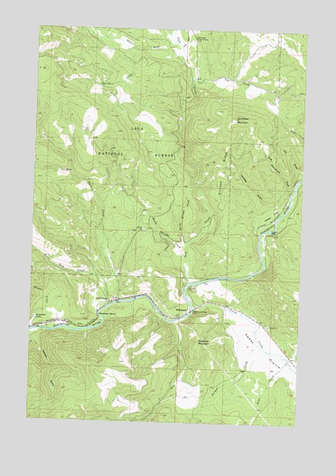
Sunflower Mountain, MT USGS Topographic Map
Click on map above to begin viewing in our Map Viewer.

This topographic map contains these locations and features:
Feature Name Type Latitude Longitude GNIS ID View Map
Bear CreekStreamN46.9069°W113.6845°779507View Map
Blackfoot Junction (historical)LocaleN46.9138°W113.7120°1781326View Map
Burnt Bridge CreekStreamN46.9283°W113.6790°780625View Map
Cow CreekStreamN46.9824°W113.6784°781777View Map
Daigles EddyBayN46.9363°W113.6404°782039View Map
Daigles Eddy Fishing Access SiteLocaleN46.9397°W113.6348°1744387View Map
Diamond MountainSummitN46.9008°W113.6726°782361View Map
Dog Monument DrawValleyN46.9488°W113.6318°782445View Map
Douglas (historical)LocaleN46.9097°W113.6537°1781296View Map
East Twin CreekStreamN46.9133°W113.7098°782960View Map
Elk DrawValleyN46.9541°W113.6279°783081View Map
Game CreekStreamN46.8960°W113.6326°783818View Map
Gold CreekStreamN46.9188°W113.6773°784046View Map
Gold Creek Guard StationLocaleN46.9966°W113.6784°784050View Map
Heyers GulchValleyN46.9024°W113.7476°784811View Map
Johnsrud ParkFlatN46.9177°W113.6781°785550View Map
Johnsrud Park Fishing Access SiteLocaleN46.9172°W113.6762°1744392View Map
Johnsrud Park Recreation SiteLocaleN46.9160°W113.6765°794363View Map
K Ross Toole Fishing Access SiteLocaleN46.9038°W113.7259°1744395View Map
Lepus DamDamN46.8983°W113.6276°798547View Map
LockwoodLocaleN46.9055°W113.7484°794366View Map
Lockwood LakeLakeN46.9074°W113.7484°786420View Map
McNamaraPopulated PlaceN46.9113°W113.6776°787113View Map
McNamara (historical)LocaleN46.9113°W113.6776°1781256View Map
McNamara BridgeBridgeN46.9108°W113.6756°787114View Map
McNamara School (historical)SchoolN46.9113°W113.6776°1781255View Map
Norman CreekStreamN46.9002°W113.6456°788056View Map
Red Rocks Fishing Access SiteLocaleN46.9141°W113.7015°1744393View Map
Sheep FlatsFlatN46.9416°W113.6395°790342View Map
Sheep Flats Fishing Access SiteLocaleN46.9477°W113.6290°1744385View Map
Spring CreekStreamN46.9938°W113.7043°791218View Map
Sunflower MountainSummitN46.9716°W113.6584°791693View Map
Twin Creek CampLocaleN46.9127°W113.7151°794362View Map
Twin CreeksPopulated PlaceN46.9127°W113.7140°792509View Map
Twin Creeks (historical)LocaleN46.9127°W113.7140°1781225View Map
Twin Creeks Post Office (historical)Post OfficeN46.9127°W113.7140°1781224View Map
Union CreekStreamN46.9116°W113.6754°792588View Map
Wagner CreekStreamN46.9077°W113.7484°792744View Map
Warm Springs CreekStreamN46.9277°W113.6795°792832View Map
West Fork Gold CreekStreamN46.9958°W113.6868°793027View Map
West Twin CreekStreamN46.9119°W113.7143°793135View Map
Whiskey GulchValleyN46.9433°W113.6387°793177View Map
Wild Horse CreekStreamN46.9941°W113.6840°793291View Map

Note: Coordinates in the location and feature list above are referenced to NAD83 datum.


Copyright (C) 2008-2025 Ryan Niemi / Sunset Dynamics ... All Rights Reserved