TopoQuest Logo
Do you find TopoQuest useful?
Help keep TopoQuest running and adding new maps/features by donating!
Bitcoin:  19c7KJd3qBynnjoSw5npx9KScwjBe4ifkT
Litecoin:  LXs6TkuXGGXo1vDsWCkWVdjQX94eUKd6ui
Home View Maps Find Maps Find Places Resources & Links


Clinton, Montana Topographic Map

USGS Map Title: Clinton, MT
USGS Map MRC: 46113G6
DRG (GeoTIFF) Download: o46113g6.tif


Neighboring USGS Topographic Map Quads:


  Blue Point, MT  
46113H7
 

  Sunflower Mountain, MT  
46113H6
 

  Potomac, MT  
46113H5
 

  Bonner, MT  
46113G7
 

  Clinton, MT  
46113G6
 

  Mineral Ridge, MT  
46113G5
 

  Elk Mountain, MT  
46113F7
 

  Iris Point, MT  
46113F6
 

  Ravenna, MT  
46113F5


Map MRC Location:

N47°
W114°
N47°
W113°
H8 H7 H6 H5 H4 H3 H2 H1
G8 G7 G6 G5 G4 G3 G2 G1
F8 F7 F6 F5 F4 F3 F2 F1
E8 E7 E6 E5 E4 E3 E2 E1
D8 D7 D6 D5 D4 D3 D2 D1
C8 C7 C6 C5 C4 C3 C2 C1
B8 B7 B6 B5 B4 B3 B2 B1
A8 A7 A6 A5 A4 A3 A2 A1
N46°
W114°
N46°
W113°

Clinton, MT USGS 1:24K Topographic Map Preview:
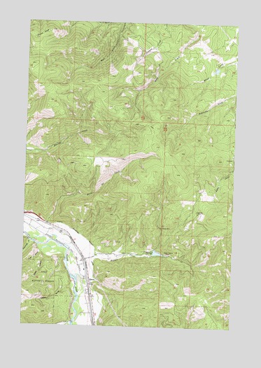
Clinton, MT USGS Topographic Map
Click on map above to begin viewing in our Map Viewer.

This topographic map contains these locations and features:
Feature Name Type Latitude Longitude GNIS ID View Map
12N17W16CDDD01 WellWellN46.7927°W113.7448°818354View Map
12N17W21AACB01 WellWellN46.7902°W113.7384°818342View Map
12N17W21ABBB01 WellWellN46.7924°W113.7440°818351View Map
12N17W22ACDB01 WellWellN46.7858°W113.7184°818300View Map
12N17W22ADDC01 WellWellN46.7849°W113.7129°818293View Map
12N17W22BBCC01 WellWellN46.7888°W113.7320°818336View Map
12N17W22BBDA01 WellWellN46.7902°W113.7284°818341View Map
12N17W22BCAD01 WellWellN46.7871°W113.7279°818307View Map
12N17W22BDCA01 WellWellN46.7866°W113.7259°818304View Map
12N17W22CADD01 WellWellN46.7824°W113.7229°818275View Map
12N17W22DAAB01 WellWellN46.7846°W113.7126°818289View Map
12N17W22DAAD01 WellWellN46.7841°W113.7115°818284View Map
12N17W22DACA01 WellWellN46.7827°W113.7151°818277View Map
12N17W22DBCB01 WellWellN46.7833°W113.7218°818280View Map
12N17W22DBCC01 WellWellN46.7827°W113.7212°818278View Map
12N17W23CCDB01 WellWellN46.7791°W113.7087°818255View Map
12N17W27AABB01 WellWellN46.7763°W113.7159°818235View Map
12N17W27AABC01 WellWellN46.7758°W113.7145°818232View Map
12N17W27AABC02 WellWellN46.7760°W113.7148°818234View Map
12N17W27AABD01 WellWellN46.7752°W113.7145°818228View Map
12N17W27AACA01 WellWellN46.7744°W113.7143°818221View Map
12N17W27AACA02 WellWellN46.7749°W113.7145°818226View Map
12N17W27AACB01 WellWellN46.7749°W113.7154°818227View Map
12N17W27AACD01 WellWellN46.7738°W113.7143°818213View Map
12N17W27ABAC01 WellWellN46.7758°W113.7184°818233View Map
12N17W27ADBA01 WellWellN46.7727°W113.7140°818204View Map
12N17W27ADCA01 WellWellN46.7702°W113.7143°818193View Map
12N17W27ADCD01 WellWellN46.7699°W113.7148°818191View Map
12N17W27ADDC01 WellWellN46.7699°W113.7132°818190View Map
12N17W27DAAB01 WellWellN46.7688°W113.7129°818178View Map
12N17W27DABA01 WellWellN46.7688°W113.7137°818179View Map
12N17W27DABA02 WellWellN46.7691°W113.7137°818180View Map
12N17W27DACA01 WellWellN46.7677°W113.7137°818176View Map
12N17W27DACA02 WellWellN46.7674°W113.7137°818174View Map
12N17W27DACD01 WellWellN46.7669°W113.7140°818171View Map
12N17W27DADB01 WellWellN46.7677°W113.7129°818175View Map
12N17W27DADC01 WellWellN46.7666°W113.7123°818168View Map
12N17W27DADD01 WellWellN46.7660°W113.7120°818161View Map
12N17W27DDAB01 WellWellN46.7658°W113.7123°818160View Map
12N17W27DDAB02 WellWellN46.7649°W113.7126°818157View Map
12N17W27DDAC01 WellWellN46.7646°W113.7132°818156View Map
12N17W27DDAC02 WellWellN46.7641°W113.7126°818153View Map
12N17W27DDAD01 WellWellN46.7644°W113.7118°818155View Map
12N17W27DDDA01 WellWellN46.7635°W113.7115°818152View Map
12N17W27DDDA02 WellWellN46.7630°W113.7112°818144View Map
12N17W27DDDA03 WellWellN46.7630°W113.7118°818145View Map
12N17W27DDDD01 WellWellN46.7624°W113.7115°818139View Map
12N17W34AAAD01 WellWellN46.7602°W113.7107°818137View Map
12N17W34AADC01 WellWellN46.7585°W113.7129°818123View Map
12N17W34CACD01 WellWellN46.7510°W113.7251°818085View Map
12N17W34DBCD01 WellWellN46.7508°W113.7195°818082View Map
12N17W34DBDD01 WellWellN46.7510°W113.7170°818084View Map
12N17W34DCAA01 WellWellN46.7508°W113.7170°818081View Map
12N17W34DDBA01 WellWellN46.7502°W113.7140°818079View Map
12N17W35BCCC01 WellWellN46.7563°W113.7098°818116View Map
12N17W35CBBB01 WellWellN46.7555°W113.7098°818113View Map
12N17W35CBBB02 WellWellN46.7566°W113.7104°818119View Map
12N17W35CBBC01 WellWellN46.7544°W113.7104°818110View Map
12N17W35CBCB01 WellWellN46.7535°W113.7104°818105View Map
12N17W35CBCC01 WellWellN46.7524°W113.7101°818097View Map
Bellview MineMineN46.7980°W113.6473°779672View Map
Bellview/Silver Bell MineMineN46.7963°W113.6473°804813View Map
Betters Station (historical)LocaleN46.7666°W113.7093°1781327View Map
Blixit Creek DamDamN46.8533°W113.6393°796276View Map
Cape Nome MineMineN46.7888°W113.6554°804812View Map
Cascade MineMineN46.7838°W113.6606°804814View Map
ClintonLocaleN46.7691°W113.7126°1781304View Map
ClintonPopulated PlaceN46.7691°W113.7126°781403View Map
Clinton Census Designated PlaceCensusN46.7718°W113.7169°2407636View Map
Clinton Elementary SchoolSchoolN46.7727°W113.7143°1781398View Map
Clinton Irrigation District CanalCanalN46.7808°W113.7090°781405View Map
Clinton Post OfficePost OfficeN46.7695°W113.7127°1781305View Map
Clinton Rural Fire DistrictBuildingN46.7845°W113.7154°1781339View Map
Dirty Ike CreekStreamN46.7916°W113.7376°782393View Map
Greenough CreekStreamN46.7852°W113.7482°784308View Map
Hidden Treasure MineMineN46.7799°W113.6656°784850View Map
Hidden Treasure MineMineN46.7796°W113.6659°804811View Map
Interchange 121CrossingN46.7766°W113.7137°1781557View Map
Jackpot MineMineN46.7874°W113.6676°804822View Map
Leeper GulchValleyN46.7660°W113.7218°786024View Map
Martha MineMineN46.7908°W113.6690°804823View Map
McDonald/Sutherland MineMineN46.8202°W113.6273°804819View Map
North Point MineMineN46.7852°W113.6695°804825View Map
Olson PeakSummitN46.8683°W113.7470°788457View Map
Queen Mary MineMineN46.7910°W113.6515°804815View Map
Schwartz Creek Fishing Access SiteLocaleN46.7519°W113.7240°1744408View Map
Swartz CreekStreamN46.7510°W113.7215°790144View Map
The Church of Jesus Christ of Latter Day SaintsChurchN46.7691°W113.7126°1781116View Map
Triangle MineMineN46.7908°W113.6690°792371View Map
Triangle MineMineN46.7910°W113.6690°804824View Map
Tule GulchValleyN46.7802°W113.7404°792442View Map
Verdy GulchValleyN46.7783°W113.7376°792691View Map
Wallace - Clinton School (historical)SchoolN46.7727°W113.7140°1781306View Map
Wallace CreekStreamN46.7774°W113.7132°792777View Map
Wallace Creek DamDamN46.7799°W113.6709°796273View Map
Wallace Creek Mill MineMineN46.7955°W113.6751°804818View Map

Note: Coordinates in the location and feature list above are referenced to NAD83 datum.


Copyright (C) 2008-2025 Ryan Niemi / Sunset Dynamics ... All Rights Reserved