TopoQuest Logo
Do you find TopoQuest useful?
Help keep TopoQuest running and adding new maps/features by donating!
Bitcoin:  19c7KJd3qBynnjoSw5npx9KScwjBe4ifkT
Litecoin:  LXs6TkuXGGXo1vDsWCkWVdjQX94eUKd6ui
Home View Maps Find Maps Find Places Resources & Links


Block, Tennessee Topographic Map

USGS Map Title: Block, TN
USGS Map MRC: 36084C3
DRG (GeoTIFF) Download: o36084c3.tif


Neighboring USGS Topographic Map Quads:


  Huntsville, TN  
36084D4
 

  Pioneer, TN  
36084D3
 

  Ivydell, TN  
36084D2
 

  Norma, TN  
36084C4
 

  Block, TN  
36084C3
 

  Jacksboro, TN  
36084C2
 

  Fork Mountain, TN  
36084B4
 

  Duncan Flats, TN  
36084B3
 

  Lake City, TN  
36084B2


Map MRC Location:

N37°
W85°
N37°
W84°
H8 H7 H6 H5 H4 H3 H2 H1
G8 G7 G6 G5 G4 G3 G2 G1
F8 F7 F6 F5 F4 F3 F2 F1
E8 E7 E6 E5 E4 E3 E2 E1
D8 D7 D6 D5 D4 D3 D2 D1
C8 C7 C6 C5 C4 C3 C2 C1
B8 B7 B6 B5 B4 B3 B2 B1
A8 A7 A6 A5 A4 A3 A2 A1
N36°
W85°
N36°
W84°

Block, TN USGS 1:24K Topographic Map Preview:
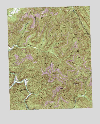
Block, TN USGS Topographic Map
Click on map above to begin viewing in our Map Viewer.

This topographic map contains these locations and features:
Feature Name Type Latitude Longitude GNIS ID View Map
Adkins MountainSummitN36.3540°W84.2991°1275487View Map
Anderson MountainSummitN36.3098°W84.3569°1275725View Map
Antioch Baptist ChurchChurchN36.3273°W84.3685°1304857View Map
Ash Log GapGapN36.2745°W84.2935°1275932View Map
Ash Log MountainSummitN36.2695°W84.3013°1275933View Map
Back SpurRidgeN36.3251°W84.2591°1276052View Map
Big Bruce RidgeRidgeN36.3042°W84.2769°1277265View Map
BlockPopulated PlaceN36.3420°W84.2547°1277696View Map
Block School (historical)SchoolN36.3442°W84.2552°1318824View Map
BrooksidePopulated PlaceN36.2529°W84.3483°1314741View Map
Brushy MountainSummitN36.3306°W84.2802°1278711View Map
Clinchmore Division (historical)CensusN36.2748°W84.2952°1648619View Map
Commissioner District 4CivilN36.2914°W84.2579°2464015View Map
Cross CreekStreamN36.2848°W84.3516°1281696View Map
Cross HollowValleyN36.3551°W84.2638°1281700View Map
Davids CreekStreamN36.2642°W84.2622°1306272View Map
DeanPopulated PlaceN36.3448°W84.3538°1282262View Map
Dean MineMineN36.3659°W84.3305°1318764View Map
Dean MineMineN36.3598°W84.3522°1318765View Map
Dean School (historical)SchoolN36.3517°W84.3491°1318766View Map
Delmont MineMineN36.3273°W84.2749°1318838View Map
Diamond Number Seven MineMineN36.3517°W84.2777°1318841View Map
Diamond Number Three MineMineN36.3492°W84.2735°1318840View Map
East Prong Nicks CreekStreamN36.2751°W84.3238°1283397View Map
Flint GapGapN36.3490°W84.2791°1284485View Map
Goldenwing MountainSummitN36.2901°W84.2589°2770994View Map
Grave BranchStreamN36.2626°W84.2747°1285922View Map
Grave GapGapN36.2845°W84.2852°1285923View Map
Gray MountainSummitN36.3451°W84.3699°1286009View Map
Greens BranchStreamN36.3204°W84.3155°1286179View Map
Grissel BranchStreamN36.2848°W84.2652°1286321View Map
Grissel KnobSummitN36.2926°W84.2716°1286322View Map
Hatmaker KnobSummitN36.2862°W84.2805°1287147View Map
HickeyPopulated PlaceN36.3545°W84.2644°1315226View Map
Hicks BranchStreamN36.2592°W84.3527°1287645View Map
High Point Number One MineMineN36.2956°W84.2505°1318860View Map
High Point Number Two MineMineN36.2959°W84.2691°1651099View Map
Horse GapGapN36.3448°W84.3263°1288402View Map
Horse Gap RidgeRidgeN36.3481°W84.3247°1288403View Map
Horsebone RidgeRidgeN36.3037°W84.3102°1288416View Map
Huckaby KnobSummitN36.3395°W84.2724°1288584View Map
Hurricane BranchStreamN36.2642°W84.2694°1288784View Map
Hurricane MountainSummitN36.2795°W84.2738°1288835View Map
Hurricane Mountain MinesMineN36.2842°W84.2708°1318861View Map
Jenney CreekStreamN36.3292°W84.3449°1289370View Map
Jenney GapGapN36.3620°W84.3258°1289371View Map
Jerry CreekStreamN36.3331°W84.2952°1289405View Map
Jerry FieldsFlatN36.3523°W84.2891°1289406View Map
Jordan Number Four MineMineN36.3398°W84.2624°1318870View Map
Jordan RidgeRidgeN36.2870°W84.3269°1289844View Map
Little Bruce RidgeRidgeN36.2956°W84.2855°1291401View Map
Lowe BranchStreamN36.3684°W84.2783°1292196View Map
Martin MineMineN36.3734°W84.3230°1318881View Map
Massengale MountainSummitN36.2917°W84.3072°1292895View Map
McCoy BranchStreamN36.3226°W84.3285°1293202View Map
McCoy RidgeRidgeN36.3120°W84.3244°1293208View Map
McKinney ForkStreamN36.3206°W84.3119°1293379View Map
Miller MountainSummitN36.2631°W84.2908°1293958View Map
Monarch MineMineN36.3362°W84.2697°1318884View Map
MontgomeryPopulated PlaceN36.3259°W84.3708°1294190View Map
Montgomery ForkStreamN36.3240°W84.3741°1294202View Map
Muse GapGapN36.3704°W84.2877°1295165View Map
New Laxton MineMineN36.3740°W84.3258°1318890View Map
Nicks CreekLocaleN36.2709°W84.3438°1295749View Map
Nicks CreekStreamN36.2704°W84.3449°1295750View Map
Nicks Creek Baptist ChurchChurchN36.2715°W84.3441°1318893View Map
Nicks Creek CemeteryCemeteryN36.2717°W84.3441°1318894View Map
Nig FieldFlatN36.2837°W84.2880°1295753View Map
North Fork Montgomery ForkStreamN36.3017°W84.2938°1295903View Map
Oldhouse BranchStreamN36.2779°W84.3488°1296402View Map
PeeweePopulated PlaceN36.2615°W84.2760°1315692View Map
Pewee MinesMineN36.2726°W84.2916°1318901View Map
Pine BaldSummitN36.3115°W84.2691°1297503View Map
Pleasant Garden RidgeRidgeN36.2870°W84.3110°1297792View Map
Pond RidgeRidgeN36.2670°W84.3188°1298114View Map
Poor MountainSummitN36.2967°W84.3424°1298141View Map
Puncheon Camp CreekStreamN36.3231°W84.3288°1298692View Map
Red Ash MinesMineN36.2842°W84.2519°1318910View Map
Roach CreekStreamN36.3276°W84.3605°1299545View Map
Roach Creek MountainSummitN36.3679°W84.3410°1299547View Map
Roach RidgeRidgeN36.3442°W84.3402°1299550View Map
Roasting Ear SpringSpringN36.2929°W84.3022°1299582View Map
Rock Spring GapGapN36.3604°W84.3038°1299791View Map
Round RockPopulated PlaceN36.2651°W84.2635°1647490View Map
Round Rock Baptist ChurchChurchN36.2656°W84.2683°1318914View Map
Round Rock CemeteryCemeteryN36.2665°W84.2641°1300179View Map
Round Rock SchoolSchoolN36.2515°W84.2766°1300181View Map
Shoal CreekStreamN36.2923°W84.3655°1303595View Map
Smoky CreekStreamN36.2840°W84.3652°1270722View Map
Smoky JunctionPopulated PlaceN36.2873°W84.3630°1303697View Map
South Fork Montgomery ForkStreamN36.3017°W84.2938°1270876View Map
Spring BranchStreamN36.3067°W84.2974°1271052View Map
Stillhouse HollowValleyN36.2689°W84.3332°1271422View Map
Stoney Fork Volunteer Fire DepartmentBuildingN36.2650°W84.2684°2654805View Map
Straight Fork MineMineN36.3640°W84.3458°1651068View Map
Sugarcamp BranchStreamN36.3290°W84.3041°1271708View Map
Turkeypen RidgeRidgeN36.3006°W84.2994°1273045View Map
TurleyPopulated PlaceN36.3695°W84.2735°1311317View Map
Turley BranchStreamN36.3673°W84.2716°1273050View Map
Turley MineMineN36.3495°W84.2794°1318927View Map
Turley Petree MineMineN36.3434°W84.2841°1651119View Map
Turley School (historical)SchoolN36.3692°W84.2752°1318928View Map
Upper Round Rock SchoolSchoolN36.2651°W84.2716°1273306View Map
West Prong Davids CreekStreamN36.2848°W84.2652°1274218View Map
West Prong Nicks CreekStreamN36.2754°W84.3238°1274223View Map
Wheeler CreekStreamN36.3104°W84.2969°1304510View Map
Wheeler GapGapN36.3201°W84.2710°1304511View Map
Whetstone BranchStreamN36.3506°W84.2602°1274300View Map
Wild Sow BranchStreamN36.3148°W84.3019°1274528View Map
Willow Springs GapGapN36.2795°W84.2885°1274772View Map
Wolf GapGapN36.3476°W84.3024°1274960View Map
Wolf RidgeRidgeN36.3376°W84.3094°1274976View Map

Note: Coordinates in the location and feature list above are referenced to NAD83 datum.


Copyright (C) 2008-2024 Ryan Niemi / Sunset Dynamics ... All Rights Reserved