TopoQuest Logo
Do you find TopoQuest useful?
Help keep TopoQuest running and adding new maps/features by donating!
Bitcoin:  19c7KJd3qBynnjoSw5npx9KScwjBe4ifkT
Litecoin:  LXs6TkuXGGXo1vDsWCkWVdjQX94eUKd6ui
Home View Maps Find Maps Find Places Resources & Links


Huntsville, Tennessee Topographic Map

USGS Map Title: Huntsville, TN
USGS Map MRC: 36084D4
DRG (GeoTIFF) Download: o36084d4.tif


Neighboring USGS Topographic Map Quads:


  Oneida North, TN  
36084E5
 

  Winfield, TN  
36084E4
 

  Ketchen, TN  
36084E3
 

  Oneida South, TN  
36084D5
 

  Huntsville, TN  
36084D4
 

  Pioneer, TN  
36084D3
 

  Robbins, TN  
36084C5
 

  Norma, TN  
36084C4
 

  Block, TN  
36084C3


Map MRC Location:

N37°
W85°
N37°
W84°
H8 H7 H6 H5 H4 H3 H2 H1
G8 G7 G6 G5 G4 G3 G2 G1
F8 F7 F6 F5 F4 F3 F2 F1
E8 E7 E6 E5 E4 E3 E2 E1
D8 D7 D6 D5 D4 D3 D2 D1
C8 C7 C6 C5 C4 C3 C2 C1
B8 B7 B6 B5 B4 B3 B2 B1
A8 A7 A6 A5 A4 A3 A2 A1
N36°
W85°
N36°
W84°

Huntsville, TN USGS 1:24K Topographic Map Preview:
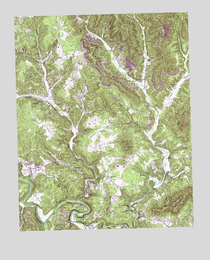
Huntsville, TN USGS Topographic Map
Click on map above to begin viewing in our Map Viewer.

This topographic map contains these locations and features:
Feature Name Type Latitude Longitude GNIS ID View Map
Acres SchoolSchoolN36.4787°W84.4302°1304762View Map
Allen CreekStreamN36.4567°W84.4755°1275596View Map
Almy SchoolSchoolN36.4526°W84.4752°1275630View Map
Anadell ChurchChurchN36.4323°W84.4397°1304825View Map
Bowl (historical)Populated PlaceN36.4609°W84.3819°1311271View Map
Brooks GapGapN36.4195°W84.4677°1278483View Map
Browns BranchStreamN36.4845°W84.4369°1327723View Map
Brushy BranchStreamN36.4276°W84.4052°1278696View Map
Buffalo Bridge ChurchChurchN36.3884°W84.4205°1305503View Map
Buffalo Bridge SchoolSchoolN36.3856°W84.4180°1305504View Map
Buffalo SchoolSchoolN36.4454°W84.4019°1278917View Map
Buttram CemeteryCemeteryN36.4128°W84.4958°1279206View Map
Byrd CemeteryCemeteryN36.4181°W84.4988°1279250View Map
Capitol Hill SchoolSchoolN36.4054°W84.4341°1305678View Map
Cave BranchStreamN36.3798°W84.4805°1279920View Map
Chambers CemeteryCemeteryN36.4131°W84.4697°1280214View Map
Commissioner District 3CivilN36.4122°W84.4865°2464193View Map
Cordell CreekStreamN36.4726°W84.4797°1327972View Map
Cross CemeteryCemeteryN36.4567°W84.3863°1281693View Map
Ditney MountainSummitN36.4223°W84.4216°1282502View Map
Doctors (historical)Populated PlaceN36.4856°W84.4374°1311274View Map
East 63 Volunteer Fire DepartmentBuildingN36.3794°W84.3865°2654871View Map
Fairview ChurchChurchN36.3795°W84.3999°1284029View Map
Fairview Elementary SchoolSchoolN36.3784°W84.4035°1318767View Map
Five Black Gum ChurchChurchN36.4204°W84.3777°1284342View Map
Flat CreekStreamN36.4054°W84.4983°1284384View Map
Griffin CemeteryCemeteryN36.4576°W84.4722°1286266View Map
HuntsvillePopulated PlaceN36.4098°W84.4905°1288766View Map
Huntsville Elementary SchoolSchoolN36.4123°W84.4862°1318777View Map
Huntsville Fire DepartmentBuildingN36.4112°W84.4886°2654314View Map
Huntsville First Baptist ChurchChurchN36.4112°W84.4874°1318778View Map
Huntsville High SchoolSchoolN36.4126°W84.4874°1288768View Map
Huntsville Middle SchoolSchoolN36.4122°W84.4870°1318779View Map
Huntsville Post OfficePost OfficeN36.4100°W84.4912°1651052View Map
John Hall FlatsFlatN36.4345°W84.4788°1289482View Map
Laurel BranchStreamN36.4115°W84.4472°1290704View Map
Little CreekStreamN36.4040°W84.4505°1291452View Map
Litton HillSummitN36.4015°W84.4716°1291725View Map
Louis Jeffers HollowValleyN36.4048°W84.4053°1292107View Map
Marcum CreekStreamN36.4615°W84.3797°1292676View Map
Mount Zion Baptist ChurchChurchN36.4609°W84.4122°1294919View Map
New Salem ChurchChurchN36.4570°W84.3855°1295643View Map
NewtownPopulated PlaceN36.4037°W84.4497°1315604View Map
Newtown ChurchChurchN36.4112°W84.4594°1295712View Map
Owens CemeteryCemeteryN36.4720°W84.4044°1296575View Map
Paint Rock ChurchChurchN36.4476°W84.4705°1296666View Map
Paint Rock CreekStreamN36.3923°W84.4572°1296668View Map
Paint Rock Volunteer Fire DepartmentBuildingN36.4524°W84.4754°2654630View Map
Phillips BranchStreamN36.4304°W84.4583°1297333View Map
Phillips BranchStreamN36.3901°W84.4955°1297335View Map
Phillips CemeteryCemeteryN36.4670°W84.4199°1297354View Map
Phillips CreekStreamN36.4737°W84.4797°1297357View Map
Posey SchoolSchoolN36.4831°W84.4049°1298289View Map
Privet MountainSummitN36.4890°W84.4202°1641732View Map
Punkin Hollow CemeteryCemeteryN36.4498°W84.4799°1298702View Map
Reed HollowValleyN36.4965°W84.4479°1641731View Map
Rockhouse ForkStreamN36.4076°W84.3944°1299823View Map
Scott County Home (historical)BuildingN36.3940°W84.4310°1318804View Map
Sexton CemeteryCemeteryN36.4445°W84.4630°1301131View Map
Shug MountainSummitN36.4737°W84.4419°1270236View Map
Silcox MountainSummitN36.3884°W84.3885°1270264View Map
Slick Rock BranchStreamN36.3920°W84.4655°1270510View Map
Smith CreekStreamN36.4406°W84.3983°1303678View Map
Stanley CreekStreamN36.4581°W84.4091°1327096View Map
Stanley CreekStreamN36.4515°W84.4772°1271243View Map
Stanley JunctionPopulated PlaceN36.4540°W84.4944°1314333View Map
Strunk CemeteryCemeteryN36.4137°W84.4610°1271613View Map
Sugar Grove ChurchChurchN36.4151°W84.3919°1271680View Map
Terry HollowValleyN36.4633°W84.4800°1272342View Map
Trammel BranchStreamN36.4729°W84.3766°1304151View Map
West CemeteryCemeteryN36.4503°W84.4499°1274142View Map
West CreekStreamN36.4326°W84.4585°1304461View Map
White Pine PointSummitN36.3906°W84.4355°1274397View Map
White Rock ChurchChurchN36.4131°W84.4938°1304533View Map
WinonaPopulated PlaceN36.3767°W84.4502°1274885View Map
Winona Post OfficePost OfficeN36.3762°W84.4483°1651071View Map
Winona School (historical)SchoolN36.3754°W84.4477°1318815View Map

Note: Coordinates in the location and feature list above are referenced to NAD83 datum.


Copyright (C) 2008-2025 Ryan Niemi / Sunset Dynamics ... All Rights Reserved