TopoQuest Logo
Do you find TopoQuest useful?
Help keep TopoQuest running and adding new maps/features by donating!
Bitcoin:  19c7KJd3qBynnjoSw5npx9KScwjBe4ifkT
Litecoin:  LXs6TkuXGGXo1vDsWCkWVdjQX94eUKd6ui
Home View Maps Find Maps Find Places Resources & Links


Fork Mountain, Tennessee Topographic Map

USGS Map Title: Fork Mountain, TN
USGS Map MRC: 36084B4
DRG (GeoTIFF) Download: o36084b4.tif


Neighboring USGS Topographic Map Quads:


  Robbins, TN  
36084C5
 

  Norma, TN  
36084C4
 

  Block, TN  
36084C3
 

  Gobey, TN  
36084B5
 

  Fork Mountain, TN  
36084B4
 

  Duncan Flats, TN  
36084B3
 

  Camp Austin, TN  
36084A5
 

  Petros, TN  
36084A4
 

  Windrock, TN  
36084A3


Map MRC Location:

N37°
W85°
N37°
W84°
H8 H7 H6 H5 H4 H3 H2 H1
G8 G7 G6 G5 G4 G3 G2 G1
F8 F7 F6 F5 F4 F3 F2 F1
E8 E7 E6 E5 E4 E3 E2 E1
D8 D7 D6 D5 D4 D3 D2 D1
C8 C7 C6 C5 C4 C3 C2 C1
B8 B7 B6 B5 B4 B3 B2 B1
A8 A7 A6 A5 A4 A3 A2 A1
N36°
W85°
N36°
W84°

Fork Mountain, TN USGS 1:24K Topographic Map Preview:
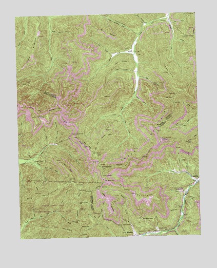
Fork Mountain, TN USGS Topographic Map
Click on map above to begin viewing in our Map Viewer.

This topographic map contains these locations and features:
Feature Name Type Latitude Longitude GNIS ID View Map
Alex BranchStreamN36.1776°W84.4785°1275542View Map
Arch MountainSummitN36.2165°W84.3955°1275840View Map
Asher ForkStreamN36.1931°W84.4280°1275942View Map
Bald KnobSummitN36.1570°W84.4630°1276211View Map
Bald Knob HollowValleyN36.1641°W84.4839°1276215View Map
Barley Mouth BranchStreamN36.1351°W84.4458°1276323View Map
Bear KnobSummitN36.2017°W84.3924°1276624View Map
Beech Grove CemeteryCemeteryN36.1281°W84.4030°1276822View Map
Beech Grove ChurchChurchN36.1273°W84.4127°1276836View Map
Big Cove BranchStreamN36.1337°W84.4955°1277274View Map
Big MountainSummitN36.2390°W84.4341°1277344View Map
Bills BranchStreamN36.2142°W84.4149°1305247View Map
Bird MountainSummitN36.1495°W84.4816°1277511View Map
Braytown CemeteryCemeteryN36.1584°W84.3755°1326283View Map
Brushy Mountain Number 4 MineMineN36.1267°W84.4455°1309633View Map
Brushy Mountain Number 5 MineMineN36.1265°W84.4430°1309634View Map
Brushy Mountain Number 6 MineMineN36.1267°W84.4460°1309635View Map
BuffaloPopulated PlaceN36.1370°W84.3874°1278899View Map
Buffalo School (historical)SchoolN36.1370°W84.3874°1642295View Map
Bunch GapGapN36.1651°W84.4324°1278991View Map
Burge MountainSummitN36.1792°W84.4005°1279034View Map
Cave BranchStreamN36.2445°W84.4097°1305736View Map
Chambers MineMineN36.2270°W84.4149°1318760View Map
Cherry Log GapGapN36.1348°W84.4588°1280353View Map
Coffin SpringSpringN36.1512°W84.4503°1280869View Map
Cold GapGapN36.1534°W84.4430°1280887View Map
Coon Pool BranchStreamN36.1265°W84.4044°1306092View Map
Darty MineMineN36.1279°W84.4127°1307629View Map
Devonia Post OfficePost OfficeN36.1562°W84.3769°1649335View Map
Dry CreekStreamN36.2273°W84.4302°1282921View Map
Emory GapGapN36.1542°W84.4599°1283764View Map
Emory Gap BranchStreamN36.1404°W84.4752°1283766View Map
Flower MountainSummitN36.2251°W84.4883°1284508View Map
Fork MountainPopulated PlaceN36.1267°W84.4199°1284621View Map
Fork MountainSummitN36.1490°W84.4197°1284622View Map
Fork Mountain School (historical)SchoolN36.1279°W84.4194°1317625View Map
Fork Mountain-Peewee Mountain MineMineN36.1442°W84.4222°1307647View Map
Fork RidgeRidgeN36.2117°W84.4938°1284628View Map
Frozen Head State Environmental Education AreaParkN36.1265°W84.4666°1309662View Map
Grassy GapGapN36.2045°W84.3894°1285895View Map
Green BranchStreamN36.2034°W84.4183°1286067View Map
Guinea GapGapN36.1673°W84.4435°1286378View Map
Guinea Hill KnobSummitN36.1634°W84.4405°1286379View Map
Gum BranchStreamN36.1495°W84.3830°1286399View Map
Hawk GapGapN36.1995°W84.3910°1287168View Map
HembreePopulated PlaceN36.2295°W84.4205°1315217View Map
Hembree School (historical)SchoolN36.2290°W84.4166°1318773View Map
High PointSummitN36.2042°W84.4402°1287709View Map
High Point MountainSummitN36.1826°W84.4369°1287715View Map
Indian ForkStreamN36.1548°W84.3766°1288982View Map
Indian Fork GapGapN36.1592°W84.4422°1288984View Map
Joe BranchStreamN36.1604°W84.3874°1289457View Map
Jury RidgeRidgeN36.1548°W84.4883°1289892View Map
Laurel ForkStreamN36.1287°W84.3927°1290745View Map
Leonard MineMineN36.2284°W84.4355°1318782View Map
Lick BranchStreamN36.1592°W84.4099°1291181View Map
Ligias RidgeRidgeN36.1765°W84.4519°1291273View Map
Lindsay MineMineN36.2290°W84.4155°1318783View Map
Linlog BranchStreamN36.1367°W84.4902°1291348View Map
Little Brimstone CreekStreamN36.2381°W84.4141°1291400View Map
Little Fork MountainSummitN36.1412°W84.4588°1291506View Map
Little MountainSummitN36.2231°W84.4249°1291582View Map
Loudon CreekStreamN36.1776°W84.4749°1292105View Map
Low CemeteryCemeteryN36.2456°W84.3944°1292163View Map
Lowe BranchStreamN36.2176°W84.4152°1292193View Map
Lowe CemeteryCemeteryN36.1273°W84.3838°1292200View Map
Mahan VillagePopulated PlaceN36.1681°W84.4891°1292508View Map
Mahan-Ellison MineMineN36.1745°W84.4424°1318784View Map
Moore MineMineN36.1426°W84.3755°1649351View Map
Moores CampPopulated PlaceN36.1495°W84.3858°1294311View Map
Mooretown School (historical)SchoolN36.1523°W84.3813°1642325View Map
Morgan State ForestForestN36.1270°W84.4835°1294382View Map
Newland (historical)Populated PlaceN36.2490°W84.3930°1311281View Map
Norman Pond KnobSummitN36.1820°W84.4585°1295827View Map
Old Mac MountainSummitN36.1290°W84.4599°1269840View Map
Ova BranchStreamN36.2451°W84.3922°1296534View Map
Panther BranchStreamN36.1404°W84.4749°1296722View Map
Panther GapGapN36.1312°W84.4569°1296748View Map
Patterson CemeteryCemeteryN36.1315°W84.4285°1296945View Map
Peach Orchard GapGapN36.1445°W84.4588°1297048View Map
Pemberton and Hibble Number One MineMineN36.2390°W84.3924°1318795View Map
Rayder CreekStreamN36.1704°W84.4899°1299006View Map
Reeves-Daugherty CemeteryCemeteryN36.1351°W84.4155°1299192View Map
Sagamine MineMineN36.1401°W84.3977°1307743View Map
Sandy Gap MountanSummitN36.1981°W84.4719°1300759View Map
Second Laurel BranchStreamN36.2406°W84.4752°1301024View Map
Shack CreekStreamN36.2270°W84.4177°1301139View Map
Smoky MountainSummitN36.1837°W84.4027°1270725View Map
Snake Den BranchStreamN36.1779°W84.4749°1270750View Map
Squire KnobSummitN36.1504°W84.4566°1271179View Map
Stallion BranchStreamN36.1254°W84.4194°1271204View Map
Stallion MountainSummitN36.1484°W84.4427°1271205View Map
Straight ForkStreamN36.2479°W84.3933°1271571View Map
Sugarcamp BranchStreamN36.1334°W84.4447°1271707View Map
Sugarcamp BranchStreamN36.1262°W84.4035°1271709View Map
The Garden SpotSummitN36.1559°W84.4405°1272392View Map
Thompson Number 1 MineMineN36.1256°W84.4052°1307756View Map
Thompson Number 2 MineMineN36.1256°W84.4091°1307757View Map
TiogaPopulated PlaceN36.1279°W84.4049°1314407View Map
Trimore MineMineN36.1715°W84.3860°1307758View Map
Tub SpringSpringN36.1263°W84.4574°1272927View Map
Walnut KnobSummitN36.1717°W84.4455°1273741View Map
Y HollowValleyN36.2353°W84.3902°1275221View Map
Zeek RidgeRidgeN36.1640°W84.4666°1275353View Map

Note: Coordinates in the location and feature list above are referenced to NAD83 datum.


Copyright (C) 2008-2024 Ryan Niemi / Sunset Dynamics ... All Rights Reserved