TopoQuest Logo
Do you find TopoQuest useful?
Help keep TopoQuest running and adding new maps/features by donating!
Bitcoin:  19c7KJd3qBynnjoSw5npx9KScwjBe4ifkT
Litecoin:  LXs6TkuXGGXo1vDsWCkWVdjQX94eUKd6ui
Home View Maps Find Maps Find Places Resources & Links


Swea City, Iowa Topographic Map

USGS Map Title: Swea City, IA
USGS Map MRC: 43094D3
DRG (GeoTIFF) Download: o43094d3.tif


Neighboring USGS Topographic Map Quads:


  Wilmert Lake, MN  
43094E4
 

  East Chain, MN  
43094E3
 

  Pilot Grove, MN  
43094E2
 

  Armstrong, IA  
43094D4
 

  Swea City, IA  
43094D3
 

  Ledyard, IA  
43094D2
 

  Seneca, IA  
43094C4
 

  Armstrong SE, IA  
43094C3
 

  Bancroft, IA  
43094C2


Map MRC Location:

N44°
W95°
N44°
W94°
H8 H7 H6 H5 H4 H3 H2 H1
G8 G7 G6 G5 G4 G3 G2 G1
F8 F7 F6 F5 F4 F3 F2 F1
E8 E7 E6 E5 E4 E3 E2 E1
D8 D7 D6 D5 D4 D3 D2 D1
C8 C7 C6 C5 C4 C3 C2 C1
B8 B7 B6 B5 B4 B3 B2 B1
A8 A7 A6 A5 A4 A3 A2 A1
N43°
W95°
N43°
W94°

Swea City, IA USGS 1:24K Topographic Map Preview:
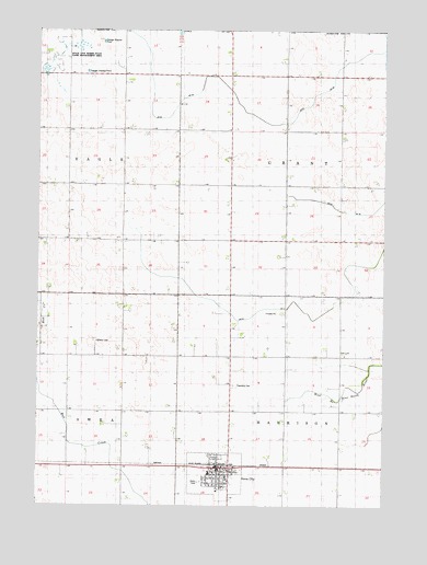
Swea City, IA USGS Topographic Map
Click on map above to begin viewing in our Map Viewer.

This topographic map contains these locations and features:
Feature Name Type Latitude Longitude GNIS ID View Map
Bancroft Lake (historical)LakeN43.4875°W94.2555°464005View Map
City of Swea CityCivilN43.3833°W94.3109°2396015View Map
Ditch Number 60CanalN43.4805°W94.2777°1823097View Map
Drainage Ditch Number 3CanalN43.4341°W94.2752°465788View Map
Farmers Co-op ElevatorLocaleN43.3863°W94.3100°1925160View Map
First Baptist ChurchChurchN43.3838°W94.3111°1925164View Map
Harrison Township CemeteryCemeteryN43.4069°W94.3044°1823100View Map
Immanuel Lutheran ChurchChurchN43.3827°W94.3066°1925165View Map
Lutheran CemeteryCemeteryN43.4183°W94.3544°1823099View Map
North Kossuth Elementary SchoolSchoolN43.3839°W94.3130°2719831View Map
North Kossuth Medical ClinicHospitalN43.3852°W94.3100°1925157View Map
North Sentral Kossuth High SchoolSchoolN43.3837°W94.3130°1925168View Map
Open Bible ChurchChurchN43.3833°W94.3089°1925167View Map
Our Saviour Lutheran ChurchChurchN43.3883°W94.3119°1925166View Map
Rock N Sons FeedlotLocaleN43.4983°W94.3542°2611868View Map
State Line Marsh State Game Management AreaParkN43.4950°W94.3655°1823098View Map
Swea CityLocaleN43.3855°W94.3097°1925169View Map
Swea CityPopulated PlaceN43.3844°W94.3150°461494View Map
Swea City AmbulanceBuildingN43.3847°W94.3106°2599713View Map
Swea City City HallBuildingN43.3836°W94.3091°1925158View Map
Swea City Police DepartmentBuildingN43.3836°W94.3091°1925161View Map
Swea City Post OfficePost OfficeN43.3838°W94.3089°1925156View Map
Swea City Public LibraryBuildingN43.3836°W94.3091°1925162View Map
Swea City Volunteer Fire DepartmentBuildingN43.3847°W94.3106°1925159View Map
Swea Post Office (historical)Post OfficeN43.4241°W94.3711°466416View Map
Township of GrantCivilN43.4653°W94.2655°467943View Map
Township of HarrisonCivilN43.3862°W94.2656°468013View Map
United Methodist ChurchChurchN43.3788°W94.3100°1925163View Map

Note: Coordinates in the location and feature list above are referenced to NAD83 datum.


Copyright (C) 2008-2025 Ryan Niemi / Sunset Dynamics ... All Rights Reserved