TopoQuest Logo
Do you find TopoQuest useful?
Help keep TopoQuest running and adding new maps/features by donating!
Bitcoin:  19c7KJd3qBynnjoSw5npx9KScwjBe4ifkT
Litecoin:  LXs6TkuXGGXo1vDsWCkWVdjQX94eUKd6ui
Home View Maps Find Maps Find Places Resources & Links


Sweet Valley, Pennsylvania Topographic Map

USGS Map Title: Sweet Valley, PA
USGS Map MRC: 41076C2
DRG (GeoTIFF) Download: o41076c2.tif


Neighboring USGS Topographic Map Quads:


  Lopez, PA  
41076D3
 

  Dutch Mountain, PA  
41076D2
 

  Noxen, PA  
41076D1
 

  Red Rock, PA  
41076C3
 

  Sweet Valley, PA  
41076C2
 

  Harveys Lake, PA  
41076C1
 

  Stillwater, PA  
41076B3
 

  Shickshinny, PA  
41076B2
 

  Nanticoke, PA  
41076B1


Map MRC Location:

N42°
W77°
N42°
W76°
H8 H7 H6 H5 H4 H3 H2 H1
G8 G7 G6 G5 G4 G3 G2 G1
F8 F7 F6 F5 F4 F3 F2 F1
E8 E7 E6 E5 E4 E3 E2 E1
D8 D7 D6 D5 D4 D3 D2 D1
C8 C7 C6 C5 C4 C3 C2 C1
B8 B7 B6 B5 B4 B3 B2 B1
A8 A7 A6 A5 A4 A3 A2 A1
N41°
W77°
N41°
W76°

Sweet Valley, PA USGS 1:24K Topographic Map Preview:
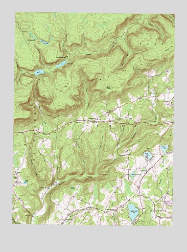
Sweet Valley, PA USGS Topographic Map
Click on map above to begin viewing in our Map Viewer.

This topographic map contains these locations and features:
Feature Name Type Latitude Longitude GNIS ID View Map
Arnold CreekStreamN41.2787°W76.1916°1168410View Map
Bates SwampSwampN41.3310°W76.1763°1168807View Map
Bean RunStreamN41.3504°W76.2041°1168847View Map
Bear SwampSwampN41.2713°W76.2027°1168945View Map
Beech LakeLakeN41.3573°W76.2265°1169106View Map
Beth RunStreamN41.3606°W76.1633°1169332View Map
Bethel ChurchChurchN41.2806°W76.2474°1169401View Map
Bethel HillSummitN41.2773°W76.2474°1169404View Map
Bethel SchoolSchoolN41.2751°W76.2477°1169410View Map
Blaine PondLakeN41.2747°W76.2401°1169785View Map
Broadway SchoolSchoolN41.2529°W76.2083°1170302View Map
Bronson CemeteryCemeteryN41.3217°W76.1283°1170315View Map
Butternut RunStreamN41.3734°W76.1485°1170818View Map
Cherry RunStreamN41.3390°W76.2419°1171670View Map
Dam Number TwoDamN41.3400°W76.2264°1172907View Map
Grassy PondLakeN41.2802°W76.1562°1175991View Map
Harris PondReservoirN41.2958°W76.1318°1176577View Map
Harris Pond DamDamN41.2934°W76.1330°1195448View Map
Hetley Grove ChurchChurchN41.2723°W76.2216°1176924View Map
Jackson HillSummitN41.2920°W76.2291°1177919View Map
KyttlePopulated PlaceN41.3112°W76.1880°1203970View Map
Lateer CemeteryCemeteryN41.3106°W76.2010°1178903View Map
Laurel RunStreamN41.2890°W76.1702°1178994View Map
Lick BranchStreamN41.2742°W76.2135°1179276View Map
Mitchler RunStreamN41.2970°W76.1652°1181380View Map
Moore CemeteryCemeteryN41.3167°W76.1752°1181505View Map
Mooretown ChurchChurchN41.3126°W76.1847°1181519View Map
Morris Airport (historical)AirportN41.2834°W76.1497°1194204View Map
Mott SchoolSchoolN41.2934°W76.1263°1181630View Map
Mount Spring DamDamN41.3467°W76.2330°1195489View Map
Mount Spring LakeReservoirN41.3397°W76.2303°1212401View Map
Mountain SpringsLocaleN41.3487°W76.2088°1181963View Map
North Branch Bowman CreekStreamN41.3404°W76.2202°1182526View Map
North LakeLakeN41.2919°W76.1445°1182604View Map
North MountainSummitN41.3315°W76.2099°1199922View Map
Oakdale SchoolSchoolN41.2551°W76.1252°1182813View Map
Phillips CreekStreamN41.2679°W76.2241°1183672View Map
PrichardPopulated PlaceN41.2551°W76.1344°1204448View Map
Retreat SchoolSchoolN41.3112°W76.1866°1184951View Map
RipplePopulated PlaceN41.3042°W76.2422°1212402View Map
Ripple (historical)Populated PlaceN41.2979°W76.2397°1197935View Map
RittenhousePopulated PlaceN41.2554°W76.2347°1204516View Map
Ross Center SchoolSchoolN41.2587°W76.1702°1185485View Map
Shingle RunStreamN41.2867°W76.1816°1187540View Map
South Branch Bowman CreekStreamN41.3404°W76.2202°1188015View Map
Splash DamDamN41.3462°W76.2091°1214235View Map
Splash DamLocaleN41.3459°W76.2083°1188184View Map
State Game Lands Number 206ParkN41.2917°W76.1997°1208076View Map
Sweet ValleyPopulated PlaceN41.2823°W76.1447°1189174View Map
Sweet Valley Golf CourseLocaleN41.2901°W76.1260°1205624View Map
Sweet Valley Post OfficePost OfficeN41.2803°W76.1463°2772997View Map
Sweet Valley Volunteer Fire Company / Sweet Valley Ambulance AssociationBuildingN41.2838°W76.1423°2652697View Map
Sylvan LakeLakeN41.2584°W76.1557°1189219View Map
The MeadowsLocaleN41.3579°W76.2335°1189424View Map
Township of RossCivilN41.3037°W76.1823°1216731View Map
WeintzPopulated PlaceN41.3262°W76.1463°1197937View Map
Wolf RunStreamN41.3515°W76.1938°1191676View Map

Note: Coordinates in the location and feature list above are referenced to NAD83 datum.


Copyright (C) 2008-2025 Ryan Niemi / Sunset Dynamics ... All Rights Reserved