TopoQuest Logo
Do you find TopoQuest useful?
Help keep TopoQuest running and adding new maps/features by donating!
Bitcoin:  19c7KJd3qBynnjoSw5npx9KScwjBe4ifkT
Litecoin:  LXs6TkuXGGXo1vDsWCkWVdjQX94eUKd6ui
Home View Maps Find Maps Find Places Resources & Links


Lopez, Pennsylvania Topographic Map

USGS Map Title: Lopez, PA
USGS Map MRC: 41076D3
DRG (GeoTIFF) Download: o41076d3.tif


Neighboring USGS Topographic Map Quads:


  Dushore, PA  
41076E4
 

  Colley, PA  
41076E3
 

  Jenningsville, PA  
41076E2
 

  Laporte, PA  
41076D4
 

  Lopez, PA  
41076D3
 

  Dutch Mountain, PA  
41076D2
 

  Elk Grove, PA  
41076C4
 

  Red Rock, PA  
41076C3
 

  Sweet Valley, PA  
41076C2


Map MRC Location:

N42°
W77°
N42°
W76°
H8 H7 H6 H5 H4 H3 H2 H1
G8 G7 G6 G5 G4 G3 G2 G1
F8 F7 F6 F5 F4 F3 F2 F1
E8 E7 E6 E5 E4 E3 E2 E1
D8 D7 D6 D5 D4 D3 D2 D1
C8 C7 C6 C5 C4 C3 C2 C1
B8 B7 B6 B5 B4 B3 B2 B1
A8 A7 A6 A5 A4 A3 A2 A1
N41°
W77°
N41°
W76°

Lopez, PA USGS 1:24K Topographic Map Preview:
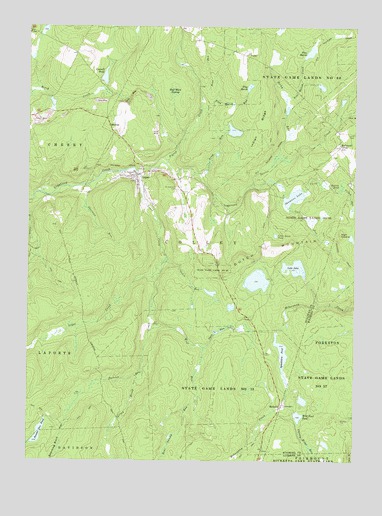
Lopez, PA USGS Topographic Map
Click on map above to begin viewing in our Map Viewer.

This topographic map contains these locations and features:
Feature Name Type Latitude Longitude GNIS ID View Map
Bear Swamp RunStreamN41.3929°W76.3097°1198381View Map
Cabin RunStreamN41.4340°W76.3216°1198512View Map
Cherry Ridge RunStreamN41.3915°W76.2752°1198561View Map
Cold RunStreamN41.4479°W76.2755°1198589View Map
Connell DamDamN41.4834°W76.3463°1195613View Map
Connell PondReservoirN41.4857°W76.3458°1172346View Map
Creveling LakeReservoirN41.3901°W76.2713°1195531View Map
Creveling Lake DamDamN41.3901°W76.2713°1195532View Map
Flag MarshSwampN41.4812°W76.2913°1192471View Map
Flag Marsh RunStreamN41.4765°W76.3091°1198740View Map
Half Moon SwampSwampN41.4792°W76.3205°1176383View Map
High CobbleSummitN41.4404°W76.2552°1198883View Map
Indian RidgeRidgeN41.4709°W76.2830°1177770View Map
Lake JohnReservoirN41.4309°W76.2726°1195571View Map
Lake John DamDamN41.4284°W76.2713°1195572View Map
Little Rouse PondReservoirN41.4401°W76.2801°1199060View Map
Long RunStreamN41.4576°W76.3099°1199080View Map
LopezPopulated PlaceN41.4579°W76.3335°1204062View Map
Lopez CreekStreamN41.4595°W76.3341°1199085View Map
Lopez Post OfficePost OfficeN41.4573°W76.3331°2772801View Map
McCarroll CornerPopulated PlaceN41.4662°W76.2558°1204125View Map
MurrayPopulated PlaceN41.4720°W76.3438°1204244View Map
Noon RunStreamN41.4817°W76.3085°1209316View Map
Open RunStreamN41.4076°W76.3072°1199253View Map
Painter Den ClubLocaleN41.3876°W76.3680°1197366View Map
Painter Den CreekStreamN41.4317°W76.3235°1199929View Map
Painter Den PondReservoirN41.3859°W76.3716°1199269View Map
Pigeon CreekStreamN41.4604°W76.3230°1199936View Map
Pine MarshLakeN41.4927°W76.2674°1214671View Map
Pine Marsh CreekStreamN41.4795°W76.2677°1209321View Map
RickettsPopulated PlaceN41.3912°W76.2777°1204502View Map
Rocky RunStreamN41.4623°W76.2808°1199952View Map
Rouse PondLakeN41.4269°W76.2872°1197367View Map
Ryman PondLakeN41.4554°W76.2613°1199428View Map
Saint Vladimirs CemeteryCemeteryN41.4531°W76.3177°1199472View Map
Saint Vladimirs ChurchChurchN41.4573°W76.3355°1199473View Map
Santee CreekStreamN41.4540°W76.2885°1199484View Map
Sherman RunStreamN41.4551°W76.3519°1199520View Map
Shumans LakeLakeN41.4511°W76.2733°1199537View Map
Snorting Buck HollowValleyN41.3890°W76.3583°1199557View Map
Splash DamDamN41.4117°W76.2797°1195554View Map
Splashdam PondReservoirN41.4062°W76.2774°1199578View Map
Spring BrookStreamN41.4042°W76.3330°1199581View Map
State Game Lands Number 57ParkN41.3973°W76.2569°1199986View Map
State Game Lands Number 66ParkN41.4848°W76.2680°1199602View Map
Township of ColleyCivilN41.4576°W76.2949°1217068View Map
Wild Fowl PondReservoirN41.3880°W76.2708°1199795View Map
Wolf RunStreamN41.4131°W76.3272°1199803View Map
Yellow RunStreamN41.4534°W76.2547°1199823View Map

Note: Coordinates in the location and feature list above are referenced to NAD83 datum.


Copyright (C) 2008-2025 Ryan Niemi / Sunset Dynamics ... All Rights Reserved