TopoQuest Logo
Do you find TopoQuest useful?
Help keep TopoQuest running and adding new maps/features by donating!
Bitcoin:  19c7KJd3qBynnjoSw5npx9KScwjBe4ifkT
Litecoin:  LXs6TkuXGGXo1vDsWCkWVdjQX94eUKd6ui
Home View Maps Find Maps Find Places Resources & Links


Big Cedar, Idaho Topographic Map

USGS Map Title: Big Cedar, ID
USGS Map MRC: 46115A7
DRG (GeoTIFF) Download: o46115a7.tif


Neighboring USGS Topographic Map Quads:


  Kooskia, ID  
46115B8
 

  Glenwood, ID  
46115B7
 

  Syringa, ID  
46115B6
 

  Stites, ID  
46115A8
 

  Big Cedar, ID  
46115A7
 

  Lodge Point, ID  
46115A6
 

  Harpster, ID  
45115H8
 

  Corral Hill, ID  
45115H7
 

  Pilot Knob, ID  
45115H6


Map MRC Location:

N47°
W116°
N47°
W115°
H8 H7 H6 H5 H4 H3 H2 H1
G8 G7 G6 G5 G4 G3 G2 G1
F8 F7 F6 F5 F4 F3 F2 F1
E8 E7 E6 E5 E4 E3 E2 E1
D8 D7 D6 D5 D4 D3 D2 D1
C8 C7 C6 C5 C4 C3 C2 C1
B8 B7 B6 B5 B4 B3 B2 B1
A8 A7 A6 A5 A4 A3 A2 A1
N46°
W116°
N46°
W115°

Big Cedar, ID USGS 1:24K Topographic Map Preview:
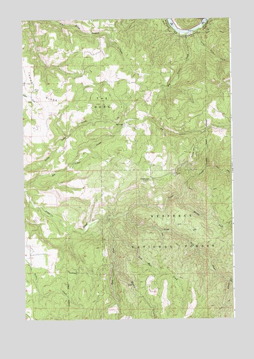
Big Cedar, ID USGS Topographic Map
Click on map above to begin viewing in our Map Viewer.

This topographic map contains these locations and features:
Feature Name Type Latitude Longitude GNIS ID View Map
Big CedarPopulated PlaceN46.0810°W115.8143°396112View Map
Big Tinker CreekStreamN46.1191°W115.7771°377611View Map
Clear Creek International AirportAirportN46.0475°W115.8691°2717104View Map
Crane HillSummitN46.0577°W115.8026°380032View Map
Hoodoo CreekStreamN46.0196°W115.8210°383298View Map
Kay CreekStreamN46.0163°W115.7535°384112View Map
Little Tinker CreekStreamN46.1199°W115.7726°384978View Map
Lost Mule CreekStreamN46.0343°W115.8204°386173View Map
Middle Fork Clear CreekStreamN46.0505°W115.7824°386805View Map
Potato HillSummitN46.0682°W115.7749°397062View Map
Ridge Runner Fire DepartmentBuildingN46.0949°W115.8653°2619210View Map
Solo CreekStreamN46.0391°W115.7529°390829View Map
South Fork Clear CreekStreamN46.0432°W115.8151°390907View Map
TahoePopulated PlaceN46.0963°W115.8071°400548View Map
Tahoe CemeteryCemeteryN46.0957°W115.8682°391816View Map
Tahoe CreekStreamN46.1213°W115.7687°391817View Map
Tahoe RidgeRidgeN46.0971°W115.8469°391818View Map
The HornSummitN46.0896°W115.8290°391967View Map
West Fork Clear CreekStreamN46.0427°W115.8226°393074View Map

Note: Coordinates in the location and feature list above are referenced to NAD83 datum.


Copyright (C) 2008-2025 Ryan Niemi / Sunset Dynamics ... All Rights Reserved