TopoQuest Logo
Do you find TopoQuest useful?
Help keep TopoQuest running and adding new maps/features by donating!
Bitcoin:  19c7KJd3qBynnjoSw5npx9KScwjBe4ifkT
Litecoin:  LXs6TkuXGGXo1vDsWCkWVdjQX94eUKd6ui
Home View Maps Find Maps Find Places Resources & Links


Tallapoosa North, Georgia Topographic Map

USGS Map Title: Tallapoosa North, GA
USGS Map MRC: 33085G3
DRG (GeoTIFF) Download: o33085g3.tif


Neighboring USGS Topographic Map Quads:


  Borden Springs, AL  
33085H4
 

  Benedict, GA  
33085H3
 

  Felton, GA  
33085H2
 

  Oak Level, AL  
33085G4
 

  Tallapoosa North, GA  
33085G3
 

  Buchanan, GA  
33085G2
 

  Fruithurst, AL  
33085F4
 

  Tallapoosa South, GA  
33085F3
 

  Bremen, GA  
33085F2


Map MRC Location:

N34°
W86°
N34°
W85°
H8 H7 H6 H5 H4 H3 H2 H1
G8 G7 G6 G5 G4 G3 G2 G1
F8 F7 F6 F5 F4 F3 F2 F1
E8 E7 E6 E5 E4 E3 E2 E1
D8 D7 D6 D5 D4 D3 D2 D1
C8 C7 C6 C5 C4 C3 C2 C1
B8 B7 B6 B5 B4 B3 B2 B1
A8 A7 A6 A5 A4 A3 A2 A1
N33°
W86°
N33°
W85°

Tallapoosa North, GA USGS 1:24K Topographic Map Preview:
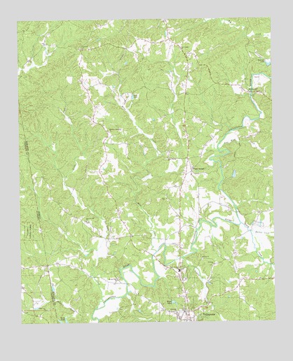
Tallapoosa North, GA USGS Topographic Map
Click on map above to begin viewing in our Map Viewer.

This topographic map contains these locations and features:
Feature Name Type Latitude Longitude GNIS ID View Map
Adderholds BridgeBridgeN33.7762°W85.2966°350684View Map
Beach CreekStreamN33.7904°W85.2658°354495View Map
Bethany CemeteryCemeteryN33.7759°W85.2855°350615View Map
Bethany ChurchChurchN33.7762°W85.2855°354577View Map
Christian Camp Home MissionChurchN33.8448°W85.2611°312656View Map
Crossroad ChurchChurchN33.8632°W85.3425°313173View Map
Ebenezer CemeteryCemeteryN33.7732°W85.2802°350628View Map
Ebenezer ChurchChurchN33.7734°W85.2794°355627View Map
Emmanuel ChurchChurchN33.7537°W85.2986°355688View Map
Flat Wood CreekStreamN33.8207°W85.2755°314204View Map
Greene CreekStreamN33.7765°W85.2950°314861View Map
Haralson County Fire Department Station 4BuildingN33.8517°W85.2919°2604515View Map
Harris CreekStreamN33.7870°W85.2608°315194View Map
Little CreekStreamN33.7562°W85.3377°317013View Map
Macks LakesReservoirN33.7582°W85.3001°317587View Map
Mann CemeteryCemeteryN33.7854°W85.3138°350647View Map
Mann CreekStreamN33.7793°W85.3075°317660View Map
McBride BridgeBridgeN33.7659°W85.3230°350715View Map
Mount Sinai Baptist Church (historical)ChurchN33.7557°W85.2950°350649View Map
Mount Zion West CemeteryCemeteryN33.7682°W85.3272°350653View Map
Mount Zion West ChurchChurchN33.7673°W85.3272°319043View Map
Munroe Mill (historical)LocaleN33.8440°W85.2605°350716View Map
New Canaan CemeteryCemeteryN33.8629°W85.2949°350655View Map
New Canaan ChurchChurchN33.8623°W85.2936°319294View Map
Old TallapoosaPopulated PlaceN33.7543°W85.2958°350719View Map
Pleasant Hill ChurchChurchN33.7918°W85.3419°320900View Map
Pope LakeReservoirN33.8431°W85.3186°321015View Map
Poplar SpringsPopulated PlaceN33.8123°W85.2897°332731View Map
Poplar Springs CemeteryCemeteryN33.8173°W85.3022°350662View Map
Poplar Springs ChurchChurchN33.8179°W85.3005°321048View Map
Rainwater FordCrossingN33.7784°W85.2902°350722View Map
Rowels BridgeBridgeN33.7951°W85.2683°350724View Map
Salem CemeteryCemeteryN33.8009°W85.3022°322333View Map
Spearman LakeReservoirN33.8560°W85.2516°323332View Map
Spearman Lake DamDamN33.8559°W85.2502°339941View Map
State Line ChurchChurchN33.7557°W85.3633°127328View Map
SteadmanPopulated PlaceN33.8268°W85.3313°350726View Map
Steadman Missionary ChurchChurchN33.8287°W85.3297°323546View Map
Tallapoosa DivisionCivilN33.7844°W85.3050°1936575View Map
Tallapoosa Primary SchoolSchoolN33.7592°W85.2782°350680View Map
Verner LakeReservoirN33.8105°W85.2692°339940View Map
Verner Lake DamDamN33.8101°W85.2700°339939View Map
West Haralson Elementary SchoolSchoolN33.7711°W85.2970°325056View Map

Note: Coordinates in the location and feature list above are referenced to NAD83 datum.


Copyright (C) 2008-2024 Ryan Niemi / Sunset Dynamics ... All Rights Reserved