TopoQuest Logo
Do you find TopoQuest useful?
Help keep TopoQuest running and adding new maps/features by donating!
Bitcoin:  19c7KJd3qBynnjoSw5npx9KScwjBe4ifkT
Litecoin:  LXs6TkuXGGXo1vDsWCkWVdjQX94eUKd6ui
Home View Maps Find Maps Find Places Resources & Links


Turley, New Mexico Topographic Map

USGS Map Title: Turley, NM
USGS Map MRC: 36107G7
DRG (GeoTIFF) Download: o36107g7.tif


Neighboring USGS Topographic Map Quads:


  Cedar Hill, NM  
36107H8
 

  Mount Nebo, NM  
36107H7
 

  Anastacio Spring, NM  
36107H6
 

  Aztec, NM  
36107G8
 

  Turley, NM  
36107G7
 

  Archuleta, NM  
36107G6
 

  Bloomfield, NM  
36107F8
 

  Blanco, NM  
36107F7
 

  Cutter Canyon, NM  
36107F6


Map MRC Location:

N37°
W108°
N37°
W107°
H8 H7 H6 H5 H4 H3 H2 H1
G8 G7 G6 G5 G4 G3 G2 G1
F8 F7 F6 F5 F4 F3 F2 F1
E8 E7 E6 E5 E4 E3 E2 E1
D8 D7 D6 D5 D4 D3 D2 D1
C8 C7 C6 C5 C4 C3 C2 C1
B8 B7 B6 B5 B4 B3 B2 B1
A8 A7 A6 A5 A4 A3 A2 A1
N36°
W108°
N36°
W107°

Turley, NM USGS 1:24K Topographic Map Preview:
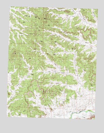
Turley, NM USGS Topographic Map
Click on map above to begin viewing in our Map Viewer.

This topographic map contains these locations and features:
Feature Name Type Latitude Longitude GNIS ID View Map
Alamo CanyonValleyN36.8364°W107.7681°885618View Map
Alamo SpringSpringN36.8549°W107.8207°900139View Map
AlcatrazPopulated PlaceN36.7564°W107.7570°901254View Map
Alcatraz Post Office (historical)Post OfficeN36.7564°W107.7570°938031View Map
Banco SpringSpringN36.8225°W107.8183°900085View Map
Bonnie RockPillarN36.7989°W107.8417°900090View Map
Bootlegger SpringSpringN36.8646°W107.8502°900073View Map
Burro SpringSpringN36.8054°W107.7679°900089View Map
Burro Spring BridgeArchN36.8069°W107.7692°2651454View Map
Caballo CanyonValleyN36.7569°W107.7756°900081View Map
Caballo SpringSpringN36.8292°W107.7863°900084View Map
Cash SpringSpringN36.8569°W107.8537°900077View Map
Cerritos CanyonValleyN36.7761°W107.8667°900094View Map
Crow Canyon ArchArchN36.8197°W107.7581°2651455View Map
Crow SpringSpringN36.8490°W107.8344°900078View Map
Hart MountainSummitN36.8608°W107.8267°889809View Map
Hart SpringSpringN36.8623°W107.8348°900076View Map
Hart Spring Number 1SpringN36.8639°W107.8387°914387View Map
Hart Spring Number 1SpringN36.8639°W107.8387°915756View Map
Hart Spring Number 2SpringN36.8639°W107.8456°914405View Map
Hart Spring Number 2SpringN36.8639°W107.8456°915217View Map
Headwater SpringSpringN36.8631°W107.8395°900075View Map
Indian SpringSpringN36.8649°W107.8477°900074View Map
Jackson SpringSpringN36.8250°W107.8495°914440View Map
Kirk SpringSpringN36.8731°W107.7713°900140View Map
Knickerbocker WellWellN36.7969°W107.8473°926984View Map
Little Delicate ArchArchN36.8147°W107.8142°2651453View Map
Mansfield CanyonValleyN36.7569°W107.7867°900093View Map
Mud SpringSpringN36.8439°W107.8445°900079View Map
Pemada CanyonValleyN36.7819°W107.7745°900092View Map
Pemada Canyon ArchArchN36.7889°W107.8292°2651458View Map
Pilares CanyonValleyN36.7958°W107.7762°898333View Map
Pilares SpringSpringN36.8277°W107.8396°900083View Map
Pueblito SpringSpringN36.8167°W107.8462°900088View Map
Rincon SpringSpringN36.8364°W107.8280°900080View Map
Sanchez SpringSpringN36.8225°W107.8117°900086View Map
Sidro CanyonValleyN36.8619°W107.7517°900072View Map
Slane KnobSummitN36.8217°W107.8670°894911View Map
TurleyPopulated PlaceN36.7525°W107.7651°902373View Map
Turley Post Office (historical)Post OfficeN36.7525°W107.7651°937536View Map
Vaca CanyonValleyN36.7511°W107.8167°900091View Map
Valencia SpringSpringN36.8361°W107.8109°900082View Map
Ventana SpringSpringN36.7896°W107.7577°900095View Map
Vereda CanyonValleyN36.8019°W107.8017°900087View Map

Note: Coordinates in the location and feature list above are referenced to NAD83 datum.


Copyright (C) 2008-2025 Ryan Niemi / Sunset Dynamics ... All Rights Reserved