TopoQuest Logo
Do you find TopoQuest useful?
Help keep TopoQuest running and adding new maps/features by donating!
Bitcoin:  19c7KJd3qBynnjoSw5npx9KScwjBe4ifkT
Litecoin:  LXs6TkuXGGXo1vDsWCkWVdjQX94eUKd6ui
Home View Maps Find Maps Find Places Resources & Links


Tarpley Pass, Texas Topographic Map

USGS Map Title: Tarpley Pass, TX
USGS Map MRC: 29099F2
DRG (GeoTIFF) Download: o29099f2.tif


Neighboring USGS Topographic Map Quads:


  A Bar A Ranch, TX  
29099G3
 

  Rock Cliff Reservoir, TX  
29099G2
 

  Bandera Pass, TX  
29099G1
 

  Tarpley, TX  
29099F3
 

  Tarpley Pass, TX  
29099F2
 

  Bandera, TX  
29099F1
 

  Texas Mountain, TX  
29099E3
 

  Twin Hollow, TX  
29099E2
 

  Timber Creek, TX  
29099E1


Map MRC Location:

N30°
W100°
N30°
W99°
H8 H7 H6 H5 H4 H3 H2 H1
G8 G7 G6 G5 G4 G3 G2 G1
F8 F7 F6 F5 F4 F3 F2 F1
E8 E7 E6 E5 E4 E3 E2 E1
D8 D7 D6 D5 D4 D3 D2 D1
C8 C7 C6 C5 C4 C3 C2 C1
B8 B7 B6 B5 B4 B3 B2 B1
A8 A7 A6 A5 A4 A3 A2 A1
N29°
W100°
N29°
W99°

Tarpley Pass, TX USGS 1:24K Topographic Map Preview:
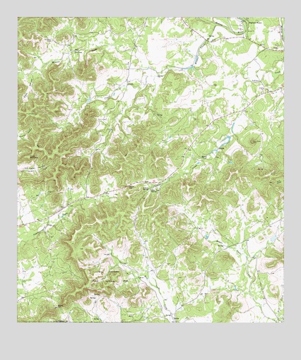
Tarpley Pass, TX USGS Topographic Map
Click on map above to begin viewing in our Map Viewer.

This topographic map contains these locations and features:
Feature Name Type Latitude Longitude GNIS ID View Map
Bandera CountyCivilN29.7472°W99.2462°1383795View Map
Barnes GapGapN29.6316°W99.2312°1330058View Map
Cedar HollowValleyN29.6872°W99.2481°1332451View Map
Chalk MountainSummitN29.6927°W99.2450°1332621View Map
El Paraiso RanchLocaleN29.7405°W99.2348°1335237View Map
Elam CanyonValleyN29.7272°W99.2434°1335293View Map
Hicks CreekStreamN29.7477°W99.1578°1374057View Map
Hill Country State Natural AreaParkN29.6330°W99.1920°2029222View Map
Hill Country State Natural Area TrailTrailN29.6422°W99.2014°2033528View Map
Indian SpringSpringN29.6802°W99.1886°1338455View Map
Lovers LeapCliffN29.7361°W99.2237°1340670View Map
Middle Verde Ranch LakeReservoirN29.6586°W99.1303°1864090View Map
Middle Verde Ranch Lake DamDamN29.6586°W99.1303°1864089View Map
Pear Tree SpringSpringN29.6801°W99.1888°1343729View Map
Pugmore CreekStreamN29.7261°W99.1848°1344623View Map
Tarpley PassGapN29.6811°W99.1986°1348254View Map
Winans CreekStreamN29.7474°W99.1570°1350283View Map
Wolf CreekStreamN29.6261°W99.1289°1350461View Map

Note: Coordinates in the location and feature list above are referenced to NAD83 datum.


Copyright (C) 2008-2024 Ryan Niemi / Sunset Dynamics ... All Rights Reserved