TopoQuest Logo
Do you find TopoQuest useful?
Help keep TopoQuest running and adding new maps/features by donating!
Bitcoin:  19c7KJd3qBynnjoSw5npx9KScwjBe4ifkT
Litecoin:  LXs6TkuXGGXo1vDsWCkWVdjQX94eUKd6ui
Home View Maps Find Maps Find Places Resources & Links


Timber Creek, Texas Topographic Map

USGS Map Title: Timber Creek, TX
USGS Map MRC: 29099E1
DRG (GeoTIFF) Download: o29099e1.tif


Neighboring USGS Topographic Map Quads:


  Tarpley Pass, TX  
29099F2
 

  Bandera, TX  
29099F1
 

  Pipe Creek, TX  
29098F8
 

  Twin Hollow, TX  
29099E2
 

  Timber Creek, TX  
29099E1
 

  Medina Lake, TX  
29098E8
 

  Mustang Valley, TX  
29099D2
 

  Quihi, TX  
29099D1
 

  Riomedina, TX  
29098D8


Map MRC Location:

N30°
W100°
N30°
W99°
H8 H7 H6 H5 H4 H3 H2 H1
G8 G7 G6 G5 G4 G3 G2 G1
F8 F7 F6 F5 F4 F3 F2 F1
E8 E7 E6 E5 E4 E3 E2 E1
D8 D7 D6 D5 D4 D3 D2 D1
C8 C7 C6 C5 C4 C3 C2 C1
B8 B7 B6 B5 B4 B3 B2 B1
A8 A7 A6 A5 A4 A3 A2 A1
N29°
W100°
N29°
W99°

Timber Creek, TX USGS 1:24K Topographic Map Preview:
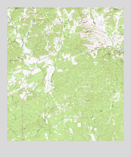
Timber Creek, TX USGS Topographic Map
Click on map above to begin viewing in our Map Viewer.

This topographic map contains these locations and features:
Feature Name Type Latitude Longitude GNIS ID View Map
Cherry HollowValleyN29.6124°W99.0614°1332714View Map
Chimney HillSummitN29.5369°W99.0417°1332759View Map
Cow CreekStreamN29.6049°W99.1164°1333545View Map
Cypress CreekStreamN29.5872°W99.0073°1333850View Map
Cypress Creek SpringSpringN29.5983°W99.0178°1998458View Map
East Verde CreekStreamN29.5375°W99.0778°1335013View Map
Indian SpringSpringN29.5860°W99.0306°1338454View Map
Indian Spring CreekStreamN29.5886°W99.0120°1338459View Map
Long HollowValleyN29.6137°W99.0386°1340461View Map
Middle SpringSpringN29.6025°W99.0406°1341517View Map
Middle Verde CreekStreamN29.5375°W99.0778°1341524View Map
Middle Verde Recharge DamDamN29.5036°W99.1003°1863680View Map
Middle Verde Recharge LakeReservoirN29.5034°W99.1004°1863681View Map
Moccasin SpringSpringN29.5819°W99.0167°1341782View Map
New Langford LakeReservoirN29.6086°W99.0303°1863219View Map
New Langford Lake DamDamN29.6086°W99.0303°1863218View Map
One Horn MountainSummitN29.5747°W99.1231°1343275View Map
Pecan Grove SpringSpringN29.5888°W99.0120°1998462View Map
Pigpen HollowValleyN29.5938°W99.1055°1343993View Map
Sheep SpringSpringN29.5969°W99.0203°1998463View Map
Smith CreekStreamN29.6241°W99.1070°1347269View Map
Timber CreekStreamN29.5786°W99.0800°1348572View Map
Vat HollowValleyN29.5749°W99.1054°1349205View Map
West Verde CreekStreamN29.5966°W99.1159°1349822View Map

Note: Coordinates in the location and feature list above are referenced to NAD83 datum.


Copyright (C) 2008-2024 Ryan Niemi / Sunset Dynamics ... All Rights Reserved