TopoQuest Logo
Do you find TopoQuest useful?
Help keep TopoQuest running and adding new maps/features by donating!
Bitcoin:  19c7KJd3qBynnjoSw5npx9KScwjBe4ifkT
Litecoin:  LXs6TkuXGGXo1vDsWCkWVdjQX94eUKd6ui
Home View Maps Find Maps Find Places Resources & Links


Tarrant, Wisconsin Topographic Map

USGS Map Title: Tarrant, WI
USGS Map MRC: 44091E7
DRG (GeoTIFF) Download: o44091e7.tif


Neighboring USGS Topographic Map Quads:


  Durand North, WI  
44091F8
 

  Meridean, WI  
44091F7
 

  Rock Falls, WI  
44091F6
 

  Durand South, WI  
44091E8
 

  Tarrant, WI  
44091E7
 

  Mondovi, WI  
44091E6
 

  Urne, WI  
44091D8
 

  Modena, WI  
44091D7
 

  Gilmanton, WI  
44091D6


Map MRC Location:

N45°
W92°
N45°
W91°
H8 H7 H6 H5 H4 H3 H2 H1
G8 G7 G6 G5 G4 G3 G2 G1
F8 F7 F6 F5 F4 F3 F2 F1
E8 E7 E6 E5 E4 E3 E2 E1
D8 D7 D6 D5 D4 D3 D2 D1
C8 C7 C6 C5 C4 C3 C2 C1
B8 B7 B6 B5 B4 B3 B2 B1
A8 A7 A6 A5 A4 A3 A2 A1
N44°
W92°
N44°
W91°

Tarrant, WI USGS 1:24K Topographic Map Preview:
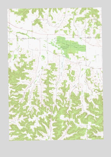
Tarrant, WI USGS Topographic Map
Click on map above to begin viewing in our Map Viewer.

This topographic map contains these locations and features:
Feature Name Type Latitude Longitude GNIS ID View Map
Averill School (historical)SchoolN44.6033°W91.8735°1578272View Map
Bear Creek SwampSwampN44.5894°W91.7993°1561373View Map
Big Swamp State Public Hunting GroundsParkN44.5872°W91.7941°1561780View Map
Brunner CouleeValleyN44.6062°W91.8174°1562297View Map
Carrel ValleyValleyN44.5496°W91.7742°1562741View Map
Dugan ValleyValleyN44.5686°W91.7724°1564166View Map
Heck Valley School (historical)SchoolN44.5539°W91.8116°1578197View Map
Howard School (historical)SchoolN44.6030°W91.8421°1578282View Map
Ides ValleyValleyN44.5178°W91.8654°1566851View Map
Isham ValleyValleyN44.5567°W91.8389°1566993View Map
Kelly Valley School (historical)SchoolN44.5458°W91.7907°1578198View Map
Mondovi-Canton School (historical)SchoolN44.5672°W91.7604°1578203View Map
Newton ValleyValleyN44.5933°W91.8617°1570269View Map
Prissel School (historical)SchoolN44.6183°W91.7874°1578295View Map
Prissel ValleyValleyN44.6002°W91.8177°1571944View Map
Sacred Heart CemeteryCemeteryN44.5727°W91.7824°1572784View Map
Saint Paul ChurchChurchN44.5491°W91.8127°1573448View Map
Schultz ValleyValleyN44.5820°W91.8234°1573820View Map
Springdale (historical)Populated PlaceN44.5272°W91.7757°1578209View Map
Steele ValleyValleyN44.5563°W91.7765°1574846View Map
Steinke ValleyValleyN44.5785°W91.8022°1574852View Map
TarrantPopulated PlaceN44.5966°W91.8432°1577850View Map
Thompson ValleyValleyN44.5680°W91.7562°1575390View Map
Tiffany CreekStreamN44.5936°W91.8329°1575443View Map
Tiffany SchoolSchoolN44.5680°W91.7654°1575444View Map
Tiffany School (historical)SchoolN44.5533°W91.8393°1578211View Map
Tiffany ValleyValleyN44.5499°W91.8445°1575446View Map
Town of CantonCivilN44.5532°W91.8322°1582915View Map
Valley View Amish SchoolSchoolN44.6030°W91.8434°2715799View Map
Walkers Corner School (historical)SchoolN44.5855°W91.8324°1578213View Map

Note: Coordinates in the location and feature list above are referenced to NAD83 datum.


Copyright (C) 2008-2025 Ryan Niemi / Sunset Dynamics ... All Rights Reserved