TopoQuest Logo
Do you find TopoQuest useful?
Help keep TopoQuest running and adding new maps/features by donating!
Bitcoin:  19c7KJd3qBynnjoSw5npx9KScwjBe4ifkT
Litecoin:  LXs6TkuXGGXo1vDsWCkWVdjQX94eUKd6ui
Home View Maps Find Maps Find Places Resources & Links


Modena, Wisconsin Topographic Map

USGS Map Title: Modena, WI
USGS Map MRC: 44091D7
DRG (GeoTIFF) Download: o44091d7.tif


Neighboring USGS Topographic Map Quads:


  Durand South, WI  
44091E8
 

  Tarrant, WI  
44091E7
 

  Mondovi, WI  
44091E6
 

  Urne, WI  
44091D8
 

  Modena, WI  
44091D7
 

  Gilmanton, WI  
44091D6
 

  Alma, WI  
44091C8
 

  Cream, WI  
44091C7
 

  Waumandee, WI  
44091C6


Map MRC Location:

N45°
W92°
N45°
W91°
H8 H7 H6 H5 H4 H3 H2 H1
G8 G7 G6 G5 G4 G3 G2 G1
F8 F7 F6 F5 F4 F3 F2 F1
E8 E7 E6 E5 E4 E3 E2 E1
D8 D7 D6 D5 D4 D3 D2 D1
C8 C7 C6 C5 C4 C3 C2 C1
B8 B7 B6 B5 B4 B3 B2 B1
A8 A7 A6 A5 A4 A3 A2 A1
N44°
W92°
N44°
W91°

Modena, WI USGS 1:24K Topographic Map Preview:
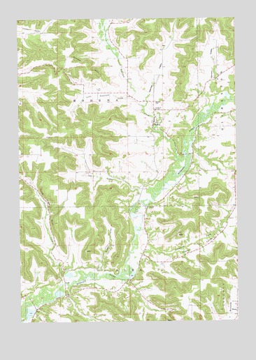
Modena, WI USGS Topographic Map
Click on map above to begin viewing in our Map Viewer.

This topographic map contains these locations and features:
Feature Name Type Latitude Longitude GNIS ID View Map
0.7 ReservoirReservoirN44.4066°W91.8235°1793587View Map
Buffalo CountyCivilN44.3798°W91.7545°1581065View Map
Cochrane Flood Control 3WR626 DamDamN44.4500°W91.8335°1793211View Map
Erickson BluffCliffN44.4822°W91.8332°1564685View Map
French ValleyValleyN44.4051°W91.8031°1565316View Map
German ValleyValleyN44.4673°W91.8012°1565486View Map
Hanson ValleyValleyN44.4686°W91.7592°1566052View Map
Hutchinson CreekStreamN44.4041°W91.8096°1566836View Map
Kissel ValleyValleyN44.3959°W91.8276°1567536View Map
Lee ValleyValleyN44.4294°W91.8055°1567929View Map
Little Tamarack CreekStreamN44.4639°W91.8029°1568441View Map
ModenaPopulated PlaceN44.4575°W91.7965°1569624View Map
Modena CemeteryCemeteryN44.4658°W91.7960°1569625View Map
Modena Lutheran ChurchChurchN44.4564°W91.7974°1837531View Map
Pine CreekStreamN44.3911°W91.8510°1571437View Map
Pine Creek BluffCliffN44.4219°W91.8579°1571440View Map
Pine Creek Bluff School (historical)SchoolN44.4447°W91.8749°1578547View Map
PraagPopulated PlaceN44.3780°W91.7507°1571867View Map
Praag School (historical)SchoolN44.3786°W91.7513°1837550View Map
Saint Paul ChurchChurchN44.4627°W91.7957°1573447View Map
Secrist H2526 DamDamN44.4066°W91.8235°1793586View Map
Sisson School (historical)SchoolN44.4936°W91.8218°1578549View Map
Tamarack CreekStreamN44.4364°W91.7838°1575237View Map
TellPopulated PlaceN44.3805°W91.8663°1577852View Map
Town of AlmaCivilN44.3768°W91.8363°1582676View Map
Town of ModenaCivilN44.4662°W91.8324°1583733View Map

Note: Coordinates in the location and feature list above are referenced to NAD83 datum.


Copyright (C) 2008-2025 Ryan Niemi / Sunset Dynamics ... All Rights Reserved