TopoQuest Logo
Do you find TopoQuest useful?
Help keep TopoQuest running and adding new maps/features by donating!
Bitcoin:  19c7KJd3qBynnjoSw5npx9KScwjBe4ifkT
Litecoin:  LXs6TkuXGGXo1vDsWCkWVdjQX94eUKd6ui
Home View Maps Find Maps Find Places Resources & Links


Tash Peak, Montana Topographic Map

USGS Map Title: Tash Peak, MT
USGS Map MRC: 45113C2
DRG (GeoTIFF) Download: o45113c2.tif


Neighboring USGS Topographic Map Quads:


  Jackson Hill, MT  
45113D3
 

  Maverick Mountain, MT  
45113D2
 

  Elkhorn Hot Springs, MT  
45113D1
 

  Butch Hill, MT  
45113C3
 

  Tash Peak, MT  
45113C2
 

  Polaris, MT  
45113C1
 

  Peterson Lake, MT  
45113B3
 

  Brays Canyon, MT  
45113B2
 

  Mill Point, MT  
45113B1


Map MRC Location:

N46°
W114°
N46°
W113°
H8 H7 H6 H5 H4 H3 H2 H1
G8 G7 G6 G5 G4 G3 G2 G1
F8 F7 F6 F5 F4 F3 F2 F1
E8 E7 E6 E5 E4 E3 E2 E1
D8 D7 D6 D5 D4 D3 D2 D1
C8 C7 C6 C5 C4 C3 C2 C1
B8 B7 B6 B5 B4 B3 B2 B1
A8 A7 A6 A5 A4 A3 A2 A1
N45°
W114°
N45°
W113°

Tash Peak, MT USGS 1:24K Topographic Map Preview:
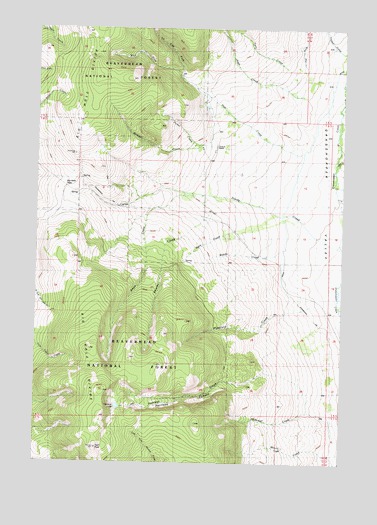
Tash Peak, MT USGS Topographic Map
Click on map above to begin viewing in our Map Viewer.

This topographic map contains these locations and features:
Feature Name Type Latitude Longitude GNIS ID View Map
06S13W03DCAA01 WellWellN45.3399°W113.1781°809009View Map
06S13W15CCCD01 SpringSpringN45.3084°W113.1901°808845View Map
Abrams CreekStreamN45.3219°W113.1806°778859View Map
Ames CreekStreamN45.3269°W113.1839°779010View Map
Big Hole PassGapN45.3305°W113.2412°779821View Map
Carroll HillSummitN45.3285°W113.2412°793906View Map
Circle-S RanchLocaleN45.3399°W113.1789°781296View Map
Cottonwood CreekStreamN45.3741°W113.1425°781716View Map
Divide CreekStreamN45.3124°W113.1267°782402View Map
East Fork Pole CreekStreamN45.3602°W113.1928°782891View Map
Farlin CreekStreamN45.3416°W113.1287°783306View Map
Glidewell CreekStreamN45.2563°W113.1289°783992View Map
Harrison CanyonValleyN45.2738°W113.1625°784574View Map
Harrison CreekStreamN45.2749°W113.1564°784576View Map
Harrison CreekStreamN45.2908°W113.1250°784577View Map
Harrison LakeLakeN45.2661°W113.2171°784583View Map
Harrison PeakSummitN45.2630°W113.2237°1934912View Map
Jager CreekStreamN45.3560°W113.1431°785409View Map
Krueger CreekStreamN45.3560°W113.1831°785852View Map
Middle CreekStreamN45.3110°W113.1506°787223View Map
Neagle CreekStreamN45.3683°W113.1273°787917View Map
Picket CreekStreamN45.3416°W113.1848°788827View Map
Pole CreekStreamN45.3391°W113.1423°789054View Map
Rock CreekStreamN45.3169°W113.1703°789661View Map
Scudder CreekStreamN45.2935°W113.1250°790168View Map
Tash PeakSummitN45.2541°W113.2262°791900View Map
Twin CreekStreamN45.3610°W113.1423°792506View Map
Wakefield CreekStreamN45.2927°W113.1542°792754View Map
West Fork Pole CreekStreamN45.3602°W113.1928°793060View Map

Note: Coordinates in the location and feature list above are referenced to NAD83 datum.


Copyright (C) 2008-2025 Ryan Niemi / Sunset Dynamics ... All Rights Reserved