TopoQuest Logo
Do you find TopoQuest useful?
Help keep TopoQuest running and adding new maps/features by donating!
Bitcoin:  19c7KJd3qBynnjoSw5npx9KScwjBe4ifkT
Litecoin:  LXs6TkuXGGXo1vDsWCkWVdjQX94eUKd6ui
Home View Maps Find Maps Find Places Resources & Links


Taylor Hill, Mississippi Topographic Map

USGS Map Title: Taylor Hill, MS
USGS Map MRC: 31088A8
DRG (GeoTIFF) Download: o31088a8.tif


Neighboring USGS Topographic Map Quads:


  New Augusta, MS  
31089B1
 

  Beaumont, MS  
31088B8
 

  Neely, MS  
31088B7
 

  Janice, MS  
31089A1
 

  Taylor Hill, MS  
31088A8
 

  McLain, MS  
31088A7
 

  Bond Pond, MS  
30089H1
 

  Barbara, MS  
30088H8
 

  Avent, MS  
30088H7


Map MRC Location:

N32°
W89°
N32°
W88°
H8 H7 H6 H5 H4 H3 H2 H1
G8 G7 G6 G5 G4 G3 G2 G1
F8 F7 F6 F5 F4 F3 F2 F1
E8 E7 E6 E5 E4 E3 E2 E1
D8 D7 D6 D5 D4 D3 D2 D1
C8 C7 C6 C5 C4 C3 C2 C1
B8 B7 B6 B5 B4 B3 B2 B1
A8 A7 A6 A5 A4 A3 A2 A1
N31°
W89°
N31°
W88°

Taylor Hill, MS USGS 1:24K Topographic Map Preview:
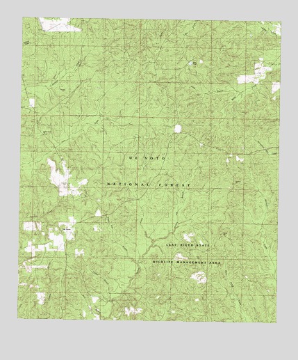
Taylor Hill, MS USGS Topographic Map
Click on map above to begin viewing in our Map Viewer.

This topographic map contains these locations and features:
Feature Name Type Latitude Longitude GNIS ID View Map
Blue PondReservoirN31.1072°W88.9186°704594View Map
Breland CemeteryCemeteryN31.0560°W88.9775°704597View Map
Cypress Creek ChurchChurchN31.0766°W88.9881°693040View Map
De Soto National ForestForestN31.0348°W88.9913°711477View Map
Deadman HillSummitN31.0585°W88.8967°705620View Map
Erambert Seed OrchardLocaleN31.0221°W88.9887°705656View Map
Flat BranchStreamN31.0330°W88.9345°693221View Map
Herring CemeteryCemeteryN31.0955°W88.9789°704611View Map
Hickory Flat BranchStreamN31.0327°W88.9356°705014View Map
Leaf River State Wildlife Management AreaParkN31.0016°W88.8834°704621View Map
Long BranchStreamN31.0949°W88.8917°693809View Map
Oak GrovePopulated PlaceN31.0363°W88.9742°694224View Map
Oak Grove School (historical)SchoolN31.0402°W88.9737°704633View Map
Ray Green FarmLocaleN31.0291°W88.9170°694517View Map
Riley CemeteryCemeteryN31.0263°W88.9134°705613View Map
Silver Run BranchStreamN31.0238°W88.9417°694793View Map
Taylor HillSummitN31.0366°W88.9014°694950View Map
Turkey BranchStreamN31.0085°W88.9542°695014View Map
West Branch Hickory CreekStreamN31.0010°W88.9575°695124View Map

Note: Coordinates in the location and feature list above are referenced to NAD83 datum.


Copyright (C) 2008-2024 Ryan Niemi / Sunset Dynamics ... All Rights Reserved