TopoQuest Logo
Do you find TopoQuest useful?
Help keep TopoQuest running and adding new maps/features by donating!
Bitcoin:  19c7KJd3qBynnjoSw5npx9KScwjBe4ifkT
Litecoin:  LXs6TkuXGGXo1vDsWCkWVdjQX94eUKd6ui
Home View Maps Find Maps Find Places Resources & Links


Teapot Mountain, Arizona Topographic Map

USGS Map Title: Teapot Mountain, AZ
USGS Map MRC: 33111B1
DRG (GeoTIFF) Download: o33111b1.tif


Neighboring USGS Topographic Map Quads:


  Picketpost Mountain, AZ  
33111C2
 

  Superior, AZ  
33111C1
 

  Pinal Ranch, AZ  
33110C8
 

  Mineral Mountain, AZ  
33111B2
 

  Teapot Mountain, AZ  
33111B1
 

  Hot Tamale Peak, AZ  
33110B8
 

  North Butte, AZ  
33111A2
 

  Grayback, AZ  
33111A1
 

  Kearny, AZ  
33110A8


Map MRC Location:

N34°
W112°
N34°
W111°
H8 H7 H6 H5 H4 H3 H2 H1
G8 G7 G6 G5 G4 G3 G2 G1
F8 F7 F6 F5 F4 F3 F2 F1
E8 E7 E6 E5 E4 E3 E2 E1
D8 D7 D6 D5 D4 D3 D2 D1
C8 C7 C6 C5 C4 C3 C2 C1
B8 B7 B6 B5 B4 B3 B2 B1
A8 A7 A6 A5 A4 A3 A2 A1
N33°
W112°
N33°
W111°

Teapot Mountain, AZ USGS 1:24K Topographic Map Preview:
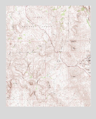
Teapot Mountain, AZ USGS Topographic Map
Click on map above to begin viewing in our Map Viewer.

This topographic map contains these locations and features:
Feature Name Type Latitude Longitude GNIS ID View Map
Arnett WellWellN33.2139°W111.0537°23652View Map
Black Hills TankReservoirN33.2081°W111.0765°40315View Map
Copper ButteSummitN33.1556°W111.0634°27900View Map
Copper Butte MineMineN33.1481°W111.0621°27901View Map
Copper CanyonValleyN33.1731°W111.0104°27905View Map
Crucifixon TankReservoirN33.2171°W111.0989°41299View Map
Granite MountainSummitN33.1623°W111.0271°29479View Map
Grapevine SpringSpringN33.2376°W111.0162°29518View Map
Kanes SpringSpringN33.2445°W111.0743°40362View Map
Lakel FlatFlatN33.2056°W111.0004°30855View Map
Last Turn HillSummitN33.1789°W111.0162°30903View Map
Lime TankReservoirN33.2414°W111.0832°40366View Map
Lower EK tankReservoirN33.2485°W111.0338°2062278View Map
Rawhide CanyonValleyN33.2403°W111.0040°33414View Map
Ray Mine Open PitMineN33.1809°W111.0096°41297View Map
Red HillsSummitN33.1951°W111.0034°33457View Map
Red TankReservoirN33.2284°W111.0383°41300View Map
Sandow HillSummitN33.1781°W111.0101°34046View Map
Sleeping Beauty MountainSummitN33.2062°W111.0290°34529View Map
Sonora HillSummitN33.1667°W111.0001°34637View Map
Sup Hor SpringSpringN33.2062°W111.0357°40432View Map
Teapot MountainSummitN33.1976°W111.0271°35170View Map
The RinconBasinN33.1537°W111.1121°35241View Map
The SpineRidgeN33.1278°W111.0446°35244View Map
Walnut SpringSpringN33.1928°W111.0479°35865View Map
West PitLakeN33.1751°W111.0055°36012View Map
White CanyonValleyN33.1576°W111.0809°36064View Map
White Canyon WildernessReserveN33.1714°W111.0971°2035338View Map
White Water SpringSpringN33.1928°W111.1035°40454View Map
Wood CanyonValleyN33.2470°W111.1121°36363View Map
Wood Canyon SpringSpringN33.2145°W111.1087°40456View Map

Note: Coordinates in the location and feature list above are referenced to NAD83 datum.


Copyright (C) 2008-2024 Ryan Niemi / Sunset Dynamics ... All Rights Reserved