TopoQuest Logo
Do you find TopoQuest useful?
Help keep TopoQuest running and adding new maps/features by donating!
Bitcoin:  19c7KJd3qBynnjoSw5npx9KScwjBe4ifkT
Litecoin:  LXs6TkuXGGXo1vDsWCkWVdjQX94eUKd6ui
Home View Maps Find Maps Find Places Resources & Links


Hot Tamale Peak, Arizona Topographic Map

USGS Map Title: Hot Tamale Peak, AZ
USGS Map MRC: 33110B8
DRG (GeoTIFF) Download: o33110b8.tif


Neighboring USGS Topographic Map Quads:


  Superior, AZ  
33111C1
 

  Pinal Ranch, AZ  
33110C8
 

  Pinal Peak, AZ  
33110C7
 

  Teapot Mountain, AZ  
33111B1
 

  Hot Tamale Peak, AZ  
33110B8
 

  El Capitan Mountain, AZ  
33110B7
 

  Grayback, AZ  
33111A1
 

  Kearny, AZ  
33110A8
 

  Hayden, AZ  
33110A7


Map MRC Location:

N34°
W111°
N34°
W110°
H8 H7 H6 H5 H4 H3 H2 H1
G8 G7 G6 G5 G4 G3 G2 G1
F8 F7 F6 F5 F4 F3 F2 F1
E8 E7 E6 E5 E4 E3 E2 E1
D8 D7 D6 D5 D4 D3 D2 D1
C8 C7 C6 C5 C4 C3 C2 C1
B8 B7 B6 B5 B4 B3 B2 B1
A8 A7 A6 A5 A4 A3 A2 A1
N33°
W111°
N33°
W110°

Hot Tamale Peak, AZ USGS 1:24K Topographic Map Preview:
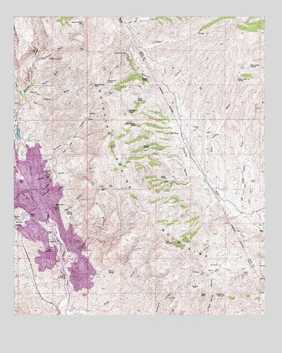
Hot Tamale Peak, AZ USGS Topographic Map
Click on map above to begin viewing in our Map Viewer.

This topographic map contains these locations and features:
Feature Name Type Latitude Longitude GNIS ID View Map
Alice MineMineN33.1323°W110.9237°588View Map
Amanda GulchValleyN33.1639°W110.9826°622View Map
Big DomeSummitN33.1406°W110.9759°1310View Map
Big TankReservoirN33.2202°W110.9087°1386View Map
Bluebell GulchValleyN33.1734°W110.9879°1743View Map
Buckeye MineMineN33.1373°W110.9118°2088View Map
Burro SpringSpringN33.1434°W110.9534°2260View Map
Cairo HillSummitN33.1709°W110.9801°2359View Map
Calumet GulchValleyN33.1795°W110.9921°2381View Map
Calumet MineMineN33.1853°W110.9821°2382View Map
Cedar CreekStreamN33.2473°W110.9451°27410View Map
Chimney SpringSpringN33.2109°W110.9434°2846View Map
Cottonwood SpringSpringN33.2228°W110.9546°3367View Map
Devils CanyonValleyN33.2167°W110.9962°28438View Map
Elder GulchValleyN33.1278°W110.9746°4392View Map
Government MountainSummitN33.2464°W110.9665°5192View Map
Hagen RanchLocaleN33.1609°W110.8762°5502View Map
Haley SpringSpringN33.1823°W110.9279°5511View Map
Haleys MountainSummitN33.1776°W110.9573°5512View Map
Hot Tamale PeakSummitN33.2212°W110.9607°6039View Map
Hot Tamale WashStreamN33.2195°W110.9937°6040View Map
Indian SpringSpringN33.1687°W110.9740°6229View Map
Indian SpringSpringN33.2148°W110.9365°6230View Map
Jimmie Luck GulchValleyN33.1778°W110.9901°6416View Map
Laguna SpringSpringN33.2348°W110.9451°6838View Map
Little Box Canyon DamDamN33.1992°W110.9973°23730View Map
Little Box LakeReservoirN33.2012°W110.9988°23731View Map
Lookout TankReservoirN33.2035°W110.9085°7371View Map
Looney SpringSpringN33.1962°W110.9362°7374View Map
Mill CreekStreamN33.2473°W110.9451°31860View Map
Mineral Creek Arch DamDamN33.2134°W110.9973°23749View Map
Mineral Creek Diversion DamDamN33.1884°W110.9973°23750View Map
Monitor MineMineN33.2176°W110.9537°8203View Map
Ordy TankReservoirN33.1810°W110.8805°9008View Map
Pearl Handle PitBasinN33.1739°W110.9926°9293View Map
Poorman GulchValleyN33.1670°W110.9821°9641View Map
Potters WashStreamN33.2214°W110.9912°9706View Map
Rattler MineMineN33.1426°W110.8862°9966View Map
RayPopulated PlaceN33.1834°W110.9976°33415View Map
Ray MineMineN33.1776°W110.9465°9999View Map
Rustler GulchValleyN33.1903°W110.9962°10603View Map
Scott MountainSummitN33.1953°W110.9526°11022View Map
Skunk Camp WashStreamN33.1678°W110.8854°438View Map
Slash S RanchLocaleN33.2014°W110.9184°11413View Map
SonoraPopulated PlaceN33.1653°W110.9959°11551View Map
Stone Cabin Box SpringSpringN33.2301°W110.8826°11869View Map
Stone Cabin SpringSpringN33.2301°W110.8823°11873View Map
Stone Cabin WashStreamN33.1767°W110.8990°442View Map
Susie GulchValleyN33.1520°W110.9754°12022View Map
Tiger MountainSummitN33.1337°W110.9079°12454View Map
Tillman SpringSpringN33.2326°W110.9829°12460View Map
Tillmans WashStreamN33.2328°W110.9898°12461View Map
TroyPopulated PlaceN33.1437°W110.8993°25341View Map
Troy MountainSummitN33.1556°W110.9257°12734View Map
Troy RanchLocaleN33.1459°W110.8990°12735View Map
Twin DomesSummitN33.1520°W110.9857°12942View Map
Vanadium SpringsSpringN33.1334°W110.8959°13194View Map
Walnut CanyonValleyN33.2389°W110.9429°13307View Map
Walnut SpringSpringN33.2242°W110.9337°13323View Map
Woodchopper SpringSpringN33.2048°W110.9398°13988View Map

Note: Coordinates in the location and feature list above are referenced to NAD83 datum.


Copyright (C) 2008-2025 Ryan Niemi / Sunset Dynamics ... All Rights Reserved